
Antiquariaat Goltzius
Libri
21157 libri di Antiquariaat Goltzius

Verlegging van den Maasmond.
1904
€28.75 ($31.62 | £23.98 | ¥5,041)
Newspaperclipping: 14 augustus 1904 with map concerning the redirection of the Maas river.

Algemeene Histori, Van het begin der Wereld af tot den tengenwoordigen tyd toe, getrokken uit Oorspronkelijke Schrijveren En opgehelderd met Landkaerten, Printverbeeldingen, Tijdrekenkundige en andere Taferelen. Beschreeven door een gezelschap van geleerde mannen in Engeland ; uit het Engelsch vertaeld, en met eenige aentekeningen vermeerderd door Kornelis Westerbaen W.Z.
WESTERBAEN W.Z., KORN., · 1736
€2,530.00 ($2,782.24 | £2,110.18 | ¥443,626)
Utrecht, Hermanus Besseling, 1736-1752, 1st edition, complete set in 19 volumes in similar contemporary half leather bindings (only the binding of volume 14 is different), all 18 engraved titlepages present, many engraved maps (56+8), engraved plates (38), vignettes (2) and en...

Portrait of Gerbrand van Leeuwen
EDELINCK, GERARD, · 1643
€253.00 ($278.22 | £211.02 | ¥44,363)
Gerbrand van Leeuwen (1643-1721), Professor of Theology in Amsterdam. Etching and engraving on hand laid paper, sheet size 351 x 436 mm., platemark 290 x 355 mm. Engraved by Gerard Edelinck (1640-1707) after Arnold Boonen (1669-1729), ca. 1675. In good condition, the margins q...

Portrait of Marie-Thérèse, Duchess of Angoulême
AUDUOIN, PIERRE, · 1778
€86.25 ($94.85 | £71.94 | ¥15,124)
Marie-Thérèse Charlotte (1778-1851) was the eldest child of King Louis XVI and Queen Marie Antoinette of France. In 1799 she married her cousin Louis Antoine, Duke of Angoulême, thus becoming the Duchess of Angoulême. She was briefly disputed Queen of France in 1830. Engraving...

Portrait of Louis Antoine de Bourbon, Duc d'Angoulême
DÉCROUAN, MICHEL, · 1775
€97.75 ($107.50 | £81.53 | ¥17,140)
Louis Antoine de Bourbon, Duc d'Angoulême (1775-1844) was the eldest son of King Charles X. Engraving on laid paper, sheet size 257 x 360 mm., platemark 191 x 251 mm. Made by Michel Décrouan (1785-1839) and published by the same in Paris. In good condition, margins and image w...

Portrait of Charles X
GARNIER, FRANÇOIS, · 1757
€172.50 ($189.70 | £143.88 | ¥30,247)
Charles X (born Charles Philippe, Count of Artois; 1757-1836) was King of France from 1824 until 1830. Etching and steel engraving on chine-collé. Sheet size 315 x 449 mm. Made by François Garnier (ca. 1800-1850) after Baron François Gérard (1770-1837). This is an early state,...

Portrait of Laurens Janszoon Coster
BRÜGGEMANN, THEODOR, · 1822
€86.25 ($94.85 | £71.94 | ¥15,124)
'Laurentius Costerus Harlemensis typogr. invent.' And with and eight-line caption (in Dutch and Latin). Tone lithograph on wove paper, sheet size 326 x 448 mm. Copy in lithography by Theodor Brüggemann (1822-1888) after the engraved portrait by J. van Campen after Cornelis Ko...

Philippus. Comes Pembrokiae
LOMBART, PIERRE, · 1612
€345.00 ($379.40 | £287.75 | ¥60,494)
Portrait of Philip Herbert, 5th Earl of Pembroke. Engraving on hand laid paper, sheet size 239 x 323 mm. Engraving by Pierre Lombart (1612/13-1681) after Anthony van Dyck (1599-1641), 1660. In good condition. Cropped within platemark and mounted on a carrier. Refences: New H...
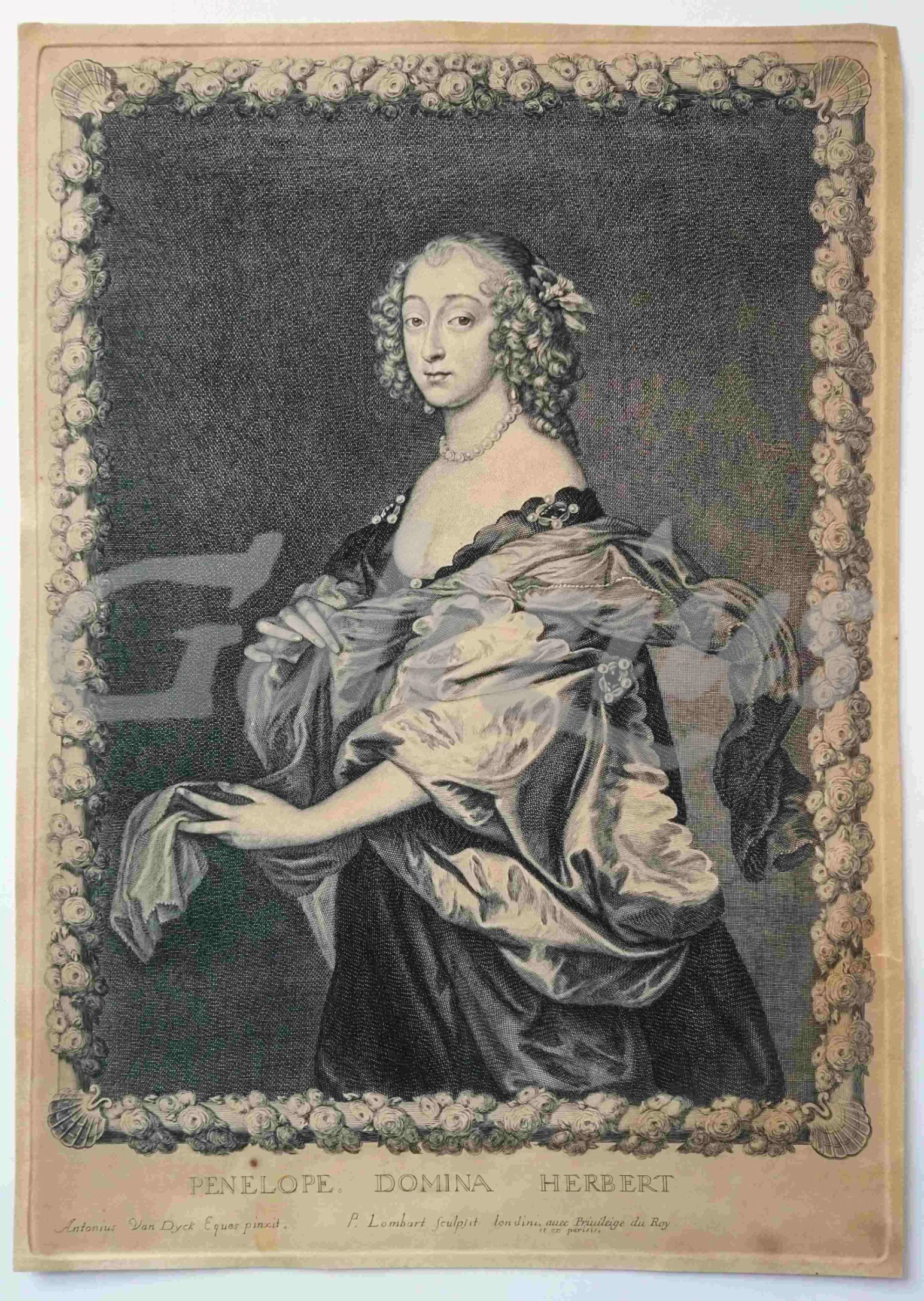
Penelope, domina Herbert
LOMBART, PIERRE, · 1612
€155.25 ($170.73 | £129.49 | ¥27,223)
Portrait of Penelope, Lady Herbert, three-quarter length, in a decorated frame with roses and seashells. Engraving on hand laid paper, sheet size 256 x 362 mm., platemark 246 x 351 mm. Engraving by Pierre Lombart (1612/13-1681) after Anthony van Dyck (1599-1641), 1660. In fair...

Naaukeurige aftekening van den loop der rivieren by Schenkenschans
TIRION, IS., · 1741
€109.25 ($120.14 | £91.12 | ¥19,157)
Map of the region around Schenkenschanz, which includes Pannerden, Zevenaar, Herwen and the castle at Elten. Engraving on hand laid paper, sheet size 302 x 211 mm., platemark 281 x 155 mm. Anonymous engraving, published by Isaak Tirion in 'Tegenwoordige staat der Vereenigde Ne...

Nieuwe kaart van Groningen
JAGEN, JAN VAN, · 1707
€201.25 ($221.31 | £167.86 | ¥35,288)
Map of the Dutch province of Groningen. Engraving on hand laid paper, with hand colouring. Sheet size 435 x 364 mm., platemark 420 x 350 mm. Made by Jan van Jagen (1707-1800) after J.C. Roeder, and published in Jacobus Kok, 'Vaderlandsch Woordenboek', Amsterdam: Johannes Alla...

Het belegh der stadt Groningen in den Jaare MDXCIV
LUYKEN, JAN, · 1594
€143.75 ($158.08 | £119.90 | ¥25,206)
A plan of the siege of Groningen in 1594. The besieging force in the lower right corner. An inset with the Sint Walburgskerk lower right, a legend with coat of arms top right. A few important buildings are depicted in the plan. Etching and engraving on hand laid paper, sheet s...

De Stadt Zieric-Zee in Plattegront
ANONYMOUS, · 1721
€132.25 ($145.44 | £110.30 | ¥23,190)
A plan of the city Zierikzee in Zeeland, the Netherlands. Etching and engraving on hand laid paper, sheet size 431 x 293 mm., platemark 425 x 280 mm. Originally made for Smallegange's 'Kroniek van Zeeland'. This later version was made for Hugo Franciscus van Heussen's 'Oudhede...

Nieuwe kaart van het Westelykste Deel der Weereld, dienende tot aanwijzing van de Scheepstogten der Nederlanderen naar Westindie
TIRION, IS., · 1754
€230.00 ($252.93 | £191.83 | ¥40,330)
Map of the western hemisphere, showing the Americas, and a part of Europe and Africa in the right edge. The coast of the South American continent is mostly complete, but North America shows only the east coast. Engraving on hand laid paper, sheet size 394 x 363 mm., platemark ...

Oude kaart der nu Vereenigde Nederlanden tot opheldering der Vaderlandsche historie in de Middeleeuwe
TIRION, IS., · 1749
€287.50 ($316.16 | £239.79 | ¥50,412)
Historical map of the Netherlands. Engraving on hand laid paper, sheet size 478 x 333 mm., platemark 328 x 288 mm. Engraving published by Is. Tirion in Amsterdam, 1749. This map originates from the multi-volume publication 'Vaderlandsche historie, vervattende de geschiedeniss...

Nieuwe kaart van het Oostelykste Deel der Weereld
TIRION, IS., · 1753
€230.00 ($252.93 | £191.83 | ¥40,330)
Map of the eastern hemisphere, from Europe and Iceland to Siberia and Indonesia, with the then discovered coast of Australia. Engraving on hand laid paper, sheet size 403 x 348 mm., platemark 370 x 324 mm. Engraving published by Is. Tirion in Amsterdam, 1753. This map origina...

De stad Goes
BYE, C. DE, · 1696
€172.50 ($189.70 | £143.88 | ¥30,247)
Plan of the Dutch city Goes, in Zeeland. Two putti hold a shield with the coat of arms of the city. A keyed legend with 30 entries lower left. Engraving on hand laid paper, sheet size 443 x 392 mm., platemark 340 x 277 mm. Made by C. de Bye, ca. 1696. This map was published i...
Morfologie Natuurlijk.
1999
€34.50 ($37.94 | £28.78 | ¥6,049)
Arnhem, Rijkswaterstaat, 1999, 28pp. original illustrated softcover binding.

Map of Boezemgebied in Holland (van Rijnlandsboezoem) voormalige en tegenwoordige toestand der Rijnverdeeling 1:100.000 1696-1699 with indicated later changes.
0
€46.00 ($50.59 | £38.37 | ¥8,066)
Chromolithograph Braakensiek, Amsterdam, published by Thieme Zutphen, 54x45cm, attractive map with insets of 'doorsnede polders\" and : een gedeelte van het Hollands Polderland (Wassenaar, Zoetermeer). with library stamp on front corner of Kaarten archief Geografisch Instituut...
Map of Rivier De Waal dated 1908 no. 11.
0
€28.75 ($31.62 | £23.98 | ¥5,041)
Lithograph Langenhuysen, Den Haag, 32x38cm, tear in top of fold. 1:10.000 detailed map of de Waal river from Ztten/Herveld.