
Ephemera
Ephemera a stampa, cartoline, manifesti e memorabilia stampati.
Risultati della ricerca
45747 libri in Ephemera

Mapa Geológico Do Brasil
Ministéro da Agricultura (Brasil) · 1960 · Wittenborn Art Books
$175.00 (€156.86 | £131.21 | ¥27,792)
Brasil: Ministéro da Agricultura, 1960. Color map measuring 45 x 38 inches. Scale = 1:5,000,000. Folded, with numerous tears along folds and edge. .

Map of República Dos Estados Unidos Do Brasil
Fundação IBGE, Instituto Brasileiro de Geografia · 1965 · Wittenborn Art Books
$175.00 (€156.86 | £131.21 | ¥27,792)
Brasil: Fundação IBGE, Instituto Brasileiro de Geografia, 1965. Color map measuring 45 x 38 inches. Scale = 1:5,000,000. Folded, with numerous tears along folds and edge. .

Mapa Geológico Do Brasil
Ministéro da Agricultura (Brasil) · 1960 · Wittenborn Art Books
$200.00 (€179.27 | £149.95 | ¥31,762)
Brasil: Ministéro da Agricultura, 1960. Color map measuring 45 x 38 inches. Scale = 1:5,000,000. Folded, with several tears along folds. .

Map of Federativa Do Brasil
Fundação IBGE, Instituto Brasileiro de Geografia · 1972 · Wittenborn Art Books
$200.00 (€179.27 | £149.95 | ¥31,762)
Brasil: Fundação IBGE, Instituto Brasileiro de Geografia, 1972. Color map measuring 45 x 38 inches. Scale = 1:5,000,000. Folded, with several tears along folds. .

Map of República Dos Estados Unidos Do Brasil
Fundação IBGE, Instituto Brasileiro de Geografia · 1965 · Wittenborn Art Books
$200.00 (€179.27 | £149.95 | ¥31,762)
Brasil: Fundação IBGE, Instituto Brasileiro de Geografia, 1965. Color map measuring 45 x 38 inches. Scale = 1:5,000,000. Folded, with several tears along folds. .

Map of Island of Trinidad, British Guiana-Venezuela-West Indies
USAF Aeronautical Chart and Information Service · 1949 · Wittenborn Art Books
$75.00 (€67.23 | £56.23 | ¥11,911)
Washington, D.C.: USAF Aeronautical Chart and Information Service, 1949. Color aeronautical chart measuring 28 x 22 inches. 4th ed. No. 772. Scale = 1:1,000,000. Index, legend, etc. on verso. Folded. Ex-library with stamp but no other markings. .

Map of Gulf of Guayaquil, Ecuador-Peru
USAF Aeronautical Chart and Information Service · 1957 · Wittenborn Art Books
$75.00 (€67.23 | £56.23 | ¥11,911)
Washington, D.C.: USAF Aeronautical Chart and Information Service, 1957. Color aeronautical chart measuring 28 x 22 inches. 6th ed. No. 951. Scale = 1:1,000,000. Index, legend, etc. on verso. Folded. Ex-library with stamp but no other markings. .

Map of Gulf of Paracas Peninsula, Peru
USAF Aeronautical Chart and Information Service · 1948 · Wittenborn Art Books
$75.00 (€67.23 | £56.23 | ¥11,911)
Washington, D.C.: USAF Aeronautical Chart and Information Service, 1948. Color aeronautical chart measuring 28 x 22 inches. 4th ed. rev. No. 1135. Scale = 1:1,000,000. Index, legend, etc. on verso. Folded. Ex-library with stamp but no other markings. .

Map of Caracas, Venezuela
USAF Aeronautical Chart and Information Service · 1948 · Wittenborn Art Books
$75.00 (€67.23 | £56.23 | ¥11,911)
Washington, D.C.: USAF Aeronautical Chart and Information Service, 1948. Black & white aeronautical chart measuring 28 x 22 inches. 2nd ed. No. 771-B. Scale = 1:500,000. Folded. Ex-library with stamp but no other markings. .

Map of Gulf of Fonseca, Central America
USAF Aeronautical Chart and Information Service · 1949 · Wittenborn Art Books
$75.00 (€67.23 | £56.23 | ¥11,911)
Washington, D.C.: USAF Aeronautical Chart and Information Service, 1949. Color aeronautical chart measuring 28 x 22 inches. 4th ed. rev. No. 710. Scale = 1:1,000,000. Index, legend, etc. on verso. Folded. Ex-library with stamp but no other markings. .
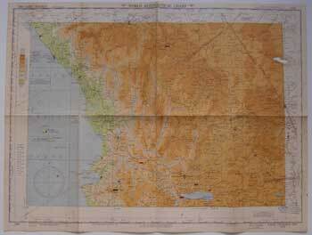
Map of Lake Chapala, Mexico
USAF Aeronautical Chart and Information Service · 1949 · Wittenborn Art Books
$65.00 (€58.26 | £48.73 | ¥10,323)
Washington, D.C.: USAF Aeronautical Chart and Information Service, 1949. Color aeronautical chart measuring 28 x 22 inches. 4th ed. No. 590. Scale = 1:1,000,000. Index, legend, etc. on verso. Folded. Ex-library with stamp but no other markings. One open tear upper right measur...

Map of Alto Ritacuva, Colombia-Venezuela
USAF Aeronautical Chart and Information Service · 1948 · Wittenborn Art Books
$75.00 (€67.23 | £56.23 | ¥11,911)
Washington, D.C.: USAF Aeronautical Chart and Information Service, 1948. Color aeronautical chart measuring 28 x 22 inches. 2nd ed. No. 828. Scale = 1:1,000,000. Index, legend, etc. on verso. Folded. Ex-library with stamp but no other markings. .

Map of Zaraza, Venezuela
USAF Aeronautical Chart and Information Service · 1948 · Wittenborn Art Books
$75.00 (€67.23 | £56.23 | ¥11,911)
Washington, D.C.: USAF Aeronautical Chart and Information Service, 1948. Black & white aeronautical chart measuring 28 x 22 inches. 2nd ed. No. 771-C. Scale = 1:500,000. Folded. Ex-library with stamp but no other markings. .

Map of Maigualida Range, Venezuela-Colombia
USAF Aeronautical Chart and Information Service · 1950 · Wittenborn Art Books
$75.00 (€67.23 | £56.23 | ¥11,911)
Washington, D.C.: USAF Aeronautical Chart and Information Service, 1950. Color aeronautical chart measuring 28 x 22 inches. 2nd ed. No. 827. Scale = 1:1,000,000. Index, legend, etc. on verso. Folded. Ex-library with stamp but no other markings. .

Map of Tehuantepec Isthmus, Guatemala-Mexico
USAF Aeronautical Chart and Information Service · 1950 · Wittenborn Art Books
$75.00 (€67.23 | £56.23 | ¥11,911)
Washington, D.C.: USAF Aeronautical Chart and Information Service, 1950. Color aeronautical chart measuring 28 x 22 inches. 5th ed. No. 644. Scale = 1:1,000,000. Index, legend, etc. on verso. Folded. Ex-library with stamp but no other markings. .
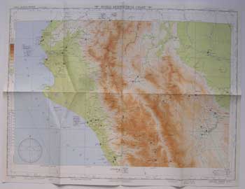
Map of Aguja Point, Ecuador-Peru
USAF Aeronautical Chart and Information Service · 1949 · Wittenborn Art Books
$75.00 (€67.23 | £56.23 | ¥11,911)
Washington, D.C.: USAF Aeronautical Chart and Information Service, 1949. Color aeronautical chart measuring 28 x 22 inches. 3rd ed. April 1949. No. 1011. Scale = 1:1,000,000. Index, legend, etc. on verso. Folded. Ex-library with stamp but no other markings. .

Map of Cape San Francisco, Colombia-Ecuador
USAF Aeronautical Chart and Information Service · 1948 · Wittenborn Art Books
$75.00 (€67.23 | £56.23 | ¥11,911)
Washington, D.C.: USAF Aeronautical Chart and Information Service, 1948. Color aeronautical chart measuring 28 x 22 inches. 2nd ed. No. 890. Scale = 1:1,000,000. Index, legend, etc. on verso. Folded. Ex-library with stamp but no other markings. .

Map of Lake Maracaibo, Colombia-Venezuela
USAF Aeronautical Chart and Information Service · 1952 · Wittenborn Art Books
$75.00 (€67.23 | £56.23 | ¥11,911)
Washington, D.C.: USAF Aeronautical Chart and Information Service, 1952. Color aeronautical chart measuring 28 x 22 inches. 6th ed. No. 770. Scale = 1:1,000,000. Index, legend, etc. on verso. Folded. Ex-library with stamp but no other markings. .

Leaf of Disney Characters
Disney, Walt (after) · 1950 · Wittenborn Art Books
$30.00 (€26.89 | £22.49 | ¥4,764)
Paris: Ed. René Touret, ca. 1950s. One leaf measuring 8 x 10 inches, printed on both sides, one in color and one in black & white. Some characters have been colored in with crayon by a child. Eight characters depicted, including Minnie Mouse, Mickey Mouse, and Porky Pig. Not s...

Les As Du Volant
French artist · 1930 · Wittenborn Art Books
$25.00 (€22.41 | £18.74 | ¥3,970)
[France, ca. 1930-1950]. Printed card measuring 4 x 5 inches depicting an automobile race. Some stains. .