
Ephemera
Ephemera a stampa, cartoline, manifesti e memorabilia stampati.
Risultati della ricerca
45746 libri in Ephemera

Italy by Mr. D'Anville Geographer to the French King, Drawn and Engrav'd from the Original Publish'd at Paris, at the Expence of the Duke of Orleans (Map)
D'Anville · 1747 · Wittenborn Art Books
$200.00 (€181.47 | £151.39 | ¥31,937)
London: Gentleman's Magazine, [1747]. 10 x 11 inches. Very Good. 18th Century, folded map. Scarce. .

An Accurate Map of Europe Drawn from the Best Modern Maps & Charts & Regulated (Map)
Bowen, Emanuel · 1747 · Wittenborn Art Books
$200.00 (€181.47 | £151.39 | ¥31,937)
London: Emanuel Bowen, [1747]. 10 x 9 inches. Very Good. 18th Century, hand-colored, folded map. Scarce. .
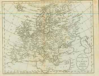
An Accurate Map of Europe Compiled from the Best Authorities, 1791 (Map)
Brookes Gazetteer · 1794 · Wittenborn Art Books
$100.00 (€90.73 | £75.70 | ¥15,969)
London: Brookes Gazetteer, [1794]. 10 x 9 inches. Very Good. 18th Century folded map originally published in Brookes Gazetteer. Scarce. .

The Seven United Provinces with the Austrian, French & Dutch Netherlands (Map)
Thomas Jefferys · 1754 · Wittenborn Art Books
$100.00 (€90.73 | £75.70 | ¥15,969)
London: Thomas Salmon, [1754?]. 8 x 9 inches. Very Good. 18th Century folded map originally published in Geographical and Historical Grammar. Scarce. Thomas Jefferys (ca. 1719-1771) was a prolific map publisher based in London. His father was a cutler, but Jefferys was apprent...

A Map of Upper Saxony Comprehending That Part of Germany Which Is the Present Seat of War. (Map)
Sylvanus Urban (Edward Cave) · 1757 · Wittenborn Art Books
$150.00 (€136.10 | £113.55 | ¥23,953)
London: Gentleman's Magazine, [1757]. 11 x 9 inches. Very Good. 18th Century folded map originally published in The Gentleman's Magazine. Map of Germany and Poland, including the cities of Breslaw (Breslau or Wroclaw), Trebnitz (Trzebnica) and Gnesna (Gniezno). Berlin is locat...
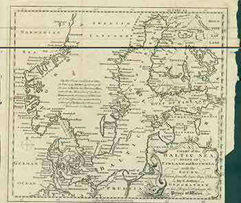
A Chart of the Baltic Sea Gulfs of Finland and Bothnia with the Sound, Drawn from the Best Maps & Charts. (Map)
Thomas Jefferys · 1748 · Wittenborn Art Books
$150.00 (€136.10 | £113.55 | ¥23,953)
London: Gentleman's Magazine, [1748]. 5 x 8 inches. Very Good. 18th Century folded map originally published in The Gentleman's Magazine. Map with text explaining the ceding of Swedish territory to Russia. Map details the coasts of Norway, Sweden, Denmark, and Finland as well a...

A Map of That Part of Westphalia in Which the French Army Was Defeated Aug 1, 1759. (Map)
18th Century English Cartographer · 1759 · Wittenborn Art Books
$100.00 (€90.73 | £75.70 | ¥15,969)
[London]: D. Henry and R. Cave, [1759]. 5 x 8 inches. Very Good. 18th Century folded map originally published in The Gentleman's Magazine, and Historical Chronicle. Volume XXIX. for the Year 1759. Scarce. .

A Map of the Seat of War on the Rhine and Parts Adjacent in Germany, 1759. (Map)
18th Century English Cartographer · 1759 · Wittenborn Art Books
$150.00 (€136.10 | £113.55 | ¥23,953)
[London]: D. Henry and R. Cave, [1759]. 10 x 9 inches. Very Good. 18th Century folded map originally published in The Gentleman's Magazine, and Historical Chronicle. Volume XXIX. for the Year 1759. Scarce. .

A General Map of Saxony and Bohemia with the Adjacent Countries, Including All Silesia. Being a Specimen of a New Geographical and Military Atlas; to Be Continued Occasionally (Map)
J. Gibson · 1700 · Wittenborn Art Books
$200.00 (€181.47 | £151.39 | ¥31,937)
[London]: J. Gibson Sculp, [1700s]. 10 x 16 inches. Very Good. 18th Century folded map of Saxony and Bohemia. Scarce. .

Belgium (Map)
J. Rapkin (Cartographer); J. Marchant (Illustrator); J. B. Allen (Engraver) · 1860 · Wittenborn Art Books
$75.00 (€68.05 | £56.77 | ¥11,977)
London: London Printing And Publishing Company, [1860s - 1890s?]. 11 x 14 inches. Very Good. Folded, hand-colored map of Belgium. .

Brussels (Map)
J. Rapkin (Cartographer); J. Watkins (Illustrator) · 1860 · Wittenborn Art Books
$75.00 (€68.05 | £56.77 | ¥11,977)
London: John Tallis & Company, [1860s - 1890s?]. 11 x 14 inches. Very Good. Folded, illustrated map of Brussels. .

Prussia (Map)
J. Rapkin (Cartographer); J. Salmon (Illustrator); S. Fisher (Engraver) · 1860 · Wittenborn Art Books
$75.00 (€68.05 | £56.77 | ¥11,977)
London: London Printing And Publishing Company, [1860s - 1890s?]. 11 x 14 inches. Very Good. Folded, hand-colored map of Prussia. .

Black Sea (Map)
J. Rapkin (Cartographer); H. Winkles (Illustrator) · 1860 · Wittenborn Art Books
$75.00 (€68.05 | £56.77 | ¥11,977)
London: London Printing And Publishing Company, [1860s - 1890s?]. 11 x 14 inches. Very Good. Minor foxing. Folded, hand-colored map of Black Sea. .

Belgium (Map)
J. Rapkin (Cartographer); J. Marchant (Illustrator); J. B. Allen (Engraver) · 1860 · Wittenborn Art Books
$75.00 (€68.05 | £56.77 | ¥11,977)
London: John Tallis & Company, [1860s - 1890s?]. 11 x 14 inches. Very Good. Folded, hand-colored map of Belgium. .

France (Map)
J. Rapkin (Cartographer); J. Wray (Illustrator); J. Rogers (Engraver) · 1860 · Wittenborn Art Books
$75.00 (€68.05 | £56.77 | ¥11,977)
London: John Tallis & Company, [1860s - 1890s?]. 11 x 14 inches. Very Good. Some wrinkling to right edge. Folded, hand-colored map of France. .

Denmark (Map)
J. Rapkin (Cartographer); H. Warren (Illustrator); J. B. Allen (Engraver) · 1860 · Wittenborn Art Books
$75.00 (€68.05 | £56.77 | ¥11,977)
London: London Printing And Publishing Company, [1860s - 1890s?]. 11 x 14 inches. Very Good. Minor foxing. Folded, hand-colored map of Denmark. .

Plan of the Battle of the Alma (Map)
J. Rapkin (Cartographer) · 1860 · Wittenborn Art Books
$75.00 (€68.05 | £56.77 | ¥11,977)
London: London Printing And Publishing Company, [1860s - 1890s?]. 11 x 14 inches. Very Good. Minor foxing. Folded, hand-colored map of Plan of the Battle of the Alma. Drawn and engraved from English and French official documents. .

Turkey in Europe (Map)
J. Rapkin (Cartographer); H. Winkles (Illustrator); J. Rogers (Engraver) · 1860 · Wittenborn Art Books
$75.00 (€68.05 | £56.77 | ¥11,977)
London: London Printing And Publishing Company, [1860s - 1890s?]. 11 x 14 inches. Very Good. Minor foxing. Folded, hand-colored map of Turkey in Europe. .

The Crimea (Map)
J. Rapkin (Cartographer); H. Winkles (Illustrator) · 1860 · Wittenborn Art Books
$75.00 (€68.05 | £56.77 | ¥11,977)
London: London Printing And Publishing Company, [1860s - 1890s?]. 11 x 14 inches. Very Good. Minor foxing. Folded, hand-colored map of The Crimea. .

Siege of Sebastopol (Map)
J. Rapkin (Cartographer) · 1860 · Wittenborn Art Books
$75.00 (€68.05 | £56.77 | ¥11,977)
London: London Printing And Publishing Company, [1860s - 1890s?]. 11 x 14 inches. Very Good. Minor foxing. Folded, hand-colored map of Siege of Sebastopol. Drawn and engraved from official documents. .