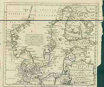
Thomas Jefferys — A Chart of the Baltic Sea Gulfs of Finland and Bothnia with the Sound, Drawn from the Best Maps & Charts. (Map)
London: Gentleman's Magazine, [1748]. 5 x 8 inches. Very Good. 18th Century folded map originally published in The Gentleman's Magazine. Map with text explaining the ceding of Swedish territory to Russia. Map details the coasts of Norway, Sweden, Denmark, and Finland as well as the Baltic republics and Germany. Map of the Baltic Sea. Prime Meridian is based in London. Scale was determined by measuring between 5 degrees of Latitude. Map reads with North Facing to the top of the map. There is a scale bar along the right side of the latitude grid, in leagues. Scarce. Thomas Jefferys (ca. 1719-1771) was a prolific map publisher based in London. His father was a cutler, but Jefferys was apprenticed to Emanuel Bowen, a prominent mapmaker and engraver. He was made free of the Merchant Taylors' Company in 1744. Jefferys was the Geographer to Frederick Price of Wales and, from 1760, to King George III. He is most known today for his maps of North America, and for his central place in the map trade-he not only sold maps commercially, but also imported the latest materials and had ties to several government bodies for whom he produced materials. .