
Ephemera
Ephemera a stampa, cartoline, manifesti e memorabilia stampati.
Risultati della ricerca
45746 libri in Ephemera

A New and Accurate Map of Turkey in Europe, Drawn from the Best Authorities and Engrav'd for the Supplement to the Gent. Mag 1770 (18th Century Map)
J. Lodge (engraver) · 1770 · Wittenborn Art Books
$100.00 (€90.73 | £75.70 | ¥15,969)
London: Sylvanus Urban, [1770]. 11 x 10 inches. Very Good. Fine copperplate engraving. 18th Century, uncolored, folded map of Ottoman Empire in 1770 showing the area from the Ionian Sea to the Black Sea and includes Bosnia, Serbia, Macedonia, Greece, Transylvania, and part of ...
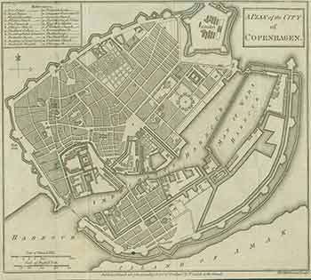
A Plan of the City of Copenhagen (18th Century Map)
T. Kitchin (engraver) · 1784 · Wittenborn Art Books
$100.00 (€90.73 | £75.70 | ¥15,969)
London: Thomas Cadell, [1784]. 11 x 13 inches. Very Good. Fine copperplate engraving. 18th Century, uncolored, folded map. Published March 26, 1784 according to Act of Parliament by T. Cadell (1742-1802) in the Strand. Scarce. .

German Empire (19th Century Map)
Letts Son & Co Limited · 1880 · Wittenborn Art Books
$125.00 (€113.42 | £94.62 | ¥19,961)
London: Letts Son & Co Limited, [1880s]. 14 x 17 inches. Good. Four small tears in right margin, and quarter inch loss in bottom right corner. Minor wrinkling. 19th Century map, printed in color. From Letts's Popular Atlas. Scarce. Letts's Popular Atlas, being a series of maps...

Austrian Empire No. 2 (19th Century Map)
Letts Son & Co Limited · 1880 · Wittenborn Art Books
$125.00 (€113.42 | £94.62 | ¥19,961)
London: Letts Son & Co Limited, [1880s]. 14 x 17 inches. Very Good. Quarter inch tear in top margin, else fine. 19th Century map, printed in color. From Letts's Popular Atlas. Scarce. Letts's Popular Atlas, being a series of maps delineating the whole surface of the globe, wit...

Switzerland (19th Century Map)
Letts Son & Co Limited · 1880 · Wittenborn Art Books
$125.00 (€113.42 | £94.62 | ¥19,961)
London: Letts Son & Co Limited, [1880s]. 14 x 17 inches. Very Good+. 19th Century map, printed in color. Two one inch tears in top margin. From Letts's Popular Atlas. Scarce. Letts's Popular Atlas, being a series of maps delineating the whole surface of the globe, with many sp...

Austrian Empire No. 1 (19th Century Map)
Letts Son & Co Limited · 1880 · Wittenborn Art Books
$125.00 (€113.42 | £94.62 | ¥19,961)
London: Letts Son & Co Limited, [1880s]. 14 x 17 inches. Very Good+. 19th Century map, printed in color. From Letts's Popular Atlas. Scarce. Letts's Popular Atlas, being a series of maps delineating the whole surface of the globe, with many special and original features; and a...
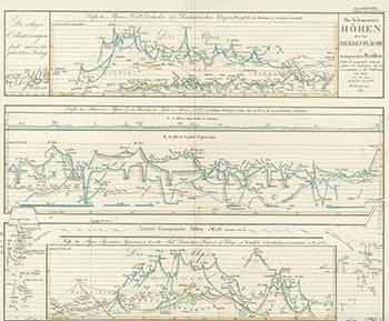
Die Bekanntesten Hohen über Der Meeresfläche in Transparenten Profilen (19th Century Map of the Best Known High Points Above the Sea Surface in Transparent Profiles)
Justus Perthes · 1850 · Wittenborn Art Books
$125.00 (€113.42 | £94.62 | ¥19,961)
Gotha, Germany: Justus Perthes Geographische Anstalt, [1850]. 14 x 17 inches. Very Good. One inch tear in bottom margin along fold, not affecting image. 19th Century folded map, printed in color, with hand colored borders. From Stieler's Hand-Atlas (No. 10). Text in German. Sc...

Nordwestliches Deutschland (19th Century Map of Northwestern Germany)
Justus Perthes · 1850 · Wittenborn Art Books
$125.00 (€113.42 | £94.62 | ¥19,961)
Gotha, Germany: Justus Perthes Geographische Anstalt, [1850]. 14 x 17 inches. Very Good. 19th Century folded map, printed in color, with hand colored borders. From Stieler's Hand-Atlas (No. 21). Text in German. Scarce. Johann Georg Justus Perthes (11 September 1749, Rudolstadt...
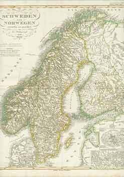
Schweden Und Norwegen (19th Century Map of Sweden and Norway)
F. V. Stülpnagel (engraver) · 1850 · Wittenborn Art Books
$125.00 (€113.42 | £94.62 | ¥19,961)
Gotha, Germany: Justus Perthes Geographische Anstalt, [1850]. 14 x 17 inches. Very Good. Minor foxing on edges of margins, not affecting image. 19th Century folded map, printed in color, with hand colored borders. From Stieler's Hand-Atlas (No. 17). Text in German. Scarce. Joh...

Ostsee-Laender Und Inneres Russland Bis Moskau (19th Century Map of Baltic Sea Countries and Central Russia to Moscow)
Ausfeld, Joh. Carl. (Johann Carl); F. V. Stülpnagel (engraver) · 1850 · Wittenborn Art Books
$125.00 (€113.42 | £94.62 | ¥19,961)
Gotha, Germany: Justus Perthes Geographische Anstalt, [1850]. 14 x 17 inches. Very Good. 19th Century folded map, printed in color, with hand colored borders. From Stieler's Hand-Atlas (No. 36). Text in German. Scarce. Johann Georg Justus Perthes (11 September 1749, Rudolstadt...

Nord-ôstliches Deutschland (19th Century Map of North-East Germany)
Ausfeld, Joh. Carl. (Johann Carl) (engraver) · 1850 · Wittenborn Art Books
$125.00 (€113.42 | £94.62 | ¥19,961)
Gotha, Germany: Justus Perthes Geographische Anstalt, [1850]. 14 x 17 inches. Very Good. Minor foxing on edges of margins, not affecting image. 19th Century folded map, printed in color, with hand colored borders. From Stieler's Hand-Atlas (No. 22a). Text in German. Scarce. Jo...

Europaeisches Russland Anch Schweden Norwegen (19th Century Map of European Russia and Sweden Norway)
Justus Perthes · 1850 · Wittenborn Art Books
$125.00 (€113.42 | £94.62 | ¥19,961)
Gotha, Germany: Justus Perthes Geographische Anstalt, [1850]. 14 x 17 inches. Very Good. 19th Century folded map, printed in color, with hand colored borders. From Stieler's Hand-Atlas (No. 37a). Text in German. Scarce. Johann Georg Justus Perthes (11 September 1749, Rudolstad...
Deutschland, Niederlande, Belgien Und Schweiz (19th Century Map of Germany, Netherlands, Belgium and Switzerland)
F. V. Stülpnagel (engraver) · 1850 · Wittenborn Art Books
$125.00 (€113.42 | £94.62 | ¥19,961)
Gotha, Germany: Justus Perthes Geographische Anstalt, [1850]. 14 x 17 inches. Very Good. Minor foxing on edges of margins, not affecting image. 19th Century folded map, printed in color, with hand colored borders. From Stieler's Hand-Atlas (No. 19). Text in German. Scarce. Joh...
Frankreich Und Umgebungen Von Paris (19th Century Map of France and Surroundings of Paris)
F. V. Stülpnagel (engraver) · 1850 · Wittenborn Art Books
$125.00 (€113.42 | £94.62 | ¥19,961)
Gotha, Germany: Justus Perthes Geographische Anstalt, [1850]. 14 x 17 inches. Very Good. 19th Century folded map, printed in color, with hand colored borders. From Stieler's Hand-Atlas (No. 14a). Text in German. Scarce. Johann Georg Justus Perthes (11 September 1749, Rudolstad...

Niederlande Belgien Luxemburg (19th Century Map of Netherlands Belgium Luxembourg)
A. Stieler (engraver) · 1850 · Wittenborn Art Books
$125.00 (€113.42 | £94.62 | ¥19,961)
Gotha, Germany: Justus Perthes Geographische Anstalt, [1850]. 14 x 17 inches. Very Good. 19th Century folded map, printed in color, with hand colored borders. From Stieler's Hand-Atlas (No. 29). Text in German. Scarce. Johann Georg Justus Perthes (11 September 1749, Rudolstadt...
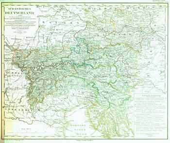
Süd-östliches Deutschland (19th Century Map of South-Eastern Germany)
F. V. Stülpnagel (engraver) · 1850 · Wittenborn Art Books
$125.00 (€113.42 | £94.62 | ¥19,961)
Gotha, Germany: Justus Perthes Geographische Anstalt, [1850]. 14 x 17 inches. Very Good. 19th Century folded map, printed in color, with hand colored borders. From Stieler's Hand-Atlas (No. 25). Text in German. Scarce. Johann Georg Justus Perthes (11 September 1749, Rudolstadt...
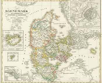
Daenemark (19th Century Map of Denmark)
A. Stieler (engraver) · 1850 · Wittenborn Art Books
$125.00 (€113.42 | £94.62 | ¥19,961)
Gotha, Germany: Justus Perthes Geographische Anstalt, [1850]. 14 x 17 inches. Very Good. 19th Century folded map, printed in color, with hand colored borders. From Stieler's Hand-Atlas (No. 16b). Text in German. Scarce. Johann Georg Justus Perthes (11 September 1749, Rudolstad...

Die Schweiz (19th Century Map of Switzerland)
F. V. Stülpnagel (engraver) · 1844 · Wittenborn Art Books
$125.00 (€113.42 | £94.62 | ¥19,961)
Gotha, Germany: Justus Perthes Geographische Anstalt, [1844]. 14 x 17 inches. Very Good. 19th Century folded map, printed in color, with hand colored borders. From Stieler's Hand-Atlas (No. 32). Text in German. Scarce. Johann Georg Justus Perthes (11 September 1749, Rudolstadt...

Spanien Und Portugal (19th Century Map of Spain and Portugal)
F. V. Stülpnagel (engraver) · 1850 · Wittenborn Art Books
$125.00 (€113.42 | £94.62 | ¥19,961)
Gotha, Germany: Justus Perthes Geographische Anstalt, [1850]. 14 x 17 inches. Very Good. 19th Century folded map, printed in color, with hand colored borders. From Stieler's Hand-Atlas (No. 13). Text in German. Scarce. Johann Georg Justus Perthes (11 September 1749, Rudolstadt...
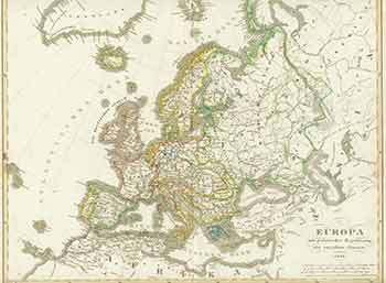
Europa (19th Century Map of Europe)
F. V. Stülpnagel (engraver) · 1848 · Wittenborn Art Books
$125.00 (€113.42 | £94.62 | ¥19,961)
Gotha, Germany: Justus Perthes Geographische Anstalt, [1848]. 14 x 17 inches. Very Good. Some foxing in margins, not affecting image. 19th Century folded map, printed in color, with hand colored borders. From Stieler's Hand-Atlas (No. 12). Text in German. Scarce. Johann Georg ...