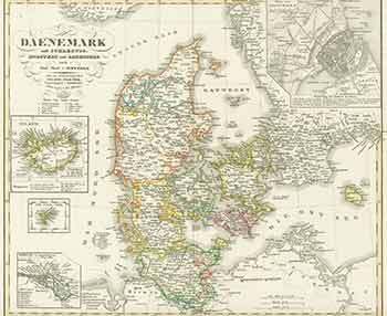
A. Stieler (engraver) — Daenemark (19th Century Map of Denmark)
Gotha, Germany: Justus Perthes Geographische Anstalt, [1850]. 14 x 17 inches. Very Good. 19th Century folded map, printed in color, with hand colored borders. From Stieler's Hand-Atlas (No. 16b). Text in German. Scarce. Johann Georg Justus Perthes (11 September 1749, Rudolstadt, Schwarzburg-Rudolstadt - 2 May 1816, Gotha, Saxe-Gotha-Altenburg) was a German publisher and founder of the publishing house that bears his name. Wilhelm Perthes engaged the collaboration of the most eminent German geographers of the time, including Stieler, Heinrich Berghaus (1797-1884), Christian Gottlieb Reichard (1758-1837), who was associated with Stieler in the compilation of the atlas, Karl Spruner (1803-1892), and Emil von Sydow (1812-1873). .