
Ephemera
Ephemera a stampa, cartoline, manifesti e memorabilia stampati.
Risultati della ricerca
45746 libri in Ephemera
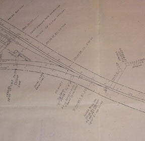
Station Plan of Klamath Falls, Oregon. Map
Southern Pacific Lines (San Francisco, Calif.) · 1959 · Wittenborn Art Books
$350.00 (€317.55 | £264.92 | ¥55,873)
Southern Pacific Company, 1959. Revised 1960. Map. Blueline print 24" x 56". Includes Western Union Line, Signal Line, Texum Station, Meander Line of 1872, Lake Ewauna. Scale 1" = 100'. .

Right of Way and Track Map of Manteca, San Joaquin County, California
Southern Pacific Lines (San Francisco, Calif.) · 1934 · Wittenborn Art Books
$350.00 (€317.55 | £264.92 | ¥55,873)
San Francisco, Calif.: Southern Pacific Company, 1934. Map. Blueline print 24" x 56" with red highlighting. Includes Manteca, Morrano, Calla, and vicinity. With L.M. Larson's subdivision, Spreckels Sugar Co. Spur. With Schedule of Property listing 17 transfers, 1871-1934. Scal...
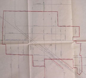
Map of Manteca, San Joaquin County, California. Present and Proposed Delivery Limits
Southern Pacific Lines (San Francisco, Calif.) · 1952 · Wittenborn Art Books
$250.00 (€226.82 | £189.23 | ¥39,909)
Sacramento, Calif.: Southern Pacific Company, 1952. Map. Blueline print 24" x 34" with red highlighting. From Durham Ferry Rd to Austin Rd, and County Road 01-159 to 0.7 mile south of City Limit. Including Western Pacific and Southern Pacific Railroad Lines, and Highway Route ...

Map of Marysville, Yuba County, California
Southern Pacific Lines (San Francisco, Calif.) · 1920 · Wittenborn Art Books
$350.00 (€317.55 | £264.92 | ¥55,873)
Sacramento, Calif.: Southern Pacific Company, 1920. Revised 1930. Map. Blueprint 32" x 96." From Bear River to Creegan. With First St through Eighteenth St, with Ranges A, B, C, and D. Train lines and Western Union lines indicated. Scale 1" = 100'. .
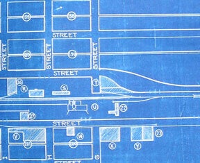
Industrial Map of Merced, California
Southern Pacific Lines (San Francisco, Calif.) · 1922 · Wittenborn Art Books
$350.00 (€317.55 | £264.92 | ¥55,873)
Stockton, Calif.: Southern Pacific Company, 1922, revised 1935. Map. Blueprint 24" x 36." From Bear River to Creegan. With Key to Industry with 52 listings, including Union Oil Co, Merced Growers' Packing Assoc. Scale 1" = 400'. .
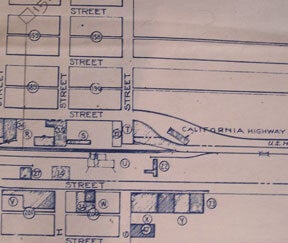
Industrial Map of Merced, California
Southern Pacific Lines (San Francisco, Calif.) · 1922 · Wittenborn Art Books
$350.00 (€317.55 | £264.92 | ¥55,873)
Stockton, Calif.: Southern Pacific Company, 1922, revised 1945. Map. Blueline print 24" x 36." From Bear River to Creegan. Includes Key to Industry, approx. 80 listings. Scale 1" = 400'. .

Right of Way and Track Map of Mount Shasta, Siskiyou County, California
Southern Pacific Lines (San Francisco, Calif.) · 1942 · Wittenborn Art Books
$350.00 (€317.55 | £264.92 | ¥55,873)
San Francisco, Calif.: Southern Pacific Company, 1942. Map. Blueline print. 24 x 56 inches. With red pencil indicating switching zones. Includes Pioneer, Mount Shasta, and vicinity. With Shedule of Property, approx. 50 transfers listed, 1866-1959. Scale: 1 inch = 400 feet. .

Industry Map of East Oakland, Hayward, and Russell, Alameda County, California
Southern Pacific Lines (San Francisco, Calif.) · 1946 · Wittenborn Art Books
$425.00 (€385.59 | £321.69 | ¥67,845)
San Francisco, Calif.: Southern Pacific Company, 1946. Map. Blueline print 36" x 67." From Fruitvale to Hayward, with Melrose, Mulford, Stonehurst, Russell City. Includes proposed Highway Route 69, shaded. With Key to Industries, approx. 40 listed. Includes Scale 1" = 1000'. .

Right of Way and Track Map of Mulford, Alameda County, California
Southern Pacific Lines (San Francisco, Calif.) · 1960 · Wittenborn Art Books
$350.00 (€317.55 | £264.92 | ¥55,873)
San Francisco, Calif.: Southern Pacific Company, 1960. Map. Blueline print 24" x 56," with red highlights. From Elmhurst to Rancho San Leandro border. Includes inset Index Map, scale 1 inch = 2miles, Elmurst to Santa Clara. With Schedule of Property listing approx. 20 transfer...

Right of Way and Track Map of Miami, Gila County, California
Southern Pacific Lines (San Francisco, Calif.) · 1960 · Wittenborn Art Books
$225.00 (€204.14 | £170.31 | ¥35,918)
San Francisco, Calif.: Southern Pacific Company, 1960. Map. Blueline print 24" x 58," Globe branch - Bowie to Live Oak, including switching zone map affixed with glue, with red pencilling. Includes Crook National Forest. With Schedule of Property listing approx. 20 transfers, ...

Industrial Map of Modesto, California
Southern Pacific Lines (San Francisco, Calif.) · 1947 · Wittenborn Art Books
$350.00 (€317.55 | £264.92 | ¥55,873)
San Francisco, Calif.: Southern Pacific Company, 1947. Map. Blueline print 23" x 35" with red pencilling. Includes index of approx. 120 industries. Includes Barium Products Co, E.D.J. Lying Warehouse, Pacific Fruit Express, Tri-Valley Packing, U.S. Army. Scale 1" = 600'. .

Right of Way and Track Map, Modesto, California
Southern Pacific Lines (San Francisco, Calif.) · 1943 · Wittenborn Art Books
$350.00 (€317.55 | £264.92 | ¥55,873)
San Francisco, Calif.: Southern Pacific Company, 1943. Map. Blueline print 24" x 56", with red highlighting. Includes Chiquita Colony, Woodland Ave Park, Maze Colony, Covell. With Schedule of Property, records of approx. 30 transfers, 1873-1948. Scale 1" = 400'. .
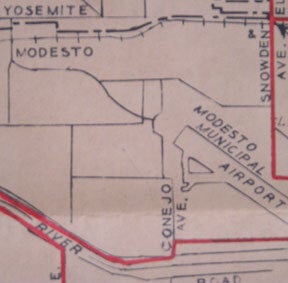
Present and Proposed Pickup and Delivery Limits, Modesto, California. Map
Southern Pacific Lines (San Francisco, Calif.) · 1954 · Wittenborn Art Books
$225.00 (€204.14 | £170.31 | ¥35,918)
Southern Pacific Company, 1954. Map. Blueline print 16" x 21", with red and green highlighting. From Whitmore Rd to Staniford Ave, and Dakota Ave to Claus Rd. Includes U.S. highway 99, railroad lines, Modesto Municipal Airport, irrigation district laterals. Not drawn to scale. .

Present and Proposed Pickup and Delivery Limits, Modesto, California. Map
Southern Pacific Lines (San Francisco, Calif.) · 1951 · Wittenborn Art Books
$225.00 (€204.14 | £170.31 | ¥35,918)
Southern Pacific Company, 1951. Map. Blueline print 22" x 22", with red and green highlighting. From Riverside Dr to Vernon Ave, and Hatch Rd to Briggsmore Ave. Includes U.S. highway 99, railroad lines, Modesto Municipal Airport. Scale: 1 inch = 3/4 mile. .
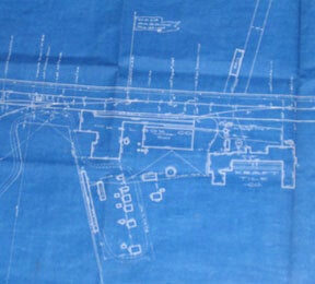
Right of Way and Track Map, Pabrico, Alameda County, California
Southern Pacific Lines (San Francisco, Calif.) · 1926 · Wittenborn Art Books
$350.00 (€317.55 | £264.92 | ¥55,873)
San Francisco, Calif.:, Calif. Southern Pacific Company, 1926. Map. Blueprint 24" x 55". Complete map of Pabrico. Includes W.S. Dickey Clay Co. K. & L. Box Co. Scale 1" = 100'. .

Right of Way and Track Map, Niles and Pabrico, Alameda County, California
Southern Pacific Lines (San Francisco, Calif.) · 1936 · Wittenborn Art Books
$350.00 (€317.55 | £264.92 | ¥55,873)
San Francisco, Calif.: Southern Pacific Company, 1936. Map. Blueline print 24" x 56", with purple pen and red pencil notation. Includes Washinton Township, Decoto, Niles, Pabrico, Rancho Arroyo de la Alameda. With Schedule of Property, approx. 30 transfers. Scale 1" = 400'. .

Map of Nogales, Santa Cruz County, Arizona
Southern Pacific Lines (San Francisco, Calif.) · 1930 · Wittenborn Art Books
$450.00 (€408.27 | £340.61 | ¥71,836)
Denver, Colo.: The Weiland Engineering Co. 1930. Insets and notes, 1937, 1940. Map. Blueprint 41.5" x 51". Some tape on face, some tearing, no missing material. Map of Nogales within city limits. With additional engineering and survey notes, and official approval notation by m...

Right of Way and Track Map - Nogales Branch, Santa Cruz County, Arizona. Benson to Nogales. Set of Two
Southern Pacific Lines (San Francisco, Calif.) · 1923 · Wittenborn Art Books
$350.00 (€317.55 | £264.92 | ¥55,873)
Tucson, Ariz.: Southern Pacific Company, 1923. Map. Blueline prints, 24" x 56" and 24" x 28". Second map is missing northern half, with tear along opposite edge. Map of Nogales railroad yard from north of Nogales to border with Mexico, with Schedule of Property Acquisition (Da...

Station Plan of Oakdale, Stanislaus County, California. Set of Two. Map
Southern Pacific Lines (San Francisco, Calif.) · 1930 · Wittenborn Art Books
$350.00 (€317.55 | £264.92 | ¥55,873)
Oakland, Calif.: Southern Pacific Company, 1930. Map. Blueprints, each 24" x 55". Station plan of Oakdale, railroad property with approx. four blocks on each side along tracks, from north of Stanislaus River to south of South St. Scale 1" = 100'. .

Station Plan of Oakdale, Stanislaus County, , California. Set of Two. Map
Southern Pacific Lines (San Francisco, Calif.) · 1930 · Wittenborn Art Books
$500.00 (€453.64 | £378.46 | ¥79,818)
Oakland, Calif.: Southern Pacific Company, 1930, revised 1960. Map. Blueline prints, each 25" x 56". Station plan of Oakdale, railroad property with approx. four blocks on each side along tracks, from north of Stanislaus River to south of South St. Scale 1" = 100'. .