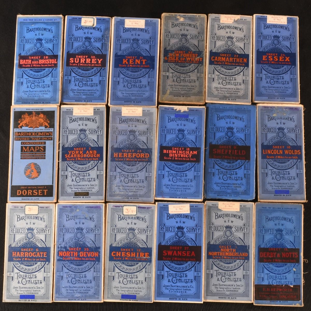
Unknown — Bartholomew&Apos;S New Reduced Survey Coloured Maps; Dorset Contoured Map
Edinburgh, John Bartholomew & Co. c1920-1937. Cloth. The complete thirty-eight volume series of reduced survey colour maps by Carthographer John Bartholomew, along with a charming contoured map of Dorset. All thirty-seven volumes of Barthlomew's New Reduced Survey coloured maps series across England and Wales, a complete set, with an additional contoured map of Dorset from John Bartholomew & Co. with the reduced survey maps believed to have been published in circa 1920, and the contoured map in 1937, after George V's death. In the publisher's blue paper wraps, with cloth colour maps inside each. A distinguished geographer and cartographer, John George Batholomew wished to address the demand for travel in the late nineteenth and early twentieth centuries as roads and rail expanded where people across the country could go. After his death in 1920, the project was taken over by his son. - 1. North Northumberland- 2. South Northumberland- 3. Cumberland- 4. Durham- 5. North Lancashire- 6. Harrogate- 7. York and Scarborough- 8. Liverpool and Manchester- 9. Sheffield, mounted on cloth covers, pocket series of Touring Maps.- 10. Lincoln Wolds- 11. North Wales- 12. Cheshire- 13 Derby & Notts- 14. Lincoln Fens- 15. Norfolk- 16. Aberystwyth- 17. Shropshire- 18. Birmingham District- 19. Huntingdon, Cambridge, etc.- 20. Suffolk- 21. Pembroke- 22. Carmarthen- 23. Hereford- 24. Oxfordshire- 25. Bedford, Hertford, and C.- 26. Essex, very scarce in commerce.- 27. Swansea- 28. Bath and Bristol- 29. Berks and Wilts- 30. Surrey- 31. Kent- 32. Sussex- 33. New Forest & Isle of Wight, very scarce in commerce.- 34. Dorset- 35. North Devon- 36. South Devon- 37. Cornwall - 4. Dorset, Revised 'Half-Inch' Contoured Maps. In the publisher's blue paper wraps. Externally, mostly smart, with the odd handling mark, slight fading to wraps, minimal to Sussex, and light fraying to edges. Fading a little heavier to York, New Forest, North Northumberland, Cheshire, Harrogate, Camarthen, Cheshire, heaviest to New Forest and Hereford. The odd small spot and graze to New Forest, Derby, Lincoln Wolds and North Devon, and to rear of Hereford. A crease to top extremity of Hereford. A couple of faint spots to Dorset Contoured. Worn contemporary price stickers to top edges except Dorset Contoured. Internally, firmly bound, with a couple of small closed tears to edges of Isle of Wight, and a closed tear to center of Sheffield map. Maps are bright and mostly clean, with minor age toning and faint signs of browning to edges, heavier to Isle of Wight. Very Good . Ill.: Unknown. Very Good .