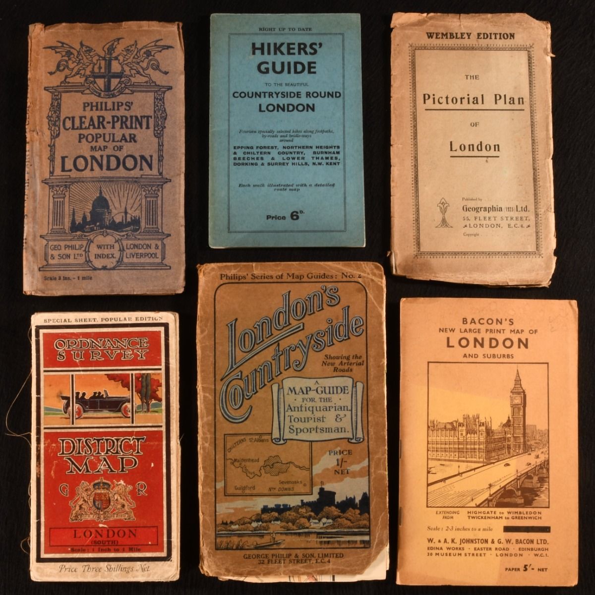
— Maps and Guides to London and Its Suburbs
London , W. & A.K. Johnston & G.W. Bacon Ltd.; George Philip & Son Ltd; Geographia Ltd.; Authority of the Ministry of Agriculture and Fis, c1900-1950 . Paperback. London : W. & A.K. Johnston & G.W. Bacon Ltd.; George Philip & Son Ltd; Geographia Ltd.; Authority of the Ministry of Agriculture and Fisheries, c1900-1950 . Paperback. Good. 8" by 5". Not Stated. A fantastic set of six pocket sized folding maps and guides for hiking and travelling to London and its surrounding areas. A lovely collection of six pocket sized maps and guides depicting London and its surroundings.Including:Bacon's New Large Print Map of London and SuburbsExtending from Highgate to Wimbledon and Twickenham to Greenwich. With a 40 page strangers' guide to London and a large coloured folding map. Philip's Clear-Print Popular Map of LondonWith a 34 page index, and a large coloured folding map.Hiker's Guide to the Beautiful Countryside Round LondonA smart copy, with fourteen specially selected hikes long footpaths, by-roads and bridle-ways around Epping Forest, Northern Heights & Chiltern Country, Burnham Beeches & Lower Thames, Dorking & Surrey Hills, N.W. Kent. Each walk Illustrated with a detailed route map. Wembley Edition: The Pictorial Plan of LondonWith a plan of Wembley and a large coloured folding map. Ordinance Survey: District Map London (South)The special sheet, popular edition. With a large coloured folding map.Philip's Series of Map Guides: No. 2; London's CountrysideA map-guide for the antiquarian tourists and sportsman, showing the new arterial roads. With a large coloured folding map.All in the original paper wraps. In paper wrap bindings. Externally, generally smart. Shelf wear to extremities, with loss to edges of Philip's Series of Map Guides No.2, The Pictorial Plan of London, and Philip's Clear-Print Popular Map of London. Joint of The Pictorial Plan of split to just over half way up the spine, with closed tears to board edges, and slight spotting and age toning to wrap. Rubbing and age toning to wrap of Ordinance Survey: District Map London (South). Loss at head of spine of Philip's Clear-Print Popular Map of London, with joint split at head, with archival tape repair and closed tears to board edges. Tail of Philip's Series of Map Guides: No. 2 joint is split, with cracking to spine. Sunning to wrap of Bacon's New Large Print Map of London and Suburbs. Internally, generally firmly bound. Pages are bright and clean with some spotting and age toning. Map of Philip's Series of Map Guides: No. 2 is disbound from paper wrap, in fragile condition, with parts of map loose and tearing. Good . Ill.: Not Stated. Good .