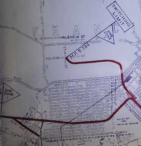
Southern Pacific Lines (San Francisco, Calif.) — Industry Map and Switching Limits Map of San Francisco and Vicinity, San Francisco County, Ca
San Francisco, Calif.: Southern Pacific Company, 1949, rev. 1958, switching limit map 1961. Blueline print, 27 inches x 96 inches. From Millbrae to Yerba Buena Island, Hunter's Point to Daly City. With index to industry, approx. 1000 entries, listed both Alphabetically and by numerical location on map. Scale approx 1 inch = 1200 feet. With two attached blueline print switching zones map,14 inches x 32 inches, four colors indicating zones, one dated 1961, one undated. From San Bruno to Presidio. Four pages of Switching Charges, effective 1960, attached. .
Machine translation by Google. The original description of the seller is leading.
Log in or create an account to translate descriptions. Accedi
Numero libro:
58-0497
$750.00 (€681.17 | £568.22 | ¥119,418)