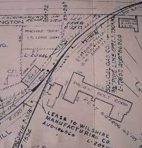
Southern Pacific Lines (San Francisco, Calif.) — Station Plan of West Glendale, Los Angeles County, California. Map
Los Angeles, Calif.: Southern Pacific Company, 1942, revised 1962. Map. Blueline print. 24 x 91 inches. Light scuffmarks. Along San Fernando Road, from Kellogg Avenue to Goodwin Avenue. Includes Los Angeles Channel, Ralph's Grocery Co, Cinch Products, Stires Drill, California Zonolight Co. With Schedule of Property listing approx 15 transfers, 1925-1942. Scale: 1 inch = 100 feet. .
Machine translation by Google. The original description of the seller is leading.
Log in or create an account to translate descriptions. Accedi
Numero libro:
56-0375
$450.00 (€410.21 | £342.40 | ¥71,817)