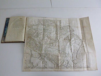
Rennell, James (1742-1830); Philippe Buache (1700 - 1773); Jean Baptiste Boucheseiche (Translator); Jean H. Castéra — Recueil de Cartes Géographiques Pour la Description de L'Indostan... Revues Par le Cen Buache, Membre de L'Institut... First Edition
Paris : Poignée, An VIII [1799-1800]. 4to. 32 x 29cm. With 11 maps, folding out to elephant folio size.Several handcolored ion outline..Contemporary tree calf, restored..James Rennell was the greatest geographer that Great Britain had yet produced. His pre-eminence, as Sir Henry Yule said in 1881, is still undisputed. He was an explorer both by sea and land, a map compiler, a physical geographer, a critical and comparative geographer, and a hydrographer.. Philippe Buache (born Feb. 7, 1700, Paris, Fr.-died Jan. 27, 1773, Paris) was a French geographer and cartographer who contributed to the theory of physical geography.. OCLC Number / Unique Identifier: 5869225: Half title: Atlas pour la description de l'Indostan Map no. [1], Carte de l'Indostan ou de l'Empire mogol, on 4 sheets Issued to accompany the author's Description historique et géographique de l'Indostan. Paris, An VIII [1800] 3 v. .