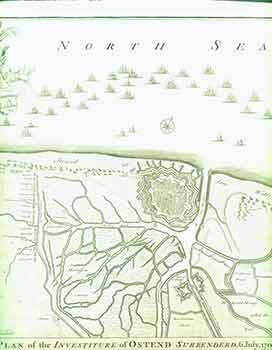
Basire (engraver) — Plan of the Investiture of Ostend Surrenderd, 6 July, 1706. (18th Century Map of North Sea)
[London]: James & Paul Knapton, [1751?]. 19 x 16 inches. Very Good. Fine copperplate engraving. 18th Century, uncolored, folded map of the environs of Ostend during the War of the Spanish Succession, when the allied army under Henry, Count of Nassau, Lord of Overkirk (Ouwerkerk in Dutch) took the town after heavy bombardment. Henry, second cousin and Master of Horse to William III, was one of Marlborough's most trusted generals and was made Field Marshal of the Dutch States Army in 1704. Nicholas Tindal (1687-1774), at one time Chaplain to Greenwich Hospital, first published a translation of Frenchman Paul de Rapin's 'History of England' in 1727, running to thirteen volumes; in 1732 it was enlarged with his own notes and maps. This map was published in 'A summary of Mr Rapin de Thoyras's History of England, and Mr Tindal's Continuation, from the Invasion of Julius Caesar, to the End of the Reign of King George I. Illustrated With Medals, Plans of Battles, Towns, and Sieges', 1751. Scarce. .