Thompson, Thos. H.; aka Thomas Hinckley Thompson, (1841-1915) — Official Historical Atlas Map of Tulare County... . Compiled, Drawn and Published from Personal Examinations and Surveys by Thos. H. Thompson, Tulare, California. First Edition
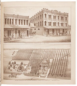
Tulare, CA: Thos. H. Thompson, 1892. Square folio. Rebound in library buckram lettered in gilt, custom clamshell case. 36 x 38cm. With maps, lithograph plates in sepia, some double-page, many with multiple images. First Edition..."Resolved, that the Atlas map of Tulare County, California, now being published by Thos. H. Thompson .. is hereby declared the Official map of Tulare County, California." ..In 1893 Kings County was formed from a part of Tulare County..Detailed mapping of the county replete with lithographed views of the various farms and ranches. Rocq 15171..Thompson lived in Tulare County; he made a special edition of the atlas (150 copies) in sepia tone, of which this is one. The map of Tulare County has full color; map of California is printed with full color; all others are sepia..OCLC Number / Unique Identifier: 1000135407.: Physical Description: 147 pages, 61 leaves of plates : maps (some color) ; 40 cm; Huntington Library , call no. 244737..A detailed subdivision and township atlas of Tulare County, in the southern Central Valley of California. Large lots are labeled with names of the owners, and in this copy many changes of ownership are noted in pencil. ROCQ 15171. NORRIS CATALOGUE 3965. 4pp. Double-sheet key map plus 108 township maps .. Condition: Title page, table of contents, and margins of a few other pages repaired with tape or backing, occasional smudging and creasing; very good. .