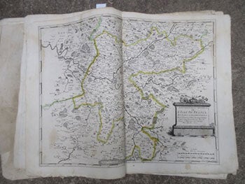
Sanson d'Abbeville, Nicolas (1600-1667); François Chauveau, (1613-1676); R. Cordier d'Abbeville, engraver — Carte Generale Du Tres-Haut, Tres-Puissant Et Tres Chrestien Royaume de France Et de Tous Les Pays Circom-Voisins. Présentée a Sa Maj[Es]Té Tres Chrest[ Ien] Louis XIIII / Par Son Tres Humble, Tres Obeissant Et Tres-Fidele Serviteur Et Suject N. Sanson D'Abbeville Geographe Ordinaire de Sa Majesté . ;Gravé Par R. Cordier D'Abbeville... . . First Edition of the Atlas [with 18 Maps]
Firmato
Paris: 1653. Folio. 30 x 43.2cm. Defective contemporary thick paper covers. Title page and dedication page with losses. Handcolored in outline. One map with loss in lower right corner and one map with tear in lower right corner, Sixteen double page maps complete, some with waterstains visible verso..Rare to find such a large ensemble of Sanson's maps. Reference: Bibliothèque nationale de France; ark:/12148/btv1b530780775/; Bibliothèque nationale de France, département Cartes et plans, GE A-592 (RES). .
Machine translation by Google. The original description of the seller is leading.
Log in or create an account to translate descriptions. Accedi
Numero libro:
16-6140
$6,500.00 (€5,923.95 | £4,968.66 | ¥1,030,641)