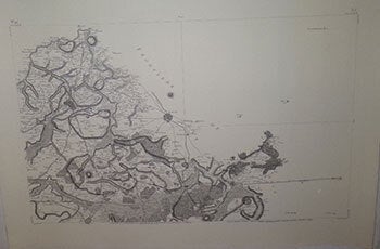
Cassini, de Thury, Cesar-Francois, (1714-1784) — Carte de France Levée Par Ordre Du Roy. No. 41 (Lille. 1758) . Modern Printing
Paris: circa 1758. Engraving on thick Arches paper. 73 x 104cm. sheet size...Echelle de dix Mille Toises ; vingt mille mètres ; 20 000 T à la M. References: Konvitz, J. Cartography in France 1660-1848, p. 21-31; Pelletier, M. Les cartes des Cassini; rumsey, 5694.06...The base of the triangulation was the verified meridian of Paris; along it, at intervals of 60,000 toises (rather more than 1° of latitude), perpendiculars were carried to east and west, from which the positions of towns and other landmarks were fixed. The project faced immense difficulties which were ultimately overcome. In 1756 the French Government withdrew its financial support, but Cassini formed a company which sought to recover its expenses from the sale of the maps. Later several provinces provided financial support. Cassini lived long enough to see the work practically completed before he died of smallpox on September 4, 1784. Publication was undertaken by his son, Jacques Dominique. The atlas appeared in 182 sheets in October 1789 .. It soon won universal acclaim and stands as model for all later map-making by triangulation' (NMM). .