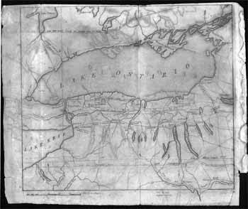
Harrison, S. — Lake Ontario and Environs, Including Niagara Falls, Fort Erie, and the Finger Lakes, New York
[Philadelphia, Pa.: The Port Folio, 1810]. Line etching measuring 11 x 9 inches. The map had accompanied an article by Thomas Cooper entitled "A Ride to Niagara." In the arcticle, Cooper writes of "M'Alpin's map of the turnpike roads of New York state." The map shows from the state as far east as Rotterdam on Oneida Lake, and includes lands to the North of Lake Onatraio. The early settlements in the area, including New Amsterdam (now Buffalo) and Catharine's Town (now Watkins Glen) are indicated, linked by an extensive network of roads and trails. Of particular interest are the indication of what are indicated as more major roads, such as the "New State Road," "Lake Erie Turnpike Road," and "Ontario & Genesee Turnpike Road" Also shown is a proposed canal between the "Tonnewanta" river and "Mud Cr." which ran into the "Genesee River," and the "New State Road now making 1809," running from what is now Syracue to Fort Niagara at the mouth of the Niagara River. Creased from folding, with some discoloration from moisture, some wear along edges, else very good. .