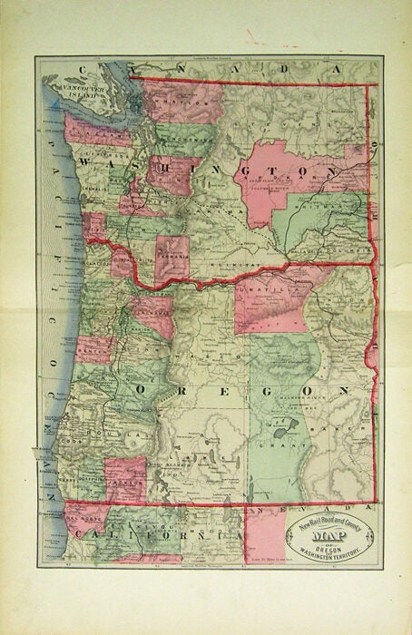
Cram, George F. — New Rail Road and County Map of Oregon and Washington Territory
[Chicago], George F. Cram, 1882. One sheet folded (56.5 x 35 cm). 43.75 x 29.5 cm. (17 x 11 1/2 inches). Hand colored. Title inside oval cartouche. Scale 36 miles to 1 inch. Taken from "Cram's Illustrated Family Atlas of the World." There were numerous versions of the New Rail Road and County maps by published by Cram and Henry S. Stebbins, with later versions machine colored due to the expense of hand coloring. Phillips 901. Marginal finger soiling, 4 inch tear archivally repaired on verso, visible only at the margin. Still quite good. We have a very good copy but with a slightly lighter machine coloring.
Machine translation by Google. The original description of the seller is leading.
Log in or create an account to translate descriptions. Accedi
Numero libro:
43539
$100.00 (€91.08 | £76.30 | ¥15,977)