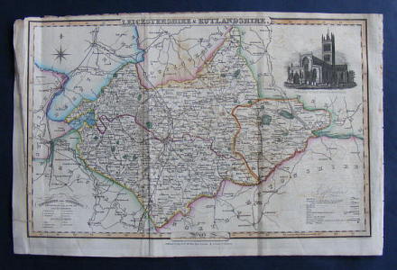
, — Map of LEICESTERSHIRE & RUTLANDSHIRE.
Pigot & Co., London & Manchester, 1841, printed area 13.75 inches (34.5 cm) wide by 8.75 inches (22.5 cm) with reasonable margins, steel engraved hand coloured map on a single sheet extracted from Pigot's National and Commercial Directory covering the County with a vignette of St. Mary's Church, Melton Mowbray, indicating the Hundreds of both Counties and showing the Mail Roads, Turnpikes, Railroads, Rivers, Canals, Towns and Villages, rubbed at extrems., with several edge nicks repaired to reverse, creases where previously folded, a little dusty, some offsetting,
Machine translation by Google. The original description of the seller is leading.
Log in or create an account to translate descriptions. Accedi
Numero libro:
37986
£25.00 (€29.97 | $32.96 | ¥5,256)