
Cerca libri
Risultati della ricerca
415 risultati per "Ocean ships"

Indonesia, Strait of Bali, East Java and Madura - Laurie and Whittle, 1794
Laurie and Whittle · 1794 · Inter-Antiquariaat Mefferdt & De Jonge
€495.00 ($545.58 | £412.96 | ¥87,122)
DETAILED BRITISH SEA CHART OF THE STRAIT OF BALI, EAST JAVA AND MADURA, 1794 “A New Plan of the Straits Situated to the East of Java & Madura commonly called The Straits of Bali and of Pondi and Respondi”, copper engraving published in London by Robert Laurie and James Whittl…
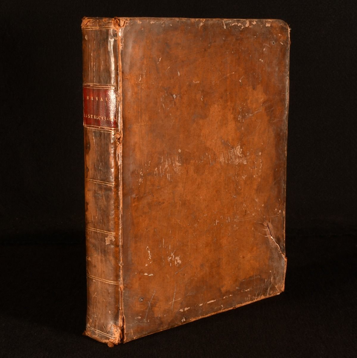
Regulations and Instructions Relating to His Majesty&Apos;S Service at Sea
The Royal Navy, His Majesty's Council · 1808 · Rooke Books
£295.00 (€353.60 | $389.74 | ¥62,236)
London, Not Stated, 1808. Leather. The scarce 1808 record of the official regulations governing the organization and discipline of the British Navy in the early 19th century, in a contemporary calf binding. The scarce 1808 edition of this work, which was published across the 18t…

Cognition in the Wild
Edwin Hutchins · 1995 · Boekhandel J de Slegte BV
€65.00 ($71.64 | £54.23 | ¥11,440)
MIT Press, 1995, Linnen band met stofomslag, 381, Edwin Hutchins combines his background as an anthropologist and an open-ocean racing sailor and navigator in this account of how anthropological methods can be combined with cognitive theory to produce a new reading of cognitive …

Indonesia, Bangka Strait - Laurie and Whittle, 1796
Laurie and Whittle · 1796 · Inter-Antiquariaat Mefferdt & De Jonge
€495.00 ($545.58 | £412.96 | ¥87,122)
NAUTICAL CHART OF THE BANGKA STRAIT BETWEEN SUMATRA AND BANGKA, 1796 “Plan of the Straits of Banca”, copper engraving published in London by Robert Laurie and James Whittle on 1 January 1796, and included in their nautical atlas The East-India Pilot, or Oriental Navigator. Co…
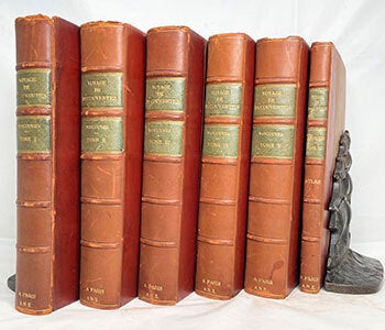
Voyage de Découvertes à L'Océan Pacifique Du Nord, Et Autour Du Monde; Entrepris Par Ordre de Sa Majesté Britannique; Exécuté, Pendant Les Années 1790, 1791, 1792, 1793, 1794 Et 1795, Par le Capitaine George Vancouver; Traduit de L'Anglais Par P.F. Henry Et Accompagné D'Un Atlas Composé de Diverses Planches Et de Cartes Géographiques [Five Volumes of Text and Atlas Volume] . First Edition
Vancouver, George (1757-1798) ; Pierre François Henry (1759 - 1833), traduction · 1801 · Wittenborn Art Books
$1,500.00 (€1,360.94 | £1,135.38 | ¥239,531)
Paris: de l'imprimerie de Didot jeune,, an X [- 1801-1802]. 8vo 13 x 20.5cm, [8.25x5.75in]; Volumes I to V - 341, 384, 381, 368, and 438 pp. respectively, Atlas (Volume VI) . with 17 plate views, 1 plate Carte des Iles Hergest, 8 fold out Coastal Charts.Very good....Uniformly bo…

NARRATIVE OF THE UNITED STATES EXPLORING EXPEDITION. During the Years 1838, 1839, 1840, 1841, 1842
WILKES, Charles · 1845 · Charles Agvent
$5,625.00 (€5,103.51 | £4,257.69 | ¥898,240)
Philadelphia. Lea & Blanchard. First Regularly Published Edition. Six 7" x 11" volumes bound in five in modern buckram retaining early marbled endpapers, complete with the Atlas volume bound with the last text volume. Illustrated with 64 engraved plates with tissue guards, 9 dou…

The Wide World - the Magazine for Men, July 1915, No. 207, Vol. 35 - a Woman Alone in China / War-Time Wanderings in the Italian Alps
PESCIO, LUIGI; M.S.T.; OUTHWAITE, E.; MORRIS, SIR EDWARD; HEIGHTON, J.; DOWDING, C.; PITT-KETHLEY, V.; ET AL · 1915 · RareNonFiction.com - Rare Books and Vintage Magazines
$299.95 (€272.14 | £227.04 | ¥47,898)
New York: The International News Company, 1915. First Edition. Single Issue Magazine. W.E.; Webb, Arch.; Wright, Frank. Pages 194-288 pages plus 16 pages of great vintage ads. Features: A Millionaire's Adventure - Milan millionaire Signor Luigi Beretta becomes the victim of an i…

Wijtloopig breede en waerachtige beschrijvinge van de ongeluckige voyage van ’t schip Aernhem; van Batavia vertrocken den 23 December 1661 in compagnie van noch ses andere schepen, onder ’t commando van de heer Aernout de Vlamingh van Outshoorn ...Amsterdam, Jacobus van der Fuyck, 1664. 4to. With a woodcut vignette on the title page and 2 decorated woodcut initials. Disbound, loosely inserted in 20th-century plain brown paper wrappers.
KERCKHOVEN, Johannes van [= Simon van den KERKHOVEN]. · 1654 · A. Asher & Co. B.V.
€2,500.00 ($2,755.46 | £2,085.66 | ¥440,011)
“28” [= 24] pp.Rare second edition, under a different title, of an eyewitness report of the dramatic shipwreck of the “Arnhem”, a Dutch East Indiaman built in 1654 for the VOC. The report was written by Simon van den Kerkhoven, a religious comforter to the sick (“Siecken-trooste…

Cartography Canary Tenerife ca 1746 | Original print: Coloured Carte Vue du Pic de Tenerife, Vue du Pic, au dessus du côté d'Ouest de Gomera (Gezicht van de piek van Kanarie, van de Piek boven Gomera), 1746, 1 p.
Schley, Jan van der · 1746 · Antiquariaat Arine van der Steur (NVvA/ILAB)
€72.60 ($80.02 | £60.57 | ¥12,778)
Original 1746 coloured coastal profile engraving by Jacques-Nicolas Bellin, depicting the Pico del Teide on Tenerife as seen from the Atlantic Ocean, with La Gomera and Gran Canaria serving as navigational landmarks for eighteenth-century mariners. These detailed sailing views i…

South China Sea, Hainan, Gulf of Tonkin - British Admiralty, (1882) 1937
1882 · Inter-Antiquariaat Mefferdt & De Jonge
€950.00 ($1,047.07 | £792.55 | ¥167,204)
THE SOUTH CHINA SEA WITH HAINAN AND THE GULF OF TONKIN ON THE EVE OF WWII IN ASIA "China Sea – northern portion." Copper engraving published in 1882 by the Hydrographic Office of the British Admiralty. This edition with additions and corrections to 1937. Size: 102.5 x 70 cm. N…

Whaling - Thomas Sutherland after William John Huggins, 1825
Huggins-- William John · 1825 · Inter-Antiquariaat Mefferdt & De Jonge
€975.00 ($1,074.63 | £813.41 | ¥171,604)
“South Sea Whale Fishery.” Aquatint engraving made in 1825 by Thomas Sutherland after a painting by William John Huggins official Marine Painter to his Majesty. Size: 43,2 x 55,9 cm. “A representation of the Ships Amelia Wilson and Castor off the Island of Bouro with their Boat…

[A bird's-eye view of Macao].[Macao, ca. 1849-1865]. Painting 350 x 150 cm. Watercolour on paper on contemporary wooden roll.
[GUANGZHOU SCHOOL]. · 1835 · A. Asher & Co. B.V.
€85,000.00 ($93,685.47 | £70,912.61 | ¥14,960,359)
A massive view of Macao from above, painted in watercolours sometime in the second half of the nineteenth century, during the era in which much of the trade in the area was beginning to shift from the old Portuguese colony to Hong Kong. The peninsula, clearly labelled with the M…

Africa - Willem + Joan Blaeu, c. 1640
Blaeu-- Joan · 1640 · Inter-Antiquariaat Mefferdt & De Jonge
€2,950.00 ($3,251.44 | £2,461.08 | ¥519,212)
BLAEU'S FAMOUS MAP OF AFRICA "Africae nova descriptio", copper engraving published in Amsterdam by Willem Jansz. and Joan Blaeu, ca. 1640. Coloured by a later hand. Verso: German text. Size: 41 × 55.5 cm. This is one of the most recognisable and decorative maps of the continen…

America - Jodocus Hondius, 1606
Hondius-- Jodocus · 1606 · Inter-Antiquariaat Mefferdt & De Jonge
€4,950.00 ($5,455.80 | £4,129.62 | ¥871,221)
HONDIUS’ HIGHLY SOUGHT AFTER MAP OF THE AMERICAS “America” copper engraving made by Jodocus Hondius the Elder for his first edition of Gerard Mercator's atlas published in Amsterdam in 1606. With handsome original hand-colouring. Size: 37.5 x 50 cm. The map shows the Nort…

Hong Kong a View of the Harbor and Victoria Peak at Sunset in 1870. Signed
Stobart, John (1929-2023) · 1990 · Wittenborn Art Books
$500.00 (€453.65 | £378.46 | ¥79,844)
Maritime Heritage Prints. 1990. Color print One of 950 signed and numbered impressions. 20 × 32 in.. This view of Hong Kong shows an ocean-going junk moving through the harbor as the American ship CHARTER OAK (left foreground) takes on cargo at sunset in 1870.... Born in Leicest…

Asia - Jodocus Hondius, 1630-1631
Hondius-- Henricus · 1628 · Inter-Antiquariaat Mefferdt & De Jonge
€1,450.00 ($1,598.16 | £1,209.69 | ¥255,206)
EARLY DUTCH MAP OF ASIA “Asiae Nova Descriptio Auctore Jodoco Hondio.” Copper engraving made in 1628 by Jodocus Hondius for the "Atlas sive cosmographicæ meditationes de fabrica mundi et fabricati figura", here in a third state published in Amsterdam in 1630/31. Original hand-c…

China, Korea, Japan - Mercator/Hondius, 1619
Hondius-- Henricus · 1619 · Inter-Antiquariaat Mefferdt & De Jonge
€2,150.00 ($2,369.69 | £1,793.67 | ¥378,409)
ONE OF THE MOST SOUGHT AFTER MAPS OF CHINA "China" Copper engraving made by Gerard Mercator published in Amsterdam by Jodocus II and Henricus Hondius in 1619. Verso Latin text. With original (?) hand colouring. Size: 34 x 47 cm. Of the lands in the Far East, China was seen as th…

New Netherland, New Amsterdam (New York) - Justus Danckerts, 1690
Danckerts-- Justus · 1690 · Inter-Antiquariaat Mefferdt & De Jonge
€6,500.00 ($7,164.18 | £5,422.73 | ¥1,144,027)
Novi Belgii Novaeque Angliae Nec Non Pennsylvaniae et Partis Virginiae Tabula (Map of New Netherland, New England, as well as Pennsylvania and a part of Virginia.) Copper engraving published by Justus Danckerts in Amsterdam in 1690. With original hand colouring. Size: 46.5 x 54.…

A voyage round the world, in the years MDCCXL, I, II, III, IV.London, printed for the author, by John and Paul Knapton, 1748. Large 4to. With 42 engraved plates, maps and plans, all but one folding. Bound by Marcus Ward & Co. (founded 1833), with their bookbinder's label on the front paste-down, in 19th-century calf, gold-tooled and blind-tooled frame on both boards, gold-tooled spine with red morocco spine label with title in gold, gold-tooled board edges, blind-tooled turn-ins, red edges, blue ribbon marker.
ANSON, George and Richard WALTER and/or Benjamin ROBINS (ed.). · 1739 · A. Asher & Co. B.V.
€6,500.00 ($7,164.18 | £5,422.73 | ¥1,144,027)
[1], [1 blank], [32], [1 blank], 417, [1 blank], [2] pp.First edition of this important and popular account of the unfortunate and famous expedition of George Anson, being considered as “the one most sought after” (Borba de Moraes). It is an account of Anson’s expedition to the …
1915 Philip G. Peabody Autograph Letter from the White Star Line S.S. Canopic, with Wartime Atlantic Blackout and Torpedo Reports, by Boston Lawyer, Social Reformer and Early Naacp Supporter
PHILIP G. PEABODY · 1915 · Katz Fine Manuscripts
$2,055.99 (€1,865.38 | £1,556.22 | ¥328,315)
UNITED STATES, 1915. Non-Book. Illustrated by /. On offer is a letter written by Philip G. Peabody (1857-1934) , a world traveller and a significant person in the drive for equal rights for black Americans in the early days of the 20th century. This letter was written to his ado…