
Ricerca avanzata
Risultati della ricerca
7 risultati per "title: East Wind West Wind"

East Wind West Wind. Afterword by Ian Buruma. English and Chinese text.
Manen, Bertien van. · 2001 · Fahrenheit 451
€175.00 ($192.87 | £146.00 | ¥30,799)
Amsterdam, De Verbeelding, 2001, 1st ed., 232 pag., coloured photographic illustrations and photo-illustrated card wrappers with flaps by Bertien van Manen, text in English and Chinese, quarto (26 x 20,2 cm.). = As new. Parr/ WassinkLundgren, The Chinese Photobook, p.398. 'Ber…

East Wind West Wind
Bertien van Manen 253154 · 2001 · Boekhandel J de Slegte BV
€100.00 ($110.21 | £83.43 | ¥17,600)
de Verbeelding Publishing, 2001, Paperback, 232, 'Bertien van Manen is a recorder of intimacy.' 'To penetrate the privacy of other people's lives would take a great deal of tact anywhere. For a Dutch photographer to have found her way into the intimate corners of Chinese lives m…

EAST WIND: WEST WIND
Buck, Pearl S. · 1968 · Handled With Care
€5.00 ($5.51 | £4.17 | ¥880)
Pan Books, 3rd printing 1968 ; Conditie: In goede staat. Paperback. Pocket. Afvoer bib.

Bertien van Manen: East Wind, West Wind
Buruma, Ian · 2001 · Klondyke BV
€100.00 ($110.21 | £83.43 | ¥17,600)
Paperback, inclusief stofomslag; 2001; Amsterdam : De Verbeelding Publishing; 232pp.; Conditie: Goed; Paperback, transperent dust jacket, illustrated with numerous (full page) photographs in colour, picture editing Hans Aarsman, text in English and Chinese, 4to.; Engels; ISBN10:…

[Manuscript portolan chart of the Atlantic Ocean, including Western Europe, South America, and West Africa].Porto, 1786. Chart ca. 86 x 68 cm; frame ca. 101 x 83.5 cm. Detailed manuscript portolan chart in ink and paint and/or ink wash in green, yellow, red, and brown on vellum. The chart is drawn within a red washed border and shows the detailed coastlines of the east coast of South America, the west coast of Africa, and the west coast of northwest Europe up to the Netherlands and including Great Britain and Ireland. The coasts are drawn in sections alternatingly in yellow, green, and red ink. Principal regions are added in large decorative script, coastal towns, cities, and capes are added in a small cursive hand. Also depicted are a detailed split graticule indicating longitude and latitude, intricate rhumb lines, islands, dangerous rocky outcrops (marked vegia (= vigia, meaning lookouts)), and inshore shoals. Further decorative elements in the chart are the flags in Brazil (Portuguese coat-of-arms), Algeria (Ottoman Empire?), and West Africa (Dutch flag, upside down); the side view of Elmina Castle in west Africa, two half wind roses, elaborate rococo floral (fleur-de-lis) ornaments at the head of the chart and in South America. The banderole at the bottom of the chart contains the following text: "Manoel Joze Vianna a Fes no Porto" and below the year of production "1786". Framed in a gold-coloured frame and mounted on a cream cloth covered backboard.
VIANNA, Manoel José. · 1482 · A. Asher & Co. B.V.
€135,000.00 ($148,787.82 | £112,627.53 | ¥23,759,551)
A very unusual and highly decorative late 18th century Portuguese manuscript chart, showing the Portuguese Empire on both sides of the Atlantic. On the left is colonial Brazil, the map listing more than 100 places along the Brazilian coast up to the Caribbean, including the foll…
East Wind West Wind.
Manen, Bertien van · 2001 · Inktswart
€110.00 ($121.23 | £91.77 | ¥19,360)
De Verbeelding, 2001. paperback met transparant stofomslag; prachtig; vlekje op boekblok; groot formaat.
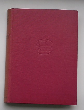
East wind: west wind. Tauchnitz 5161.
BUCK, PEARL S., · 1935 · Antiquariaat Victory
€8.00 ($8.82 | £6.67 | ¥1,408)
Leipzig, Tauchnitz, 1935. 262 pp. Hardcover. Spine faded.