
Mullen Books, Inc. ABAA / ILAB
Libri
89 libri di Mullen Books, Inc. ABAA / ILAB

Mcnally's System of Geography: An Improved System of Geography, Designed for Schools, Academies, and Seminaries
Mcnally, Francis · 1866
$200.00 (€182.27 | £152.11 | ¥31,872)
New York, A.S. Barnes and Co, 1866. Hardcover. A light blue casebound book with a black spine. 110 pages; illustrated in both color and black-and-white. G: Wear to edges and corners, with small tears at the top and bottom of the spine. Smudging, stains, and fading to the cover...
Mitchell's School Atlas: Comprising the Maps, Etc. , Designed to Accompany Mitchell's School and Family Geography
Mitchell, S. Augustus · 1852
$100.00 (€91.13 | £76.05 | ¥15,936)
Philadelphia, Thomas, Cowperthwait & Co, 1852. Hardcover. A large brown casebound book with a green spine. Unpaginated. Profusely illustrated with black-and-white images; contains color maps. G: Significant wear to the edges and corners, with the top and bottom of the spine mi...
The Hotelmen's Consolidated Tours of the Eastern States
1926
$30.00 (€27.34 | £22.82 | ¥4,781)
The National Survey, 1926. Hardcover. A textured burgundy casebound book. 150 pages; profusely illustrated with color maps. VG .
A New System of Geography, Ancient and Modern, for the Use of Schools, Accompanied with an Atlas Adapted to the Work
Morse, Jedidiah · 1822
$30.00 (€27.34 | £22.82 | ¥4,781)
Boston, Richardson & Lord, 1822. Hardcover. A small casebound book with a leather spine that has gilt text. ~374 pages. G+: An old book with significant wear to the edges and corners. Tanning and foxing to the pages. Some small holes and tears that do not appear to affect text...
The National Standard Atlas of the World, 1898: Specifically Adapted for Commercial and Library Reference, Astronomical, Geographical, Chronological, Historical, Statistical, Financial, Commercial, Educational, Agricultural, Descriptive, and Illustrative, Giving the Latest and Best Instructice Maps and Charts Together with the Most Pratical Comprehensive and Useful Statistical Information, the Whole Brought Down to the Latest Dates, and Presented in the Most Convienent Form for Every-Day Use, wi
1898
$225.00 (€205.05 | £171.12 | ¥35,857)
Fort Dearborn Publishing Co, 1898. Hardcover. A large blue leather casebound book with silver text on the front. Color-illustrated end pages. 418 pages; profusely illustrated with both color and black-and-white images. VG: An old book in excellent condition. Stain on the spine...
Collection Des Cartes Taride: Grande Carte de France Par Departements Lignes de Chemins de Fer-- Lignes de Navigation Colonies Francaises
Taride, A. · 1920
$200.00 (€182.27 | £152.11 | ¥31,872)
Paris, 1920. Old map of France folded and laid in brown paper wraps. VG-: The wraps have seen better days, with creases and tears along the edges and bends to the corners. There are a few small stains and stray marks. The map is clean and bright, but has ten small holes worn t...
200 Jahre Artaria & Compagnie
Freytag, Berndt and Artaria · 1970
$90.00 (€82.02 | £68.45 | ¥14,343)
Vienna, Austria, Freytag-Berndt and Artaria, 1970. Softcover. Green wraps with gilt text. 1-146 pp. with 2 unnumbered pages of plates. Chiefly text. A 200 year history of Viennese cartography companies. VG minor pencil marking on endpage, rear cover creased at corner .
Turtle Island
Daniel Crouch Rare Books · 2024
$35.00 (€31.90 | £26.62 | ¥5,578)
London, Daniel Crouch Rare Books, 2024. Softcover. Illustrated matte softcover with French flaps. The title is printed in white font down a black spine. Pages: (4), 5-176. Profusely illustrated with both color and black-and-white images. "..the Lenape call this land, North Ame...
Atlas Deutsche Geschichte: Römerzeit Bis 1914; 2000 Jahre Deutscher Geschichte
Schwabe, Ernst · 2008
$25.00 (€22.78 | £19.01 | ¥3,984)
Holzminden Reprint-Verl. Leipzig, 2008. Hardcover. A matte hardcover with illustrated boards. The spine is blue with the title in black lettering. Pages: (9), 2-108. Profusely illustrated with color images, as well as at least one foldout map. VG+: Looks like it has rarely bee...
Illustrated Historical Atlas of Porter County, Indiana
A.G. Hardesty (Firm) · 1876
$300.00 (€273.40 | £228.16 | ¥47,809)
Valparaiso, Indiana, A.G. Hardesty, 1876. Hardcover. Oversized light brown and black folio with gilt lettering; 1 atlas ([4],7-90 pages); illustrations, hand-colored maps. Includes Table of Contents and a Preface. The following maps are missing: Map of Indiana -- see note belo...
Meyers Universla-Atlas Mit 225 Haupt- U. Nebenkt. , Darunter 2 Grobraumkarten, 394 Abbildungen Von Landschaften, Vokstypen, Stadten Usw. Nebst Ausfuhrl. Erl. U.E. Umfass. Textteil, Reg. Mit Rund 70000 Namen
[Not Identified] · 1936
$50.00 (€45.57 | £38.03 | ¥7,968)
Leipzig, Bibliographisches Institut, 1936. Hardcover. Dark brown leather and light brown cloth over boards with light brown lettering on the spine; 63 pp.; richly illustrated; b&w photos; folded color maps. Text in German. Nice, bright folded maps in this book!. VG (Boards and...
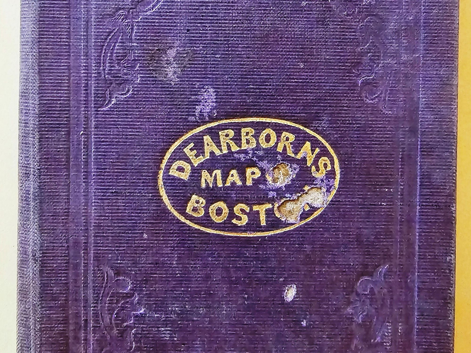
A New & Complete Map of the City of Boston, with Part of Charlestown, Cambridge and Roxbury... By G.W. Boynton for N. Dearborn
1844
$1,000.00 (€911.34 | £760.53 | ¥159,362)
Boston, N. Dearborn, 1844. Folded cloth case with "Dearborn's Map of Boston in gilt embossing on cover. Unfolds to 18.4" x 15.5" An exquisite copy of this treasure. VG, very minor staining and tenderness at fold corners with minor wear holes of lilliputian dimensions, bright a...
Sfere Terrestri E Celesti Di Autore Italiano Oppure Fatte O Conservate in Italia (a Unique Translation by Edward Luther Stevenson)
Fiorini, Matteo · 1914
$1,250.00 (€1,139.17 | £950.66 | ¥199,203)
Not Identified, [Edward Luther Stevenson], 1914. This is the only copy ever produced, created for personal use by Edward Luther Stevenson. Hardcover. Red cloth over boards with gilt lettering on the spine; 430 pp. interspersed with many unnumbered blank sheets for notes. THIS ...
Block Island Geology: History, Processes, and Field Excursions
Sirkin, Leslie A. · 1994
$20.00 (€18.23 | £15.21 | ¥3,187)
Watch Hill, Rhode Island, Book & Tackle Shop, 1994. Paperback. Light blue wraps with illustration and white lettering; 203 pp.; richly illustrated. Good (Wraps are edgeworn/scuffed/smudged/foxed; textblock edges are worn/scuffed/smudged/foxed; interior is clean; binding is sol...
Washington, Oregon, Idaho, Nevada, Utah, and Arizona (Mcnally's System of Geography, Map No. 17)
Stuart, Oliver J. · 1869
$100.00 (€91.13 | £76.05 | ¥15,936)
[New York], [Not Identified], 1869. Paperback. Hand-colored engraved map depicting Washington, Oregon, Idaho, Nevada, Utah, and Arizona. Map measures 12" x 9.5" Interesting and scarce map depicting Washington, Oregon, Idaho, Nevada, Utah, and Arizona. Verso is page 41 of the b...
Texas, New Mexico and Indian Territory (Mcnally's System of Geography, Map No. 19)
Stuart, Oliver J. · 1869
$100.00 (€91.13 | £76.05 | ¥15,936)
[New York], [Not Identified], 1869. Paperback. Hand-colored engraved map depicting Texas, New Mexico and Indian Territory. Map measures 12" x 9.5" Interesting and scarce map depicting Texas, New Mexico and Indian Territory. Verso is page 45 of the book and has text regarding "...
Wyoming, Nebraska, Kansas, Dakota, Colorado and Montana (Mcnally's System of Geography, Map No. 18)
Stuart, Oliver J. · 1869
$80.00 (€72.91 | £60.84 | ¥12,749)
[New York], [Not Identified], 1869. Paperback. Hand-colored engraved map depicting Wyoming, Nebraska, Kansas, Dakota, Colorado and Montana. Map measures 12" x 9.5" Interesting and scarce map depicting Wyoming, Nebraska, Kansas, Dakota, Colorado and Montana, from a time before ...
Antique Maps & Atlases: Catalogue XXXI
Richard B. Arkway, Inc · 0
$30.00 (€27.34 | £22.82 | ¥4,781)
New York, Richard B. Arkway, Inc, Undated. Softcover. grey textured wraps w/ blue printing. 36 pgs w/ bw illustrations throughout. Pages may have instances of speckled foxing. Details an illustrates 140 pieces; item 93 has red ink notations. Good+ (scuffs, smudges to wraps; in...
Tenth Annual Report of the United States Geological and Geographical Survey of the Territories: Embracing Colorado and Parts of Adjacent Territories: Being a Report of Progress of the Exploration for the Year 1876
Hayden, F.V. and Charles A. White, et al. · 1878
$355.00 (€323.52 | £269.99 | ¥56,574)
Washington, D.C. Government Printing Office, 1878. Hardcover. Dark brown boards with gilt lettering on the spine; 546 pp.; richly illustrated; folded maps. Good - (Boards are heavily worn/scuffed/smudged/foxed, with a hole in the spine strip; boards and spine are not solid and...
Piante Delle Citta Capiluoghi Delle Provincie Del Regno Lombardo Veneto Che Mostrano la Situazione Dei Principali Stabilmenti CIVILI E Militari in Esse Esistenti = Plane Der Provinzial Haupstadte Des Lombardisch-Venetianischen Konigreichs Mit Angabe Der Daselbst Befindlichen Wichtigeren CIVIL Und Militar Etablissements
Bettalli, Antonio · 1838
$1,000.00 (€911.34 | £760.53 | ¥159,362)
Milan, Bettalli, 1838. Hardcover. White boards with black lettering and illustration, and brown spine; unpaginated; 18 leaves of plates (maps), 5 are folded; all maps are in black & white. Text in Italian. This book is exceedingly rare, and in incredible condition. It's richly...