
Antiquariaat Goltzius
Libri
1109 libri di Antiquariaat Goltzius

Historische Atlas van de Biesbosch
WIJK, W. VAN, · 2012
€28.75 ($31.56 | £23.94 | ¥5,027)
Zwolle, Uitgeverij WBOOKS, 2012, 208pp. many illustrations, original hardcover binding.
Nimwegen. Niederrheinischer stadteatlas, IIe Reihe, 1. Heft: Nimwegen.
GORISSEN, F., · 1956
€172.50 ($189.36 | £143.67 | ¥30,164)
Kleve, Boss, 1956, 154 (index)pp. many illustrations, original linen binding, gilt lettering on spine and front. text in Dutch. Historical atlas of Nijmegen.

Luchtfoto atlas. Complete set in 14 volumes of all Dutch provinces.
2004
€172.50 ($189.36 | £143.67 | ¥30,164)
Landsmeer, 12 Provincien, 2004-2005, 14 volumes, many illustrations, aerial photography and maps, complete set of all atlasses with aerial photographs. Flecoland, Utrecht, Zeeland, Limburg, Noord-Brabant Oost, Noord-Brabant West, Zuid-Holland, Overijssel, Drenthe, Noord-Holla...
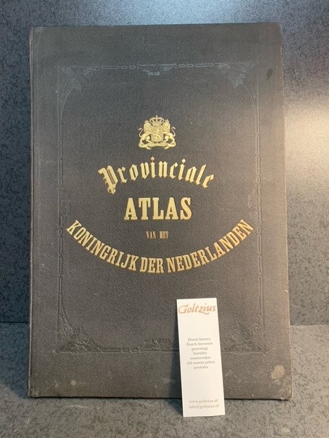
Kaarten der provinciën van het Koningrijk der Nederlanden : vervaardigd naar de groote topographische en militaire kaart van het Ministerie van Oorlog en naar Schetsen der gemeenten door P.H. Witkamp / door J. Smulders & Co. ... ; met bijvoeging van uitvoerige statistieke opgave van P.H. Witkamp.
WITKAMP, P.H., · 1866
€805.00 ($883.68 | £670.45 | ¥140,767)
's Gravenhage, H. Bogaerts/J. Smulders & Co., [1866-67], largo folio: 51x37cm, based on the statistical information of Pieter Harmen Witkamp (1816-1892), 10 lithograph maps, handcoloured borders, coats of arms and other details, textpages describing the individual provinces, ...
Topographical map of The Netherlands, topografische kaart van Nederland. Military map of the Netherlands. Bonnebladen.
1928
€40.25 ($44.18 | £33.52 | ¥7,038)
One page printed chromo topographical map paper on linen, 50x80cm. a so called bonneblad, based on the projection of Bonne. Attractive topographical maps in colour. scale 1:25000. The following maps are present: No. 34 Groenlo, No. 46 West Vierlingsbeek (verkend 1928, 1934 en...

Beschryving van de heerlykheid en het dorp Alphen aan den Ryn. Leiden, H. v. Damme, 1714.
Plemper, P. · 1714
€454.25 ($498.65 | £378.33 | ¥79,433)
Leiden, Hendrik van Damme, 1714, 8vo., later full parchment binding, [24]+261+[11] pp., beautifully rebound, the bookblock has some stains and smudges, but is of solid construction, printer's mark on titlepage (Improbo Servabitur Labore), with 7 fold out engravings by F. Bleis...

Der Rhein von Strassburg bis zur Holländische Grenze in technischer und wirthschaftlicher Beziehung. Unter Benutzung amtlicher Quellen im Auftrage des Herrn Ministers der Öffentlichen Arbeiten. Bearbeitet im Frühjahr 1902.
BEYERHAUS, E., · 1902
€46.00 ($50.50 | £38.31 | ¥8,044)
1902, 32 x 24 cm. viii,128 pp. Original decorated cloth. With 8 (of which 7 folding) lithograph plans/maps in colour, and 137 b/w illustrations in text.From the library of Prof. Dr. G.P. van de Ven. Gerard van de Ven (1941-2017) was a prominent Dutch scholar, author and profes...
De Bussy's atlas van Nederland voor kantoor, school en thuis
1923
€115.00 ($126.24 | £95.78 | ¥20,110)
[1923], large folio atlas of the Netherlands. Bentveld (Bloemendaal) edition (NV Nederl. Exploitatie Mij. 1916, directeur: Bern. J. Veldhuis): all plates have advertisments concerning Bentveld, original binding, very good state, plates of the Netherlands and provinces are prin...
Steden in de renaissance. Civitates Orbis Terrarum.
2008
€28.75 ($31.56 | £23.94 | ¥5,027)
Leiden, HF Ullmann [Tandem Verlag GmbH], 2008, 264pp. gilt edges, original binding, hardcover, including dustwrappers, in original slipcase and in original box, luxurious edition, as new. Illustrated.

Kaartboek van Gelderland 1843.
KUYK, W. JZN., · 1971
€28.75 ($31.56 | £23.94 | ¥5,027)
Alphen aan den Rijn, Canaletto, 1971, Facs. introduction by A.H. Sijmons (7pp) + 15 plates: 2 titelpages, 12 maps, and register, faux leather binding, filt ornament on front. 40×49 cm. From the library of Prof. Dr. G.P. van de Ven. Gerard van de Ven (1941-2017) was a prominen...

Adler erdglobus
1930
€74.75 ($82.06 | £62.26 | ¥13,071)
Leipzig, Hesse & Becker Verlag, Germany, 1930-1940, 35cm/110cm, paper globe, published by Dr. Sandro Limbach, the original wooden stand and the metal half ring are missing. Some damage to the globe. Interesting and detailed earthglobe from the thirties.

Deventer/Zutphen (Gelderland), nr. 33 Topographical map of The Netherlands, topografische kaart van Nederland. Military map of the Netherlands. Bonnebladen.eland
1847
€34.50 ($37.87 | £28.73 | ¥6,033)
Ministerie van Oorlog, Top. Bureau, engraved map surveyed in 1847, engraved in 1858, 58x85cm 1: 50.000 One page detailed topographical map paper on linen, a so called bonneblad, based on the projection of Bonne. Zutphen, Apeldoorn, Hengelo, Bathmen. Hinges suffering. One part ...
Gameren (prov.Gelderland). Origineel gelithografeerd kaartje uit de Gemeenteatlas ca. 1868, 17x22 cm.
Kuyper, J. · 0
€34.50 ($37.87 | £28.73 | ¥6,033)
Published by Hugo Suringar, Leeuwarden.
Hattem. Topographical military map. 1847/1858.
1847
€46.00 ($50.50 | £38.31 | ¥8,044)
Ministerie van Oorlog, 1847/1858, Large topographical military map, scale 1:50.000, 58x88cm, printed paper on linen, some notes in ink in the margins.
Topographical map of The Netherlands, topografische kaart van Nederland. Military map of the Netherlands. Bonnebladen.
1938
€40.25 ($44.18 | £33.52 | ¥7,038)
One page printed chromo topographical map paper on linen, 50x80cm. a so called bonneblad, based on the projection of Bonne. Attractive topographical maps in colour. scale 1:25000. The following maps are present: No. 32 C Zeist/No. 32 D Woudenberg (second half 20th century), N...
Kaart van Friesland ontworpen en getekend door J. Kuyper
KUYPER, J, · 1887
€51.75 ($56.81 | £43.10 | ¥9,049)
Leeuwarden, Hugo Suringar, 1887, 12th edition, this map is damaged along the folds. it needs to be restored/reinforced, but is very attractive once framed. 80x40cm Scale 1: 180.000.
Manoeuvreerkaart der 4e Divisie Infanterie in 1907 op de schaal van 1: 50.000
0
€40.25 ($44.18 | £33.52 | ¥7,038)
One printed page chromo topographical military map, paper on linen, 52x83cm, from Harderwijk-Nijkerk to Oene-Vaassen-Beekbergen. Detailed map of this part of Holland. 19th century.
Topographical map of The Netherlands, topografische kaart van Nederland. Bonnebladen.
1860
€34.50 ($37.87 | £28.73 | ¥6,033)
One page printed chromo topographical map paper on linen, 25x40cm. a so called Bonneblad, based on the projection of Bonne. Attractive topographical maps in colour. Published by Topografisch Bureau 1860-1950. scale 1:25000. The following maps are present: no. 415 Laren (1880-...
Atlas A.N.W.B. Bl. 24. Dordrecht.
1928
€28.75 ($31.56 | £23.94 | ¥5,027)
One colour printed atlaspage on linen, 22x19cm, review 1928.
Atlas A.N.W.B. Bl. 19. Arnhem.
1927
€28.75 ($31.56 | £23.94 | ¥5,027)
One colour printed atlaspage on linen, 22x19cm, review 1927.