
Bailgate Books Ltd
Libri
8001 libri di Bailgate Books Ltd
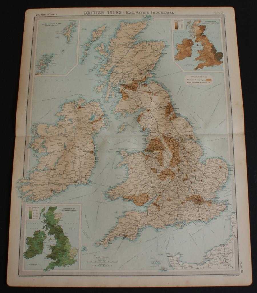
Railways and Industrial Map of the British Isles from the 1920 Times Atlas (Plate 16) with inset maps showing Distribution of Land Under Pasture and Cultivation
The Times and J. G. Bartholomew · 1920
£24.00 (€28.77 | $31.68 | ¥5,052)
The Times, London, 1920. First Edition, Softcover. Very Good Condition/No Dust Jacket. Disbound single sheet with horizontal centre fold from the 1920 "The Times Survey Atlas of the World". Map is in colour and is suitable for framing. Map covers whole of British Isles at scal...

Vegetation and Climate (Rainfall and Temperature) Map of the British Isles from the 1920 Times Atlas (Plate 15)
The Times and J. G. Bartholomew · 1920
£22.00 (€26.37 | $29.04 | ¥4,631)
The Times, London, 1920. First Edition, Softcover. Very Good Condition/No Dust Jacket. Disbound single sheet with horizontal centre fold from the 1920 "The Times Survey Atlas of the World". Sheet is divided into 7 panels. Main vegetation map covers whole of British Isles at sc...
Plans of "Town of England & Scotland" from the 1920 Times Atlas (Plate 26) with Glasgow, Edinburgh, Hull, Newcastle, Liverpool, Manchester, Birmingham, Bradford and Leeds, Bristol, Plymouth, Southampton and Portsmouth
The Times and J. G. Bartholomew · 1920
£26.00 (€31.16 | $34.32 | ¥5,473)
The Times, London, 1920. First Edition, Softcover. Very Good Condition/No Dust Jacket. Disbound single sheet with vertical centre fold from the 1920 "The Times Survey Atlas of the World". Sheet is divided into 12 small plans. Map is in colour and suitable for framing. Map at s...
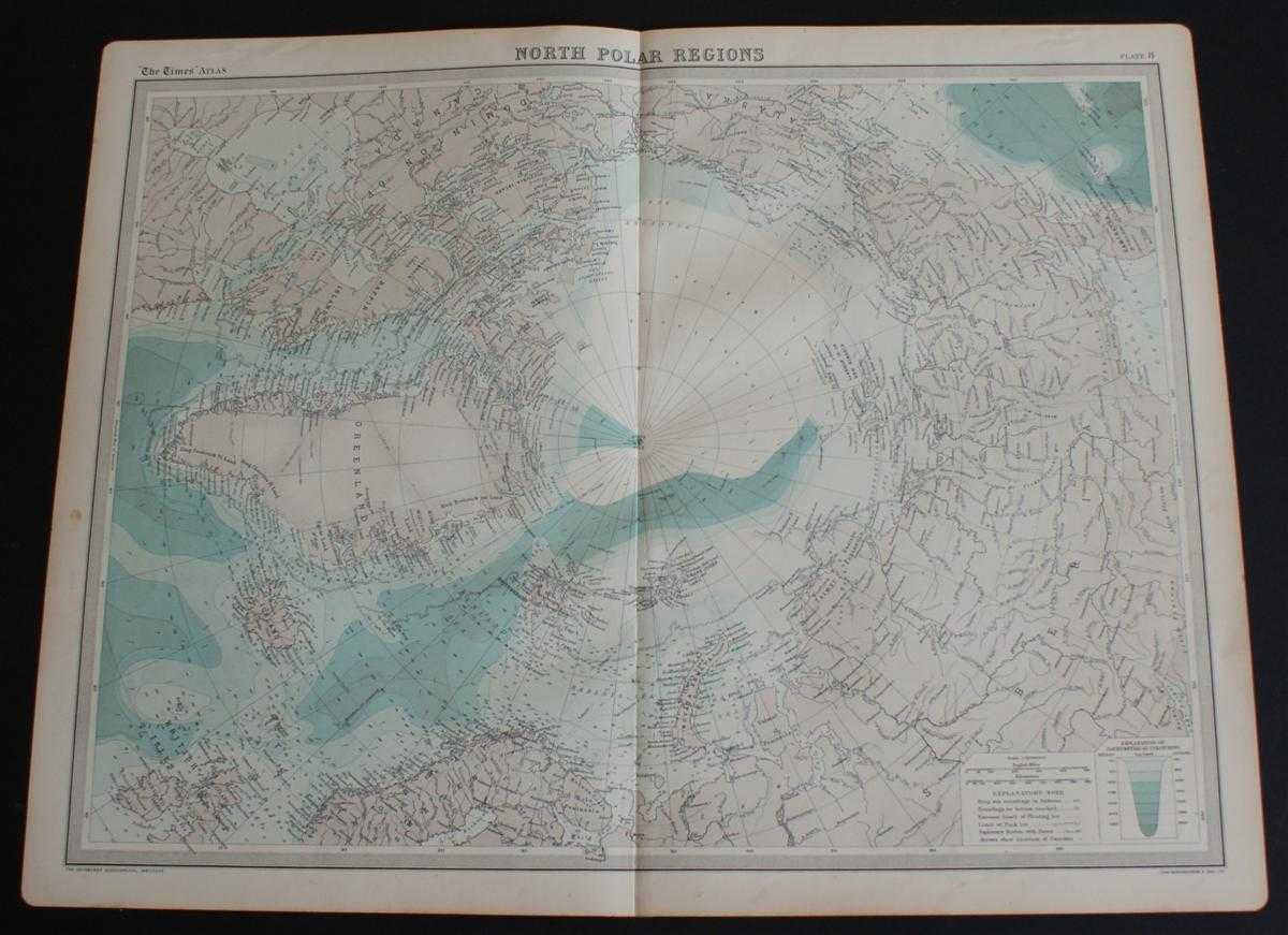
Map of "North Polar Regions" or the Arctic from 1920 Times Atlas (Plate 8)
The Times and J. G. Bartholomew · 1920
£24.00 (€28.77 | $31.68 | ¥5,052)
The Times, London, 1920. First Edition, Softcover. Very Good Condition/No Dust Jacket. Disbound single sheet with vertical centre fold from the 1920 "The Times Survey Atlas of the World". Map is in colour and suitable for framing. Map at scale 1:14,000,000 with explanatory not...
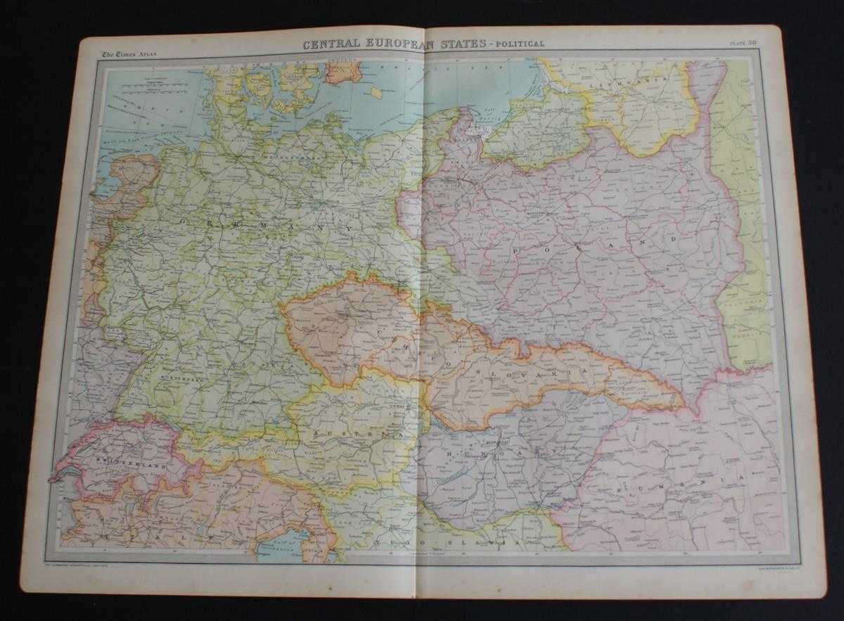
Map of "Central European States" from 1920 Times Atlas (Plate 38) including Germany, Switzerland, Austria, Czheco-Slovakia, Hungary and Poland with parts of Lithuania, Yugo-Slavia, Italy, Denmark and Rumania
The Times and J. G. Bartholomew · 1920
£24.00 (€28.77 | $31.68 | ¥5,052)
The Times, London, 1920. First Edition, Softcover. Very Good Condition/No Dust Jacket. Disbound single sheet with vertical centre fold from the 1920 "The Times Survey Atlas of the World". Map is in colour and suitable for framing. Colour is according to country with slightly d...
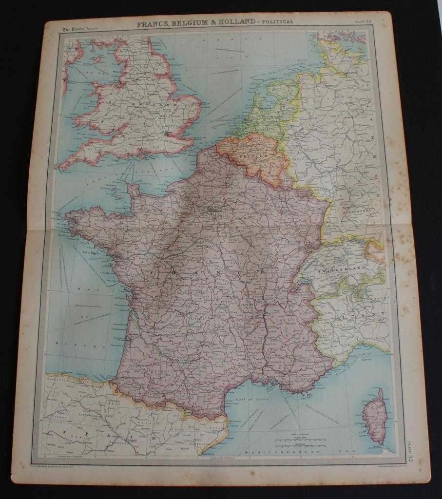
Map of France, Belgium, Holland, England, Wales, Switzerland, Andorra and Luxemburg from 1920 Times Atlas (Plate 32 "France, Belgium & Holland - Political") with Corsica, Channel Islands and parts of Germany, Italy and Spain
The Times and J. G. Bartholomew · 1920
£22.00 (€26.37 | $29.04 | ¥4,631)
The Times, London, 1920. First Edition, Softcover. Good Condition/No Dust Jacket. Disbound single sheet with horizontal centre fold from the 1920 "The Times Survey Atlas of the World". Map is in colour and suitable for framing. Colour is according to country, France, Belgium a...
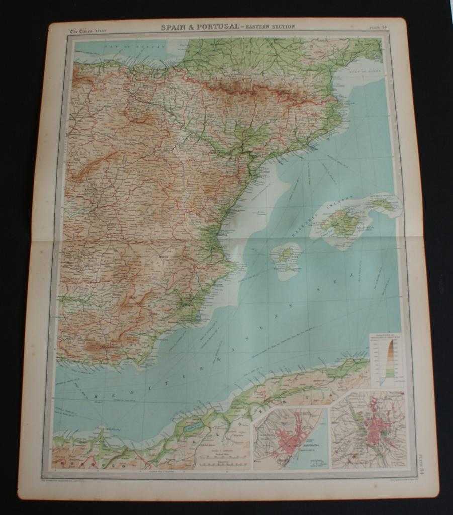
Map of Eastern Spain including the Pyrenees, Andorra and the Balearic Islands from 1920 Times Atlas (Plate 34 "Spain & Portugal - Eastern Section") with inset plans of Barcelona and Madrid
The Times and J. G. Bartholomew · 1920
£24.00 (€28.77 | $31.68 | ¥5,052)
The Times, London, 1920. First Edition, Softcover. Very Good Condition/No Dust Jacket. Disbound single sheet with horizontal centre fold from the 1920 "The Times Survey Atlas of the World". Map is in colour and suitable for framing. Colour is according to contour, boundaries o...

Map of Portugal and Western Spain from 1920 Times Atlas (Plate 33 "Spain & Portugal - Western Section") including inset plans of Oporto, Cadiz, Gibraltar and Lisbon and environs
The Times and J. G. Bartholomew · 1920
£24.00 (€28.77 | $31.68 | ¥5,052)
The Times, London, 1920. First Edition, Softcover. Very Good Condition/No Dust Jacket. Disbound single sheet with horizontal centre fold from the 1920 "The Times Survey Atlas of the World". Map is in colour and suitable for framing. Colour is according to contour, boundaries o...
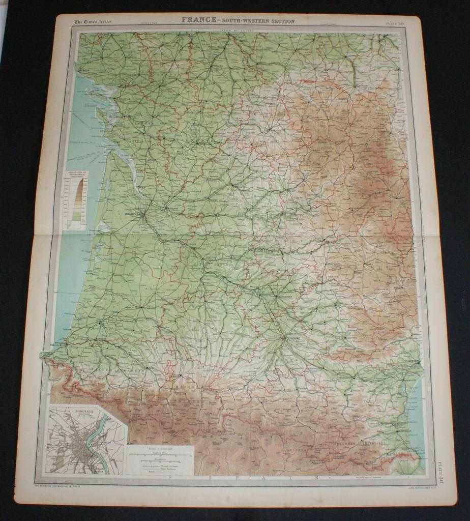
Map of "France - South-Western Section" from 1920 Times Atlas (Plate 30) including Andorra, Bordeaux, Poitiers, Angouleme, Limoges, Clermont, La Rochelle, Rochefort, Toulouse, Beziers, Tarbes, Pau, and Bayonnes
The Times and J. G. Bartholomew · 1920
£22.00 (€26.37 | $29.04 | ¥4,631)
The Times, London, 1920. First Edition, Softcover. Very Good Condition/No Dust Jacket. Disbound single sheet with horizontal centre fold from the 1920 "The Times Survey Atlas of the World". Map is in colour and suitable for framing. Colour is according to contour, boundaries o...

Map of "France - South-Eastern Section" from 1920 Times Atlas (Plate 31) including Corsica, Marseille, Lyon, St Etienne, Nice, Cleremont, Beziers, Montpellier, Nimes, Avignon, Cannes, Geneva, Grenoble and Turin
The Times and J. G. Bartholomew · 1920
£22.00 (€26.37 | $29.04 | ¥4,631)
The Times, London, 1920. First Edition, Softcover. Very Good Condition/No Dust Jacket. Disbound single sheet with horizontal centre fold from the 1920 "The Times Survey Atlas of the World". Map is in colour and suitable for framing. Colour is according to contour, boundaries o...
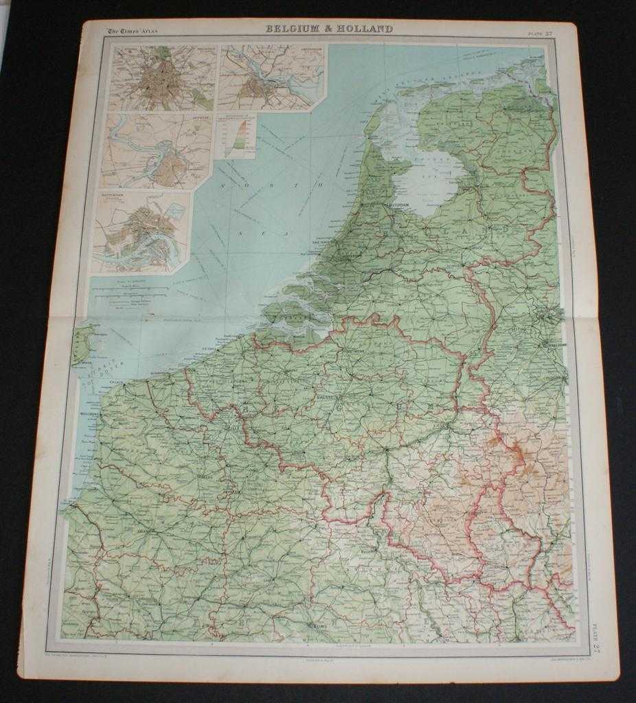
Map of "Belgium & Holland" from 1920 Times Atlas (Plate 27) including Luxemburg and with inset plans of Brussels, Amsterdam, Antwerp and Rotterdam
The Times and J. G. Bartholomew · 1920
£24.00 (€28.77 | $31.68 | ¥5,052)
The Times, London, 1920. First Edition, Softcover. Very Good Condition/No Dust Jacket. Disbound single sheet with horizontal centre fold from the 1920 "The Times Survey Atlas of the World". Map is in colour and suitable for framing. Colour is according to contour, boundaries o...
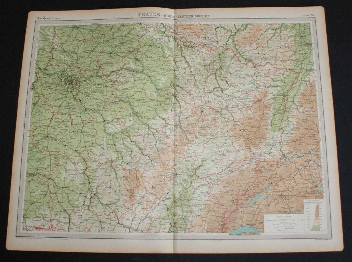
Map of "France - North-Eastern Section" from 1920 Times Atlas (Plate 29) covering Paris, Orleans, Moulins, Nevers, Troyes, Riems, Nancy, Dijon, Strasbourg, Mulhouse, Besancon, Luxemburg, Mannheim, Basel and Bern
The Times and J. G. Bartholomew · 1920
£22.00 (€26.37 | $29.04 | ¥4,631)
The Times, London, 1920. First Edition, Softcover. Very Good Condition/No Dust Jacket. Disbound single sheet with vertical centre fold from the 1920 "The Times Survey Atlas of the World". Map is in colour and suitable for framing. Colour is according to contour, boundaries of ...
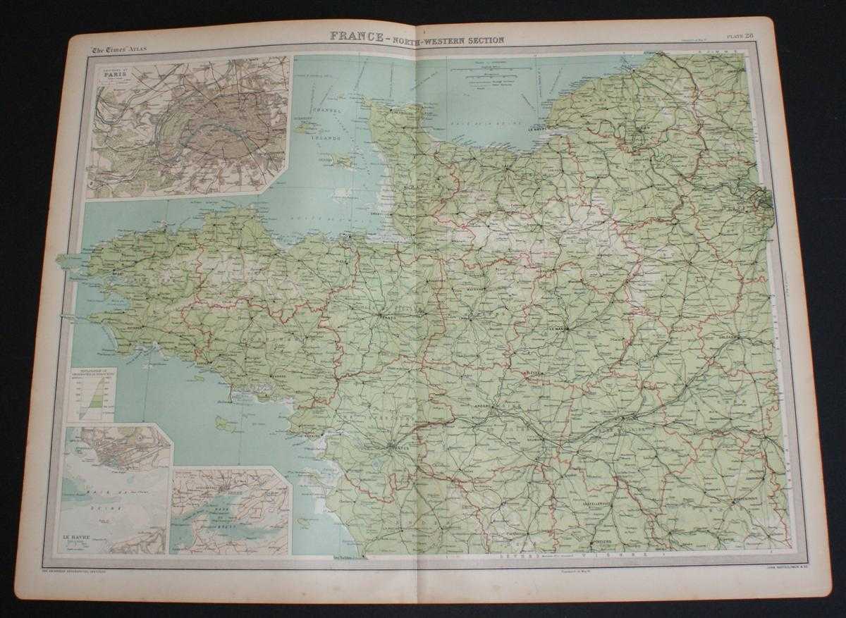
Map of "France - North-Western Section" from 1920 Times Atlas (Plate 28) covering Paris, Rouen, Le Havre, Rennes, Le Mans, Brest, Nantes, Angers, Tours and Poitiers and including the Channel Islands and an inset plan of Paris
The Times and J. G. Bartholomew · 1920
£22.00 (€26.37 | $29.04 | ¥4,631)
The Times, London, 1920. First Edition, Softcover. Very Good Condition/No Dust Jacket. Disbound single sheet with vertical centre fold from the 1920 "The Times Survey Atlas of the World". Map is in colour and suitable for framing. Colour is according to contour, boundaries of ...

Map of "Southern Italy" from 1920 Times Atlas (Plate 37) including Sardinia, Sicily, Malta and Tunis
The Times and J. G. Bartholomew · 1920
£22.00 (€26.37 | $29.04 | ¥4,631)
The Times, London, 1920. First Edition, Softcover. Very Good Condition/No Dust Jacket. Disbound single sheet with vertical centre fold from the 1920 "The Times Survey Atlas of the World". Map is in colour and suitable for framing. Colour is according to contour, boundaries of ...

Map of "Northern Italy, Austria, etc." from 1920 Times Atlas (Plate 36) including Turin, Milan, Verona, Trieste, Venice, Florence, Ravenna, Bologna, Rome, Munich, Vienna, Budapest, Salzberg, Elba, etc.
The Times and J. G. Bartholomew · 1920
£22.00 (€26.37 | $29.04 | ¥4,631)
The Times, London, 1920. First Edition, Softcover. Very Good Condition/No Dust Jacket. Disbound single sheet with vertical centre fold from the 1920 "The Times Survey Atlas of the World". Map is in colour and suitable for framing. Colour is according to contour, boundaries of ...

Map of "Switzerland" from 1920 Times Atlas (Plate 35) including Liechtenstein
The Times and J. G. Bartholomew · 1920
£24.00 (€28.77 | $31.68 | ¥5,052)
The Times, London, 1920. First Edition, Softcover. Very Good Condition/No Dust Jacket. Disbound single sheet with vertical centre fold from the 1920 "The Times Survey Atlas of the World". Map is in colour and suitable for framing. Colour is according to contour, boundaries of ...
Map of "Northern Russia & Finland" from 1920 Times Atlas (Plate 45) including Moscow, Petrograd (St Petersburg) and covering Finland, Lapland, Estonia, Latvia, Lithuania and north Russia as far east as Ural Mountains and Gulf of Ob
The Times and J. G. Bartholomew · 1920
£22.00 (€26.37 | $29.04 | ¥4,631)
Map The Times, London, 1920. First Edition, Softcover. Very Good Condition/No Dust Jacket. Disbound single sheet with vertical centre fold from the 1920 "The Times Survey Atlas of the World". Map is in colour and suitable for framing. Colour is according to contour, boundaries...

Map of "Southern Scandinavia & Denmark" from 1920 Times Survey Atlas (Plate 42) including Southern Norway and Sweden, Copenhagen, Goteborg, Malmo, Stockholm, Kristiania, Bergen, Krisiansund, Hernosand, etc.
The Times and J. G. Bartholomew · 1920
£20.00 (€23.97 | $26.40 | ¥4,210)
Map The Times, London, 1920. First Edition, Softcover. Very Good Condition/No Dust Jacket. Disbound single sheet with horizontal centre fold from the 1920 "The Times Survey Atlas of the World". Map is in colour and suitable for framing. Colour is according to contour, boundari...

Map of "Germany - Southern Section" from 1920 Times Survey Atlas (Plate 39) including Munich, Nurnberg, Salzburg, Pilsen, Frankfurt, Manheim, Wiesbaden, Strasbourg, Zurich, Lucerne, Basel, Mulhouse, Stuttgart, Karlsruhe, Bern, etc.
The Times and J. G. Bartholomew · 1920
£20.00 (€23.97 | $26.40 | ¥4,210)
Map The Times, London, 1920. First Edition, Softcover. Very Good Condition/No Dust Jacket. Disbound single sheet with vertical centre fold from the 1920 "The Times Survey Atlas of the World". Map is in colour and suitable for framing. Colour is according to contour, boundaries...

Map of "Persia" or modern day Iran from the 1920 Times Survey Atlas (Plate 53) including Bagdad, Basra, Bushire, Tabriz, Isfahan, Teheran, Fars, Khorasan, Kerman, Yezd and the Persian Gulf
The Times and J. G. Bartholomew · 1920
£22.00 (€26.37 | $29.04 | ¥4,631)
Map The Times, London, 1920. First Edition, Softcover. Very Good Condition/No Dust Jacket. Disbound single sheet with vertical centre fold from the 1920 "The Times Survey Atlas of the World". Map is in colour and suitable for framing. Colour on both land and sea is by contour....