
Bailgate Books Ltd
Libri
8001 libri di Bailgate Books Ltd
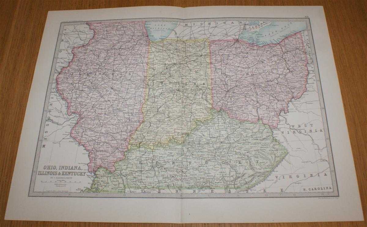
Map of Ohio, Indiana, Illinois and Kentucky - Sheet 68 (part of USA) Disbound from the 1890 'The Library Reference Atlas of the World'
John Bartholomew · 1890
£32.00 (€38.35 | $42.24 | ¥6,736)
Macmillan and Co. London, 1890. First Edition, Softcover. Very Good Condition/No Dust Jacket. Single disbound coloured map sheet, from John Bartholomew's Library Reference Atlas, covering part of the United States of America. Suitable for framing. Approx size 35 x 46 cm, verti...

Map of New York, New Jersey, Pennsylvania, Maryland and Delaware with inset plans showing Environs of New York and Philadelphia - Sheet 67, Middle States of USA, disbound from the 1890 'The Library Reference Atlas of the World'
John Bartholomew · 1890
£32.00 (€38.35 | $42.24 | ¥6,736)
Macmillan and Co. London, 1890. First Edition, Softcover. Very Good Condition/No Dust Jacket. Single disbound coloured map sheet, from John Bartholomew's Library Reference Atlas, covering part of the United States of America. Suitable for framing. Approx size 46 x 35 cm, horiz...

Diagrams Illustrating Astronomical Geography - Sheet 1 Disbound from the 1890 'The Library Reference Atlas of the World', including Solar and Lunar Eclipses, Course of the Moon, Solar System, Phases of the Moon, etc.
John Bartholomew · 1890
£32.00 (€38.35 | $42.24 | ¥6,736)
Macmillan and Co. London, 1890. First Edition, Softcover. Very Good Condition/No Dust Jacket. Single disbound coloured map sheet from John Bartholomew's Library Reference Atlas. Suitable for framing. Approx size 35 x 46 cm, vertical centre fold. Sheet is clean, crisp, clear an...
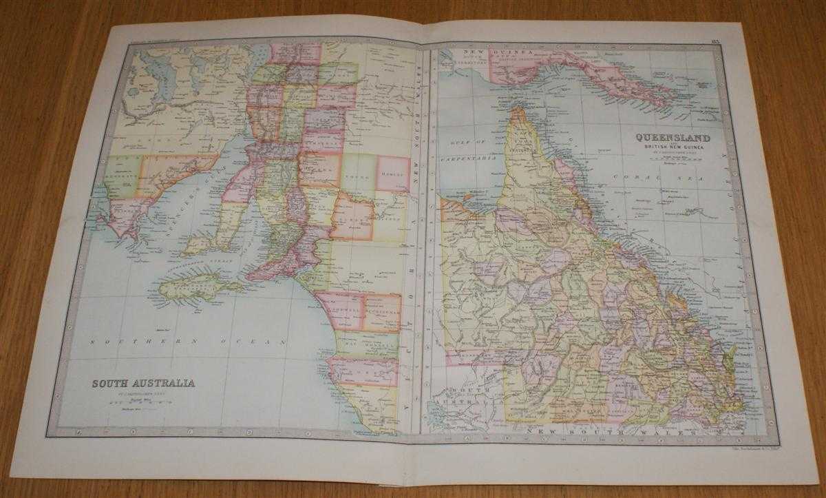
Map of Queensland and British New Guinea, and South Australia (eastern half only) - Sheet 83 Disbound from the 1890 'The Library Reference Atlas of the World'
John Bartholomew · 1890
£33.00 (€39.55 | $43.56 | ¥6,946)
Macmillan and Co. London, 1890. First Edition, Softcover. Very Good Condition/No Dust Jacket. Single disbound coloured map sheet from John Bartholomew's Library Reference Atlas. Suitable for framing. Approx size 35 x 46 cm, vertical centre fold. Map is clean, crisp, clear and ...

Map of Victoria and New South Wales, Australia - Sheet 82 Disbound from the 1890 'The Library Reference Atlas of the World' with small inset plans of Port Melbourne and Port Jackson
John Bartholomew · 1890
£35.00 (€41.95 | $46.20 | ¥7,367)
Macmillan and Co. London, 1890. First Edition, Softcover. Very Good Condition/No Dust Jacket. Single disbound coloured map sheet from John Bartholomew's Library Reference Atlas. Suitable for framing. Approx size 46 x 35 cm, horizontal centre fold. Map is clean, crisp, clear an...

Map of South Africa - Sheet 56 Disbound from the 1890 'The Library Reference Atlas of the World' including Great Mamaqua Land, Bechuanaland, Koranna Land, South African Republic, Orange Free State, Cape Colony, etc.
John Bartholomew · 1890
£34.00 (€40.75 | $44.88 | ¥7,157)
Macmillan and Co. London, 1890. First Edition, Softcover. Very Good Condition/No Dust Jacket. Single disbound coloured map sheet from John Bartholomew's Library Reference Atlas. Suitable for framing. Approx size 35 x 46 cm, vertical centre fold. Light foxing in the margins, ma...

Map of Central Africa - Sheet 55 Disbound from the 1890 'The Library Reference Atlas of the World' covering modern day Gabon, Angola, Democratic Republic of Congo, Uganda, Tanzania, Zambia and Kenya
John Bartholomew · 1890
£34.00 (€40.75 | $44.88 | ¥7,157)
Macmillan and Co. London, 1890. First Edition, Softcover. Very Good Condition/No Dust Jacket. Single disbound coloured map sheet from John Bartholomew's Library Reference Atlas. Suitable for framing. Approx size 35 x 46 cm, vertical centre fold. Map is clean, crisp, clear and ...

Map of South America (Section 3) covering Paraguay, Argentine Republic, Uruguay, Chile and the Falkland Islands, with small inset plan of Valparaiso - Sheet 79 Disbound from the 1890 'The Library Reference Atlas of the World'
John Bartholomew · 1890
£34.00 (€40.75 | $44.88 | ¥7,157)
Macmillan and Co. London, 1890. First Edition, Softcover. Very Good Condition/No Dust Jacket. Single disbound coloured map sheet from John Bartholomew's Library Reference Atlas. Suitable for framing. Section 3 only of 3 covering South America. Approx size 46 x 35 cm, horizonta...

Map of South America (Section 2) covering large parts of Brazil, Dutch Guiana and French Guiana including small inset plan of Rio de Janeiro - Sheet 78 Disbound from the 1890 'The Library Reference Atlas of the World'
John Bartholomew · 1890
£32.00 (€38.35 | $42.24 | ¥6,736)
Macmillan and Co. London, 1890. First Edition, Softcover. Very Good Condition/No Dust Jacket. Single disbound coloured map sheet from John Bartholomew's Library Reference Atlas. Suitable for framing. Section 2 only of 3 covering South America. Approx size 46 x 35 cm, horizonta...

Map of South America (Section 1) covering Colombia, Venezuela, British Guiana, Ecuador, Peru and parts of Brazil and Bolivia - Sheet 77 Disbound from the 1890 'The Library Reference Atlas of the World'
John Bartholomew · 1890
£32.00 (€38.35 | $42.24 | ¥6,736)
Macmillan and Co. London, 1890. First Edition, Softcover. Very Good Condition/No Dust Jacket. Single disbound coloured map sheet from John Bartholomew's Library Reference Atlas. Suitable for framing. Section 1 only of 3 covering South America. Approx size 46 x 35 cm, horizonta...

Map of India (Section 3) covering southern India and Ceylon (Sri Lanka) including small inset plans of Madras and Bombay - Sheet 48 Disbound from the 1890 'The Library Reference Atlas of the World'
John Bartholomew · 1890
£34.00 (€40.75 | $44.88 | ¥7,157)
Macmillan and Co. London, 1890. First Edition, Softcover. Very Good Condition/No Dust Jacket. Single disbound coloured map sheet from John Bartholomew's Library Reference Atlas. Suitable for framing. Section 3 only of 3 covering India (as was in 1890). Approx size 46 x 35 cm, ...

Map of India (Section 2) covering parts of modern day central and eastern India, Bangladesh, Bhutan and Nepal with small inset plan of Calcutta - Sheet 47 Disbound from the 1890 'The Library Reference Atlas of the World'
John Bartholomew · 1890
£32.00 (€38.35 | $42.24 | ¥6,736)
Macmillan and Co. London, 1890. First Edition, Softcover. Very Good Condition/No Dust Jacket. Single disbound coloured map sheet from John Bartholomew's Library Reference Atlas. Section 2 only of 3 covering India (as was in 1890). Approx size 35 x 46 cm, vertical centre fold. ...
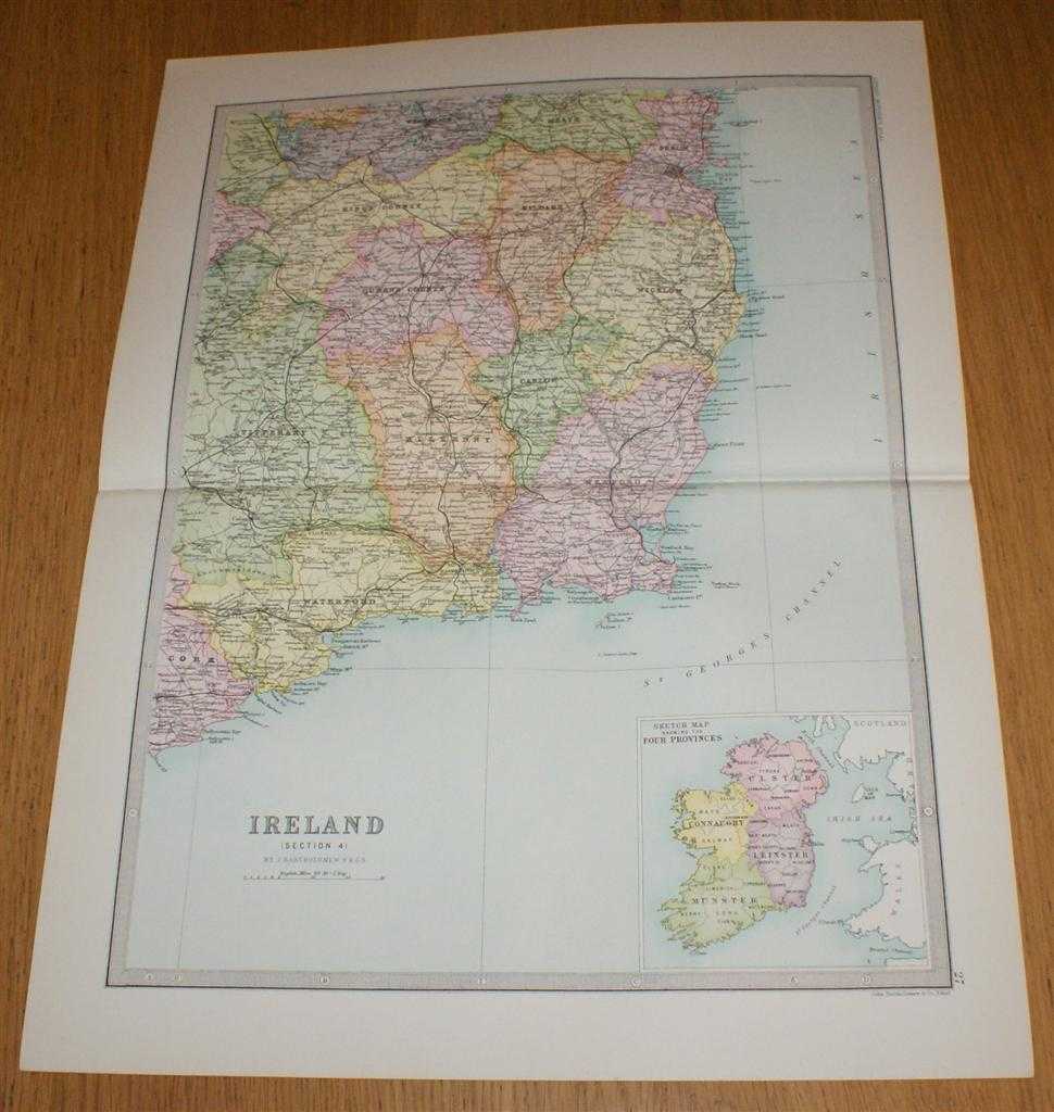
Map of Ireland (Section 4) covering the south eastern portion of Ireland with small inset map showing Four Provinces of Ireland - Sheet 27 Disbound from the 1890 'The Library Reference Atlas of the World'
John Bartholomew · 1890
£35.00 (€41.95 | $46.20 | ¥7,367)
Macmillan and Co. London, 1890. First Edition, Softcover. Very Good Condition/No Dust Jacket. Single disbound coloured map sheet from John Bartholomew's Library Reference Atlas. Section 4 only of 4 covering Ireland. Approx size 46 x 35 cm, horizontal centre fold. Corners light...
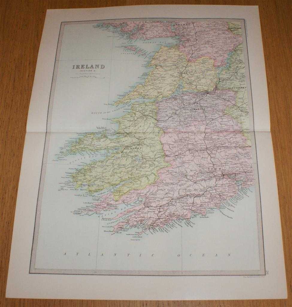
Map of Ireland (Section 3) covering the south western portion of Ireland - Sheet 26 Disbound from the 1890 'The Library Reference Atlas of the World'
John Bartholomew · 1890
£33.00 (€39.55 | $43.56 | ¥6,946)
Macmillan and Co. London, 1890. First Edition, Softcover. Very Good Condition/No Dust Jacket. Single disbound coloured map sheet from John Bartholomew's Library Reference Atlas. Section 3 only of 4 covering Ireland. Approx size 46 x 35 cm, horizontal centre fold. Corners light...
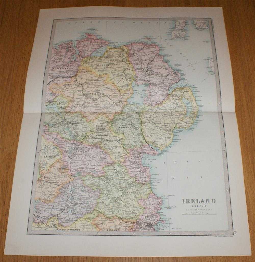
Map of Ireland (Section 2) covering the North Eastern portion of the island of Ireland including most of Northern Ireland - Sheet 25 Disbound from the 1890 'The Library Reference Atlas of the World'
John Bartholomew · 1890
£35.00 (€41.95 | $46.20 | ¥7,367)
Macmillan and Co. London, 1890. First Edition, Softcover. Very Good Condition/No Dust Jacket. Single disbound coloured map sheet from John Bartholomew's Library Reference Atlas. Section 2 only of 4 covering Ireland. Approx size 46 x 35 cm, horizontal centre fold. Corners light...
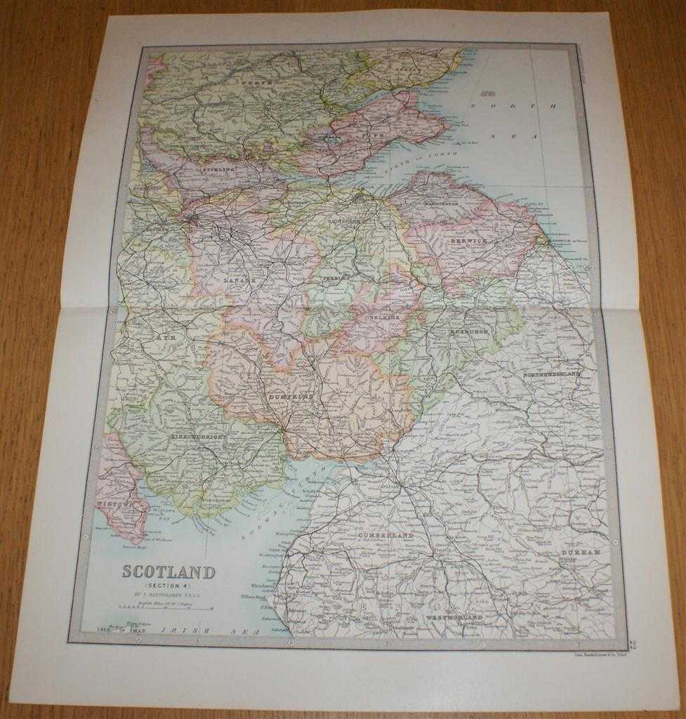
Map of Scotland (Section 4) covering Southern Scotland and Scottish/English Border - Sheet 22 Disbound from the 1890 'The Library Reference Atlas of the World'
John Bartholomew · 1890
£35.00 (€41.95 | $46.20 | ¥7,367)
Macmillan and Co. London, 1890. First Edition, Softcover. Very Good Condition/No Dust Jacket. Single disbound coloured map sheet from John Bartholomew's Library Reference Atlas. Section 4 only of 4 covering Scotland. Approx size 46 x 35 cm, horizontal centre fold. Corners ligh...
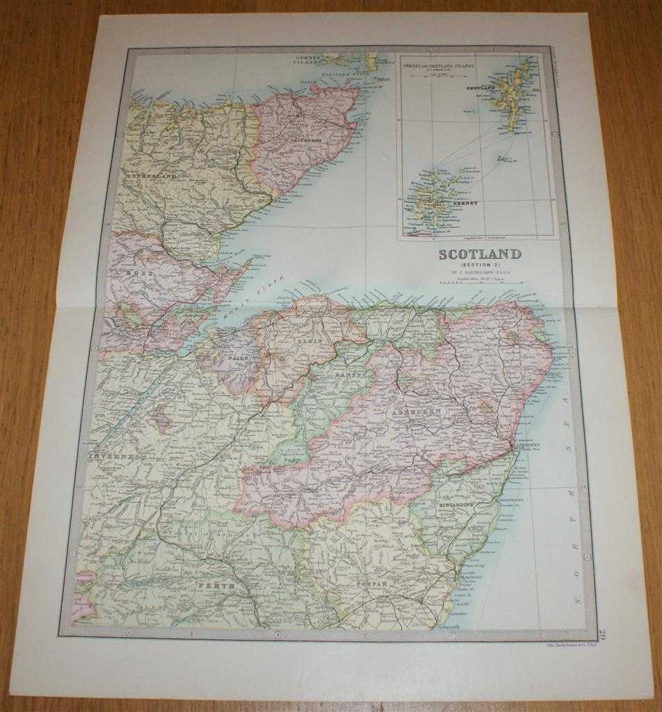
Map of Scotland (Section 2) covering North East Scotland including Thurso, Orkney, Shetland, Inverness, Aberdeen and Montrose - Sheet 20 Disbound from the 1890 'The Library Reference Atlas of the World'
John Bartholomew · 1890
£34.00 (€40.75 | $44.88 | ¥7,157)
Macmillan and Co. London, 1890. First Edition, Softcover. Very Good Condition/No Dust Jacket. Single disbound coloured map sheet from John Bartholomew's Library Reference Atlas. Section 2 only of 4 covering Scotland. Approx size 46 x 35 cm, horizontal centre fold. Corners ligh...
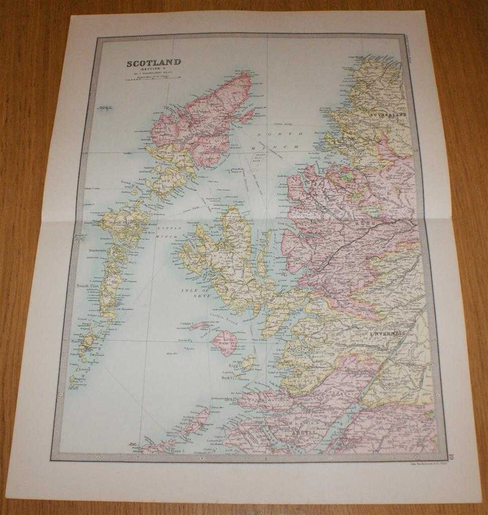
Map of Scotland (Section 1) covering the Western Isles or Outer Hebrides, Skye, Rum and parts of North West Scotland - Sheet 19 Disbound from the 1890 'The Library Reference Atlas of the World'
John Bartholomew · 1890
£35.00 (€41.95 | $46.20 | ¥7,367)
Macmillan and Co. London, 1890. First Edition, Softcover. Very Good Condition/No Dust Jacket. Single disbound coloured map sheet from John Bartholomew's Library Reference Atlas. Section 1 only of 4 covering Scotland. Approx size 46 x 35 cm, horizontal centre fold. Corners ligh...
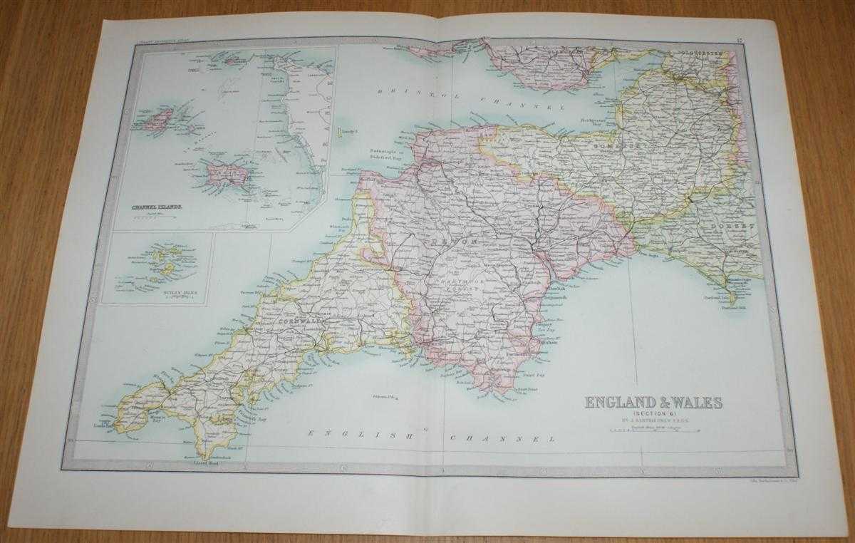
Map of England & Wales (Section 6) covering the West Country (Cornwall, Devon, Somerset) with insets of Scilly Isles and Channel Islands - Sheet 17 Disbound from the 1890 'The Library Reference Atlas of the World'
John Bartholomew · 1890
£35.00 (€41.95 | $46.20 | ¥7,367)
Macmillan and Co. London, 1890. First Edition, Softcover. Very Good Condition/No Dust Jacket. Single disbound coloured map sheet from John Bartholomew's Library Reference Atlas. Section 6 only of 6 covering England and Wales. Approx size 35 x 46 cm, vertical centre fold. Corne...

Map of England & Wales (Section 5) covering Wales - Sheet 16 Disbound from the 1890 'The Library Reference Atlas of the World'
John Bartholomew · 1890
£36.00 (€43.15 | $47.52 | ¥7,578)
Macmillan and Co. London, 1890. First Edition, Softcover. Very Good Condition/No Dust Jacket. Single disbound coloured map sheet from John Bartholomew's Library Reference Atlas. Section 5 only of 6 covering England and Wales. Approx size 35 x 46 cm, vertical centre fold. Corne...