
Bailgate Books Ltd
Libri
8001 libri di Bailgate Books Ltd

Bartholomew's Map of England and Wales, Sheet 6, Leeds and Harrogate, dissected & mounted on linen - Bartholomew's "Half-Inch To Mile"
John Bartholomew & Co · 1918
£12.00 (€14.38 | $15.85 | ¥2,531)
Map John Bartholomew & Co, Duncan Street, Edinburgh, 1918. Edition Unstated, Soft cover. Very Good/No Dust Jacket. Undated by publisher. Scale; Two miles to an inch. Publisher's address given as Edward Stanford, Long Acre, London. No price shown for this map but catalogue for ...
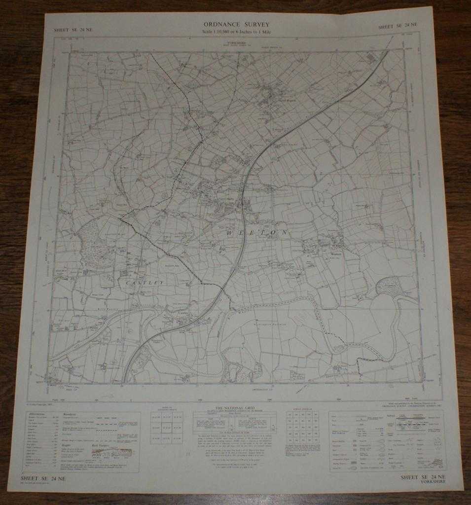
Ordnance Survey (OS) Map 1:10,560 Provisional Edition Sheet SE 24NE. Yorkshire, Weeton, Castley, North Rigton. Major roads revised 1965. Boundaries revised to 1-12-64.
Ordnance Survey · 1967
£9.50 (€11.39 | $12.55 | ¥2,004)
Map Ordnance Survey, Chessington, Surrey, 1967. Provisional Edition, Softcover. Very Good Condition/No Dust Jacket. This map is clean, crisp and unfolded, with a small nick at the right-hand edge. Pencilled projections of (probably) a new road. It has been stored flat, will be...

Ordnance Survey (OS) Map 1:25 000 First Series (Provisional Edition) Sheet SE06. Yorkshire, Hebden. Minor corrections to 1960.
Ordnance Survey · 1960
£9.50 (€11.39 | $12.55 | ¥2,004)
Map Ordnance Survey, Chessington, Surrey, 1960. First Series (Provisional Edition), Softcover. Near Fine Condition/No Dust Jacket. This map is clean, crisp and unfolded and has been stored flat, it will be supplied in a cardboard tube and is ideal for mounting/ framing. The ar...
1:2500 Ordnance Survey Map, Yorkshire (East Riding) Sheet CXCII 13, Edition of 1910, Re-Surveyed in 1890, Revised in 1908, Reprint 25/45 Wa, Large-scale plan of the area between the villages of Wheldrake, Thorganby and Escrick, SE of York.
Ordnance Survey · 1908
£9.50 (€11.39 | $12.55 | ¥2,004)
Map Ordnance Survey, 1908. Revised Edition, Single sheet. Very Good Condition/No Dust Jacket. Large-scale plan of the area between the villages of Wheldrake, Thorganby and Escrick, SE of York. Map shows; part Leonard Scales Lane, South Plantation, South Close, Keld Carrs, Keld...

1:2500 Ordnance Survey Map, Leicestershire Sheet XIV.5, Second Edition 1904, Surveyed in 1884, Revised in 1902, Reprint 15/26 20/41, Large-scale plan of the village of Saltby and the surrounding area in Leicestershire
Ordnance Survey · 0
£9.50 (€11.39 | $12.55 | ¥2,004)
Map Ordnance Survey. Revised Edition, Single Sheet. Very Good Condition/No Dust Jacket. Large-scale plan of the village of Saltby and the surrounding area in Leicestershire. Includes: Methodist Chapel (Wesleyan), School, St Peter's Church, Grave Yard, Quarry, Allotment Gardens...
1:2500 Ordnance Survey Map, Leicestershire Sheet XIV.1, Second Edition 1904, Surveyed in 1884, Revised in 1902, Reprint 40/41, Large-scale plan of the area north of the village of Saltby in Leicestershire
Ordnance Survey · 1904
£9.50 (€11.39 | $12.55 | ¥2,004)
Map Ordnance Survey, 1904. Revised Edition, Single sheet. Very Good Condition/No Dust Jacket. Includes: Saltby Lodge, farm (Swallow Hole Farm), farm (Barn Lodge Farm) , farm (Heath Farm), Swallowhole Covert, Swallow Hole (geological feature), Bescaby Oaks and Croxton Park (Old...
Map of India North, Plate 29 disbound from 1959 Mid-Century Times Atlas of the World, Volume II, (South-West Asia and Russia) includes North-east India, Scale 1:4,000,000
John Bartholomew · 1959
£28.00 (€33.56 | $36.99 | ¥5,905)
The Times Publishing Company Ltd. London, 1959. Mid-Century Edition, Softcover. Fine Condition/No Dust Jacket. Single disbound map sheet from 'The Times Atlas of the World, Mid-Century Edition; Volume II Eurasia, suitable for framing. Map is in colour and has vertical centre f...
Map of Arctic Ocean Greenland, Plate 48 disbound from 1959 Mid-Century Times Atlas of the World, Volume II, (South-West Asia & Russia) Scale 1:12,500,000, four insets of Greenland Coastal Settlements 1:5,000,000
John Bartholomew · 1959
£38.00 (€45.55 | $50.20 | ¥8,014)
The Times Publishing Company Ltd. London, 1959. Mid-Century Edition, Softcover. Fine Condition/No Dust Jacket. Single disbound map sheet from 'The Times Atlas of the World, Mid-Century Edition; Volume II Eurasia, suitable for framing. Map is in colour and has vertical centre f...
Map of U.S.S.R. Leningrad, Urals, Plate 47 disbound from 1959 Mid-Century Times Atlas of the World, Volume II, (South-West Asia & Russia) Scale 1: 5,000,000. Inset plans of Industrial Urals 1:2,500,000 and Leningrad 1:100,000
John Bartholomew · 1959
£32.00 (€38.36 | $42.28 | ¥6,749)
The Times Publishing Company Ltd. London, 1959. Mid-Century Edition, Softcover. Fine Condition/No Dust Jacket. Single disbound map sheet from 'The Times Atlas of the World, Mid-Century Edition; Volume II Eurasia, suitable for framing. Map is in colour and has vertical centre f...
Map of U.S.S.R. Moscow, Ukraine, Plate 46 disbound from 1959 Mid-Century Times Atlas of the World, Volume II, (South-West Asia & Russia) Scale 1: 5,000,000. Inset plans of Moscow 1:100,000 and Kremlin (larger scale)
John Bartholomew · 1959
£38.00 (€45.55 | $50.20 | ¥8,014)
The Times Publishing Company Ltd. London, 1959. Mid-Century Edition, Softcover. Fine Condition/No Dust Jacket. Single disbound map sheet from 'The Times Atlas of the World, Mid-Century Edition; Volume II Eurasia, suitable for framing. Map is in colour and has vertical centre f...
Map of U.S.S.R. Volga, Don, Dnieper , Plate 45 disbound from 1959 Mid-Century Times Atlas of the World, Volume II, (South-West Asia & Russia) Scale 1: 2,500,000. Ukraine, Stalingrad, Moscow, Khar'kov, Kiyev
John Bartholomew · 1959
£34.00 (€40.75 | $44.92 | ¥7,171)
The Times Publishing Company Ltd. London, 1959. Mid-Century Edition, Softcover. Fine Condition/No Dust Jacket. Single disbound map sheet from 'The Times Atlas of the World, Mid-Century Edition; Volume II Eurasia, suitable for framing. Map is in colour and has vertical centre f...
Map of U.S.S.R. Caucasus, Crimea, Plate 44 disbound from 1959 Mid-Century Times Atlas of the World, Volume II, (South-West Asia & Russia) Scale 1: 2.500,000. Inset Crimea 1: 2,5000,000
John Bartholomew · 1959
£34.00 (€40.75 | $44.92 | ¥7,171)
The Times Publishing Company Ltd. London, 1959. Mid-Century Edition, Softcover. Fine Condition/No Dust Jacket. Single disbound map sheet from 'The Times Atlas of the World, Mid-Century Edition; Volume II Eurasia, suitable for framing. Map is in colour and has vertical centre f...

Map of U.S.S.R. Central Asia, Kazakhstan, Plate 43 disbound from 1959 Mid-Century Times Atlas of the World, Volume II, (South-West Asia & Russia) Scale 1: 5,000,000. Tadzhikiztan,Kirgizeya. Inset Fergana Basin 1: 2,5000,000
John Bartholomew · 1959
£28.00 (€33.56 | $36.99 | ¥5,905)
The Times Publishing Company Ltd. London, 1959. Mid-Century Edition, Softcover. Fine Condition/No Dust Jacket. Single disbound map sheet from 'The Times Atlas of the World, Mid-Century Edition; Volume II Eurasia, suitable for framing. Map is in colour and has vertical centre f...
Map of U.S.S.R. Kuznetz, Irkutz, Plate 42 disbound from 1959 Mid-Century Times Atlas of the World, Volume II, (South-West Asia & Russia) Scale 1: 5,000,000. Part of Mongolia, small parts of China, Kazakhstan
John Bartholomew · 1959
£28.00 (€33.56 | $36.99 | ¥5,905)
The Times Publishing Company Ltd. London, 1959. Mid-Century Edition, Softcover. Fine Condition/No Dust Jacket. Single disbound map sheet from 'The Times Atlas of the World, Mid-Century Edition; Volume II Eurasia, suitable for framing. Map is in colour and has vertical centre f...
Map of U.S.S.R. Northern Siberia, Plate 41 disbound from 1959 Mid-Century Times Atlas of the World, Volume II, (South-West Asia & Russia) Scale 1: 5,000,000. Inset maps of Novaya Zemlya and Franz Joseph Land (same scale)
John Bartholomew · 1959
£28.00 (€33.56 | $36.99 | ¥5,905)
The Times Publishing Company Ltd. London, 1959. Mid-Century Edition, Softcover. Fine Condition/No Dust Jacket. Single disbound map sheet from 'The Times Atlas of the World, Mid-Century Edition; Volume II Eurasia, suitable for framing. Map is in colour and has vertical centre f...
Map of U.S.S.R. Khabarovsk, Vladivostok, Plate 40 disbound from 1959 Mid-Century Times Atlas of the World, Volume II, (South-West Asia & Russia) Scale 1: 5,000,000. Includes small part of Japan
John Bartholomew · 1959
£28.00 (€33.56 | $36.99 | ¥5,905)
The Times Publishing Company Ltd. London, 1959. Mid-Century Edition, Softcover. Fine Condition/No Dust Jacket. Single disbound map sheet from 'The Times Atlas of the World, Mid-Century Edition; Volume II Eurasia, suitable for framing. Map is in colour and has vertical centre f...
Map of U.S.S.R. Kolyma, Kamchatka, Plate 39 disbound from 1959 Mid-Century Times Atlas of the World, Volume II, (South-West Asia & Russia) Scale 1: 5,000,000. Small part of Alaska, inset map of O. Vrangelya (Wrangel Island)
John Bartholomew · 1959
£28.00 (€33.56 | $36.99 | ¥5,905)
The Times Publishing Company Ltd. London, 1959. Mid-Century Edition, Softcover. Fine Condition/No Dust Jacket. Single disbound map sheet from 'The Times Atlas of the World, Mid-Century Edition; Volume II Eurasia, suitable for framing. Map is in colour and has vertical centre f...
Map of Union of Soviet Socialist Republics, Plate 38 disbound from 1959 Mid-Century Times Atlas of the World, Volume II, (South-West Asia & Russia) Scale 1: 15,000,000. Also Korea, Japan, Mongolia, Scandinavia
John Bartholomew · 1959
£28.00 (€33.56 | $36.99 | ¥5,905)
The Times Publishing Company Ltd. London, 1959. Mid-Century Edition, Softcover. Fine Condition/No Dust Jacket. Single disbound map sheet from 'The Times Atlas of the World, Mid-Century Edition; Volume II Eurasia, suitable for framing. Map is in colour and has vertical centre f...
Map of Dardanelles, Bosphorus, Turkey east, Plate 37 disbound from 1959 Mid-Century Times Atlas of the World, Volume II, (South-West Asia & Russia) Scale 1: 2,000,000; Marmara Den 1:1,000,000; Istanbul (Constantinople) 1:100,000
John Bartholomew · 1959
£28.00 (€33.56 | $36.99 | ¥5,905)
The Times Publishing Company Ltd. London, 1959. Mid-Century Edition, Softcover. Fine Condition/No Dust Jacket. Single disbound map sheet from 'The Times Atlas of the World, Mid-Century Edition; Volume II Eurasia, suitable for framing. Map is in colour and has vertical centre f...
Map of Turkey West, Plate 36 disbound from 1959 Mid-Century Times Atlas of the World, Volume II, (South-West Asia and Russia) Scale 1: 2,000,000; includes Cyprus, Sporadhes (Dodecanese), Kriti (Crete)( part), Sea of Marmara
John Bartholomew · 1959
£28.00 (€33.56 | $36.99 | ¥5,905)
The Times Publishing Company Ltd. London, 1959. Mid-Century Edition, Softcover. Fine Condition/No Dust Jacket. Single disbound map sheet from 'The Times Atlas of the World, Mid-Century Edition; Volume II Eurasia, suitable for framing. Map is in colour and has vertical centre f...