
Bailgate Books Ltd
Libri
495 libri di Bailgate Books Ltd

1:2500 Ordnance Survey Map, Yorkshire (West Riding) Sheet CCLXI.9. Edition of 1931, Resurveyed 1891, Rev. 1929, Re-Levelled 1930, Rev. 75/31 Thunder Bridge and Surrounding Area
Ordnance Survey · 1932
£9.50 (€11.39 | $12.53 | ¥1,997)
Map Ordnance Survey, 1932. Revised Edition, Softcover. Good Condition/No Dust Jacket. Black and white map. Edges are slightly crumpled corners, short tears in margins and a tape stain, upper edge is darkened and has two small areas of loss in the margin. Front of map is slight...

1:2500 Ordnance Survey Map, Yorkshire (West Riding) Sheet CCLX.13. Edition of 1932, Resurveyed in 1888-90, Revised in 1929, Re-levelled in 1930-31,Reprint 100/32. Meltham (Part) & Area Immediately South-West
Ordnance Survey · 1932
£9.50 (€11.39 | $12.53 | ¥1,997)
Map Ordnance Survey, 1932. Revised Edition, Softcover. Good Condition/No Dust Jacket. Black and white map. Edges are worn with multiple short tears from the edges in margins only, but previous tape (not now present) has extended into map and created discoloured patches and one...

1:2500 Ordnance Survey Map, Yorkshire (West Riding) Sheet CCLIX.14. Second Edition 1906, Resurveyed in 1890, Revised in 1904, Reprint 25/23, 50/36. Standedge Tunnel, Manchester Road (A62) & Redbrook Reservoir
Ordnance Survey · 1906
£15.00 (€17.98 | $19.78 | ¥3,153)
Map Ordnance Survey, 1906. Revised Edition, Softcover. Very Good Condition/No Dust Jacket. Black and white map two marginal areas darkened from no-longer present adhesive tape. Some short tears from the edges in margins only, light crumpling and rubbed slightly darkened edges....
Bartholomew's Map of England and Wales, Sheet 6, Leeds and Harrogate, dissected & mounted on linen - Bartholomew's "Half-Inch To Mile"
John Bartholomew & Co · 1918
£12.00 (€14.39 | $15.82 | ¥2,523)
Map John Bartholomew & Co, Duncan Street, Edinburgh, 1918. Edition Unstated, Soft cover. Very Good/No Dust Jacket. Undated by publisher. Scale; Two miles to an inch. Publisher's address given as Edward Stanford, Long Acre, London. No price shown for this map but catalogue for ...
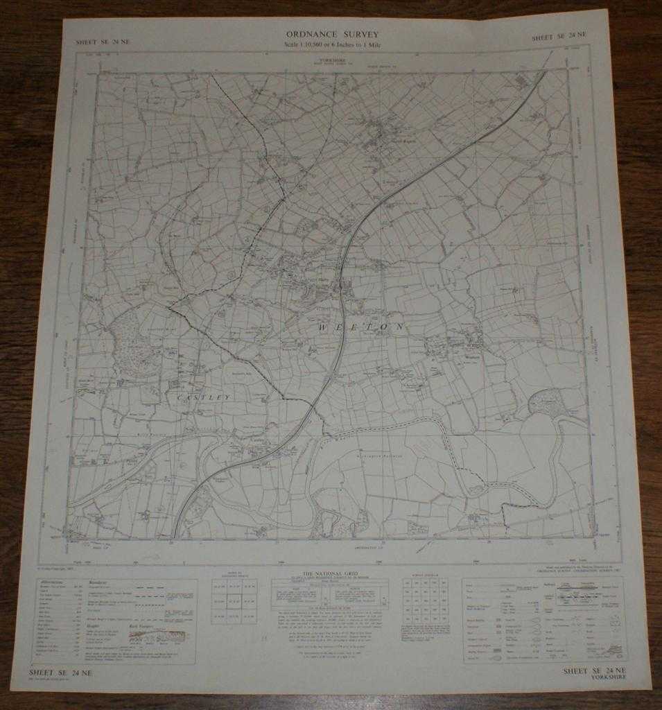
Ordnance Survey (OS) Map 1:10,560 Provisional Edition Sheet SE 24NE. Yorkshire, Weeton, Castley, North Rigton. Major roads revised 1965. Boundaries revised to 1-12-64.
Ordnance Survey · 1967
£9.50 (€11.39 | $12.53 | ¥1,997)
Map Ordnance Survey, Chessington, Surrey, 1967. Provisional Edition, Softcover. Very Good Condition/No Dust Jacket. This map is clean, crisp and unfolded, with a small nick at the right-hand edge. Pencilled projections of (probably) a new road. It has been stored flat, will be...

Ordnance Survey (OS) Map 1:25 000 First Series (Provisional Edition) Sheet SE06. Yorkshire, Hebden. Minor corrections to 1960.
Ordnance Survey · 1960
£9.50 (€11.39 | $12.53 | ¥1,997)
Map Ordnance Survey, Chessington, Surrey, 1960. First Series (Provisional Edition), Softcover. Near Fine Condition/No Dust Jacket. This map is clean, crisp and unfolded and has been stored flat, it will be supplied in a cardboard tube and is ideal for mounting/ framing. The ar...
1:2500 Ordnance Survey Map, Yorkshire (East Riding) Sheet CXCII 13, Edition of 1910, Re-Surveyed in 1890, Revised in 1908, Reprint 25/45 Wa, Large-scale plan of the area between the villages of Wheldrake, Thorganby and Escrick, SE of York.
Ordnance Survey · 1908
£9.50 (€11.39 | $12.53 | ¥1,997)
Map Ordnance Survey, 1908. Revised Edition, Single sheet. Very Good Condition/No Dust Jacket. Large-scale plan of the area between the villages of Wheldrake, Thorganby and Escrick, SE of York. Map shows; part Leonard Scales Lane, South Plantation, South Close, Keld Carrs, Keld...

1:2500 Ordnance Survey Map, Leicestershire Sheet XIV.5, Second Edition 1904, Surveyed in 1884, Revised in 1902, Reprint 15/26 20/41, Large-scale plan of the village of Saltby and the surrounding area in Leicestershire
Ordnance Survey · 0
£9.50 (€11.39 | $12.53 | ¥1,997)
Map Ordnance Survey. Revised Edition, Single Sheet. Very Good Condition/No Dust Jacket. Large-scale plan of the village of Saltby and the surrounding area in Leicestershire. Includes: Methodist Chapel (Wesleyan), School, St Peter's Church, Grave Yard, Quarry, Allotment Gardens...
1:2500 Ordnance Survey Map, Leicestershire Sheet XIV.1, Second Edition 1904, Surveyed in 1884, Revised in 1902, Reprint 40/41, Large-scale plan of the area north of the village of Saltby in Leicestershire
Ordnance Survey · 1904
£9.50 (€11.39 | $12.53 | ¥1,997)
Map Ordnance Survey, 1904. Revised Edition, Single sheet. Very Good Condition/No Dust Jacket. Includes: Saltby Lodge, farm (Swallow Hole Farm), farm (Barn Lodge Farm) , farm (Heath Farm), Swallowhole Covert, Swallow Hole (geological feature), Bescaby Oaks and Croxton Park (Old...
Map of India North, Plate 29 disbound from 1959 Mid-Century Times Atlas of the World, Volume II, (South-West Asia and Russia) includes North-east India, Scale 1:4,000,000
John Bartholomew · 1959
£28.00 (€33.57 | $36.92 | ¥5,886)
The Times Publishing Company Ltd. London, 1959. Mid-Century Edition, Softcover. Fine Condition/No Dust Jacket. Single disbound map sheet from 'The Times Atlas of the World, Mid-Century Edition; Volume II Eurasia, suitable for framing. Map is in colour and has vertical centre f...
Map of Arctic Ocean Greenland, Plate 48 disbound from 1959 Mid-Century Times Atlas of the World, Volume II, (South-West Asia & Russia) Scale 1:12,500,000, four insets of Greenland Coastal Settlements 1:5,000,000
John Bartholomew · 1959
£38.00 (€45.56 | $50.10 | ¥7,989)
The Times Publishing Company Ltd. London, 1959. Mid-Century Edition, Softcover. Fine Condition/No Dust Jacket. Single disbound map sheet from 'The Times Atlas of the World, Mid-Century Edition; Volume II Eurasia, suitable for framing. Map is in colour and has vertical centre f...
Map of U.S.S.R. Leningrad, Urals, Plate 47 disbound from 1959 Mid-Century Times Atlas of the World, Volume II, (South-West Asia & Russia) Scale 1: 5,000,000. Inset plans of Industrial Urals 1:2,500,000 and Leningrad 1:100,000
John Bartholomew · 1959
£32.00 (€38.37 | $42.19 | ¥6,727)
The Times Publishing Company Ltd. London, 1959. Mid-Century Edition, Softcover. Fine Condition/No Dust Jacket. Single disbound map sheet from 'The Times Atlas of the World, Mid-Century Edition; Volume II Eurasia, suitable for framing. Map is in colour and has vertical centre f...
Map of U.S.S.R. Moscow, Ukraine, Plate 46 disbound from 1959 Mid-Century Times Atlas of the World, Volume II, (South-West Asia & Russia) Scale 1: 5,000,000. Inset plans of Moscow 1:100,000 and Kremlin (larger scale)
John Bartholomew · 1959
£38.00 (€45.56 | $50.10 | ¥7,989)
The Times Publishing Company Ltd. London, 1959. Mid-Century Edition, Softcover. Fine Condition/No Dust Jacket. Single disbound map sheet from 'The Times Atlas of the World, Mid-Century Edition; Volume II Eurasia, suitable for framing. Map is in colour and has vertical centre f...
Map of U.S.S.R. Volga, Don, Dnieper , Plate 45 disbound from 1959 Mid-Century Times Atlas of the World, Volume II, (South-West Asia & Russia) Scale 1: 2,500,000. Ukraine, Stalingrad, Moscow, Khar'kov, Kiyev
John Bartholomew · 1959
£34.00 (€40.76 | $44.83 | ¥7,148)
The Times Publishing Company Ltd. London, 1959. Mid-Century Edition, Softcover. Fine Condition/No Dust Jacket. Single disbound map sheet from 'The Times Atlas of the World, Mid-Century Edition; Volume II Eurasia, suitable for framing. Map is in colour and has vertical centre f...
Map of U.S.S.R. Caucasus, Crimea, Plate 44 disbound from 1959 Mid-Century Times Atlas of the World, Volume II, (South-West Asia & Russia) Scale 1: 2.500,000. Inset Crimea 1: 2,5000,000
John Bartholomew · 1959
£34.00 (€40.76 | $44.83 | ¥7,148)
The Times Publishing Company Ltd. London, 1959. Mid-Century Edition, Softcover. Fine Condition/No Dust Jacket. Single disbound map sheet from 'The Times Atlas of the World, Mid-Century Edition; Volume II Eurasia, suitable for framing. Map is in colour and has vertical centre f...

Map of U.S.S.R. Central Asia, Kazakhstan, Plate 43 disbound from 1959 Mid-Century Times Atlas of the World, Volume II, (South-West Asia & Russia) Scale 1: 5,000,000. Tadzhikiztan,Kirgizeya. Inset Fergana Basin 1: 2,5000,000
John Bartholomew · 1959
£28.00 (€33.57 | $36.92 | ¥5,886)
The Times Publishing Company Ltd. London, 1959. Mid-Century Edition, Softcover. Fine Condition/No Dust Jacket. Single disbound map sheet from 'The Times Atlas of the World, Mid-Century Edition; Volume II Eurasia, suitable for framing. Map is in colour and has vertical centre f...
Map of U.S.S.R. Kuznetz, Irkutz, Plate 42 disbound from 1959 Mid-Century Times Atlas of the World, Volume II, (South-West Asia & Russia) Scale 1: 5,000,000. Part of Mongolia, small parts of China, Kazakhstan
John Bartholomew · 1959
£28.00 (€33.57 | $36.92 | ¥5,886)
The Times Publishing Company Ltd. London, 1959. Mid-Century Edition, Softcover. Fine Condition/No Dust Jacket. Single disbound map sheet from 'The Times Atlas of the World, Mid-Century Edition; Volume II Eurasia, suitable for framing. Map is in colour and has vertical centre f...
Map of U.S.S.R. Northern Siberia, Plate 41 disbound from 1959 Mid-Century Times Atlas of the World, Volume II, (South-West Asia & Russia) Scale 1: 5,000,000. Inset maps of Novaya Zemlya and Franz Joseph Land (same scale)
John Bartholomew · 1959
£28.00 (€33.57 | $36.92 | ¥5,886)
The Times Publishing Company Ltd. London, 1959. Mid-Century Edition, Softcover. Fine Condition/No Dust Jacket. Single disbound map sheet from 'The Times Atlas of the World, Mid-Century Edition; Volume II Eurasia, suitable for framing. Map is in colour and has vertical centre f...
Map of U.S.S.R. Khabarovsk, Vladivostok, Plate 40 disbound from 1959 Mid-Century Times Atlas of the World, Volume II, (South-West Asia & Russia) Scale 1: 5,000,000. Includes small part of Japan
John Bartholomew · 1959
£28.00 (€33.57 | $36.92 | ¥5,886)
The Times Publishing Company Ltd. London, 1959. Mid-Century Edition, Softcover. Fine Condition/No Dust Jacket. Single disbound map sheet from 'The Times Atlas of the World, Mid-Century Edition; Volume II Eurasia, suitable for framing. Map is in colour and has vertical centre f...
Map of U.S.S.R. Kolyma, Kamchatka, Plate 39 disbound from 1959 Mid-Century Times Atlas of the World, Volume II, (South-West Asia & Russia) Scale 1: 5,000,000. Small part of Alaska, inset map of O. Vrangelya (Wrangel Island)
John Bartholomew · 1959
£28.00 (€33.57 | $36.92 | ¥5,886)
The Times Publishing Company Ltd. London, 1959. Mid-Century Edition, Softcover. Fine Condition/No Dust Jacket. Single disbound map sheet from 'The Times Atlas of the World, Mid-Century Edition; Volume II Eurasia, suitable for framing. Map is in colour and has vertical centre f...