
Bailgate Books Ltd
Libri
495 libri di Bailgate Books Ltd

1:2,500 Ordnance Survey Map, Durham, Sheet XLII.11. Edition of 1897, Surveyed 1856, Revised 1896, 20/16, Shildon and New Shildon
Ordnance Survey · 1897
£22.00 (€26.38 | $29.01 | ¥4,625)
Map Ordnance Survey, 1897. Revised Edition, Softcover. Fair Condition/No Dust Jacket. Black and white map. Map is marked, smudged and darkened and has some faint pencil annotations. Edges are darkened and have adhesive fabric tape which is fraying and deteriorated in places. R...

1:2,500 Ordnance Survey Map, Durham, Sheet XLII.2. Edition of 1897, Surveyed 1856, Revised 1896, 50/07, Bishop Auckland and Area to West with Escomb (part) and Etherley Dene
Ordnance Survey · 1897
£25.00 (€29.97 | $32.96 | ¥5,256)
Map Ordnance Survey, 1897. Revised Edition, Softcover. Fair Condition/No Dust Jacket. Coloured map. Map is marked, smudged and darkened. Edges are slightly darker and are worn and in places torn. Three vertical folds and one horizontal fold. Folds are fragile, worn and rubbed,...
1:2,500 Ordnance Survey Map, Yorkshire (North Riding) Sheet LIV.4. Edition of 1913, Re-Surveyed 1891, Revised 1912, Re-Levelled 1910, 25/23, Catterick (part) and Area to NE with Bolton upon Swale and North Ellerton
Ordnance Survey · 1913
£15.00 (€17.98 | $19.78 | ¥3,153)
Map Ordnance Survey, 1913. Revised Edition, Softcover. Good Condition/No Dust Jacket. Black and white map. Map is lightly marked with slightly darkened edges. Edges are slightly worn with some small tears which do not extend beyond the margins. No formal fold but light vertica...
1:2,500 Ordnance Survey Map, Yorkshire (North Riding) Sheet LIV.3. Edition of 1913, Re-Surveyed 1891, Revised 1912, Re-Levelled 1910, 50/23, Catterick (part)and Area to NW
Ordnance Survey · 1913
£15.00 (€17.98 | $19.78 | ¥3,153)
Map Ordnance Survey, 1913. Revised Edition, Softcover. Good Condition/No Dust Jacket. Black and white map. Map is lightly marked with slightly darkened edges. Edges are slightly worn with some small tears which do not extend beyond the margins. No formal fold but light vertica...
1:2,500 Ordnance Survey Map, Yorkshire (North Riding) Sheet LXV.8. Edition of 1912, Re-Surveyed 1892-93, Revised 1910, Re-Levelled 1911, Hawes and Appersett
Ordnance Survey · 1912
£15.00 (€17.98 | $19.78 | ¥3,153)
Map Ordnance Survey, 1912. Revised Edition, Softcover. Good Condition/No Dust Jacket. Black and white map. Map has been annotated and the Hawes area has various points or routes plotted in and joined in ink. Map is otherwise only very lightly marked. Slight darkening to edges ...
1:2,500 Ordnance Survey Map, Yorkshire (North Riding) Sheet LXV.12. Edition of 1912, Re-Surveyed 1892-93, Revised 1910, Re-Levelled 1911, Gayle (part) and Area to South
Ordnance Survey · 1912
£12.00 (€14.39 | $15.82 | ¥2,523)
Map Ordnance Survey, 1912. Revised Edition, Softcover. Good Condition/No Dust Jacket. Black and white map. Map has been annotated and the Gayle area has various points plotted in and joined in ink. Map is otherwise lightly smudged with a broad darkened strip down the left hand...

1:2,500 Ordnance Survey Map, Yorkshire (West Riding) Sheet CCLXXIII.6. Edition of 1931, Re-Surveyed 1891, Revised 1929, Re-Levelled 1930, 75/31, Upper Denby (part) and Area to West
Ordnance Survey · 1931
£12.00 (€14.39 | $15.82 | ¥2,523)
Map Ordnance Survey, 1931. Revised Edition, Softcover. Good Condition/No Dust Jacket. Black and white map. Map is lightly marked and smudged with slightly darkened edges. Edges have some tears, one of which extends slightly beyond the margin into the mapped area. Tape marks on...
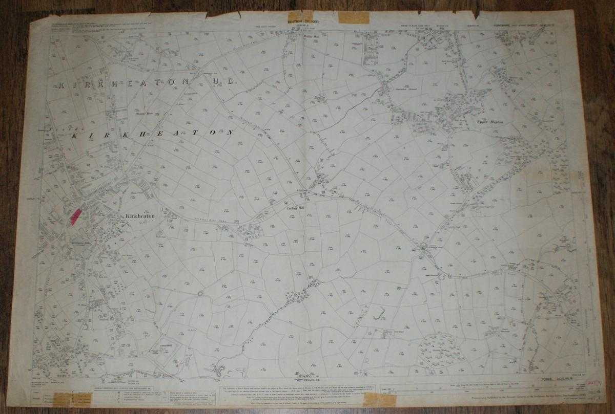
1:2,500 Ordnance Survey Map, Yorkshire (West Riding) Sheet CCXLVII.9. Edition of 1932, Re-Surveyed 1888, Revised 1930, Re-Levelled 1931, 75/32 50/39, Kirkheaton and Area to East
Ordnance Survey · 1932
£12.00 (€14.39 | $15.82 | ¥2,523)
Map Ordnance Survey, 1932. Revised Edition, Softcover. Good Condition/No Dust Jacket. Black and white map. Map is lightly marked and is slightly darkened towards the edges. Top and bottom edges have small tears and tape stains in the margins. Some light annotation and one smal...
1:2,500 Ordnance Survey Map, Yorkshire (North Riding) Sheet LXXXVI.13. Edition of 1929, Re-Surveyed 1890, Revised 1928, Re-Levelled 1910, 100/29, Nosterfield and Area to North
Ordnance Survey · 1929
£12.00 (€14.39 | $15.82 | ¥2,523)
Map Ordnance Survey, 1929. Revised Edition, Softcover. Good Condition/No Dust Jacket. Black and white map. Map is lightly marked and smudged. Edges are slightly worn with some small tears and tape stains. Tear on bottom edge extends into mapped area and is stained from previou...
1:2,500 Ordnance Survey Map, Yorkshire (West Riding) Sheet CCLXI.4. Edition of 1932, Re-surveyed 1891-92, Revised 1930, Re-Levelled 1931, Midgley and Area to West, Prince of Wales Colliery
Ordnance Survey · 1932
£13.50 (€16.19 | $17.80 | ¥2,838)
Map Ordnance Survey, 1932. Revised Edition, Softcover. Good Condition/No Dust Jacket. Black and white map. Reverse is lightly marked, with edges that are lightly worn, crumpled and darkened. One vertical fold which is worn and fragile, a further four vertical crease and one ho...
1:2,500 Ordnance Survey Map, Yorkshire (West Riding) Sheet CCLXI.14. Edition of 1931, Re-surveyed 1892, Revised 1929, Re-Levelled 1930, Lower Cumberworth with Area to NW and Cumberworth Common
Ordnance Survey · 1931
£9.50 (€11.39 | $12.53 | ¥1,997)
Map Ordnance Survey, 1931. Revised Edition, Softcover. Fair Condition/No Dust Jacket. Black and white map. Reverse is lightly marked, with edges that are lightly worn, crumpled and darkened. One vertical fold which is worn and fragile, a further four vertical crease and one ho...
1:2,500 Ordnance Survey Map, Yorkshire (West Riding) Sheet CCLXI.10. Edition of 1931, Re-surveyed 1892, Revised 1929, Re-Levelled 1930, 75/31 25/45.Ch, Shelly and Area to NW
Ordnance Survey · 1931
£12.00 (€14.39 | $15.82 | ¥2,523)
Map Ordnance Survey, 1931. Revised Edition, Softcover. Fair Condition/No Dust Jacket. Black and white map. Reverse is lightly marked, with edges that are lightly worn, crumpled and darkened. One vertical fold which is worn and fragile, a further four vertical crease and one ho...
1:2,500 Ordnance Survey Map, Yorkshire (West Riding) Sheet CCLXI.11. Edition of 1931, Re-surveyed 1892, Revised 1929, Re-Levelled 1930, Emley Park with Emley Moor Collieries and Park Gate
Ordnance Survey · 1931
£12.50 (€14.99 | $16.48 | ¥2,628)
Map Ordnance Survey, 1931. Revised Edition, Softcover. Good Condition/No Dust Jacket. Black and white map. Reverse is lightly marked, with edges that are lightly worn, crumpled and darkened. One vertical fold which is worn and fragile, a further four vertical crease and one ho...

1:2,500 Ordnance Survey Map, Yorkshire (West Riding) Sheet CCLXI.12. Edition of 1931, Re-surveyed 1891-2, Revised 1929, Re-Levelled 1930 75/31, Park Mill and Surrounding Area
Ordnance Survey · 1931
£12.00 (€14.39 | $15.82 | ¥2,523)
Map Ordnance Survey, 1931. Revised Edition, Softcover. Good Condition/No Dust Jacket. Black and white map. Reverse is lightly marked, with edges that are lightly worn, crumpled and darkened. One vertical fold which is worn and fragile, a further four vertical crease and one ho...
1:2,500 Ordnance Survey Map, Yorkshire (West Riding) Sheet CCLXI.12. Edition of 1906, Re-surveyed 1891, Revised 1904, 35/12, Park Mill and Surrounding Area
Ordnance Survey · 1906
£15.00 (€17.98 | $19.78 | ¥3,153)
Map Ordnance Survey, 1906. Revised Edition, Softcover. Good Condition/No Dust Jacket. Black and white map. Reverse is lightly marked, with edges that are lightly worn, crumpled and darkened. One vertical fold which is worn and fragile, a further four vertical crease and one ho...
1:2,500 Ordnance Survey Map, Yorkshire (West Riding) Sheet CCLXI.1. Edition of 1932, Re-surveyed 1891, Revised 1930, Re-Levelled 1931, 100/32 30/43, Rowley Hill and Surrounding Area
Ordnance Survey · 1932
£12.00 (€14.39 | $15.82 | ¥2,523)
Map Ordnance Survey, 1932. Revised Edition, Softcover. Fair Condition/No Dust Jacket. Black and white map. Reverse is lightly marked, with edges that are lightly worn, crumpled and darkened. One vertical fold which is worn and fragile, a further four vertical crease and one ho...

1:2,500 Ordnance Survey Map, Yorkshire (West Riding) Sheet CCLXI.5. Edition of 1932, Re-surveyed 1891, Revised 1930, Re-Levelled 1930.31, 100/32 25/44.Ch, Highburton and Kirkburton
Ordnance Survey · 1932
£12.00 (€14.39 | $15.82 | ¥2,523)
Map Ordnance Survey, 1932. Revised Edition, Softcover. Good Condition/No Dust Jacket. Black and white map. Reverse is lightly marked, with edges that are lightly worn, crumpled and darkened. One vertical fold which is worn and fragile, a further four vertical crease and one ho...
1:2,500 Ordnance Survey Map, Yorkshire (West Riding) Sheet CCLXI.3. Edition of 1932, Re-surveyed 1891, Revised 1930, Re-Levelled 1931, 100/32, Flockton and Flockton U. D.
Ordnance Survey · 1932
£12.50 (€14.99 | $16.48 | ¥2,628)
Map Ordnance Survey, 1932. Revised Edition, Softcover. Good Condition/No Dust Jacket. Black and white map. Slight darkening and short tears at edges (margins only). One vertical fold, paper is rubbed here and is a little fragile and with splits at top, bottom and about centre ...
1:2,500 Ordnance Survey Map, Yorkshire (West Riding) Sheet CCLXII.6. Edition of 1931, Re-surveyed 1887-8, Revised 1929, Re-Levelled 1930, 75/31 50/42 Holmbridge & Surrounding Area
Ordnance Survey · 1931
£9.50 (€11.39 | $12.53 | ¥1,997)
Map Ordnance Survey, 1931. Revised Edition, Softcover. Good Condition/No Dust Jacket. Black and white map. Slight darkening and short tears at edges (margins only). One vertical fold, paper is rubbed here and is a little fragile and with splits at top, bottom and about centre ...
1:2500 Ordnance Survey Map, Yorkshire (West Riding) Sheet CCLXI.7. Edition of 1932, Resurveyed 1891, Rev. 1930, Re-Levelled 1931, Rev. 100/32 Emley and Surrounding Area
Ordnance Survey · 1932
£9.50 (€11.39 | $12.53 | ¥1,997)
Map Ordnance Survey, 1932. Revised Edition, Softcover. Good Condition/No Dust Jacket. Black and white map. Tape stain on lower edge (margin only), slight darkening, light crumpling and nicks and short tears at edges (margins only). Light smudges and marks on map surface, four ...