
Bailgate Books Ltd
Libri
495 libri di Bailgate Books Ltd

Cambridge - Bartholomew's Revised "Half-Inch" Contoured Maps, Great Britain Sheet 20
John Bartholomew & Son Ltd. · 1954
£17.00 (€20.38 | $22.41 | ¥3,574)
John Bartholomew & Son Ltd. Edinburgh, 1954. Revised Edition, Softcover. Very Good Condition/No Dust Jacket. Single sheet map is cloth backed and has blue card covers. Sheet is folded as for original sale. Scale 1:126,720 or Half-Inch to Mile. Map is coloured according to cont...

Vale of Trent - Bartholomew's Revised "Half-Inch" Contoured Maps, Great Britain Sheet 24
John Bartholomew & Son Ltd. · 1960
£7.50 (€8.99 | $9.89 | ¥1,577)
John Bartholomew & Son Ltd. Edinburgh, 1960. Revised Edition, Softcover. Very Good Condition/No Dust Jacket. Single sheet map is cloth backed and has blue card covers. Sheet is folded as for original sale. Scale 1:126,720 or Half-Inch to Mile. Map is coloured according to cont...

Warwickshire - Bartholomew's Revised "Half-Inch" Contoured Maps, Great Britain Sheet 19
John Bartholomew & Son Ltd. · 1957
£5.00 (€5.99 | $6.59 | ¥1,051)
John Bartholomew & Son Ltd. Edinburgh, 1957. Revised Edition, Softcover. Very Good Condition/No Dust Jacket. Single sheet map is cloth backed and has blue card covers. Sheet is folded as for original sale. Scale 1:126,720 or Half-Inch to Mile. Map is coloured according to cont...

Teesdale - Bartholomew's Revised "Half-Inch" Contoured Maps, Great Britain Sheet 35
John Bartholomew & Son Ltd. · 1947
£5.00 (€5.99 | $6.59 | ¥1,051)
John Bartholomew & Son Ltd. Edinburgh, 1947. Revised Edition, Softcover. Good Condition/No Dust Jacket. Single sheet map is mounted on cloth and has blue card covers. Sheet is folded as for original sale. Scale 1:126,720 or Half-Inch to Mile. Map is coloured according to conto...

Grampians - Bartholomew's Revised "Half-Inch" Contoured Maps, Great Britain Sheet 51
John Bartholomew & Son Ltd. · 1952
£8.00 (€9.59 | $10.55 | ¥1,682)
John Bartholomew & Son Ltd. Edinburgh, 1952. Revised Edition, Softcover. Good Condition/No Dust Jacket. Single sheet map is cloth backed and has blue card covers. Sheet is folded as for original sale. Scale 1:126,720 or Half-Inch to Mile. Map is coloured according to contour a...
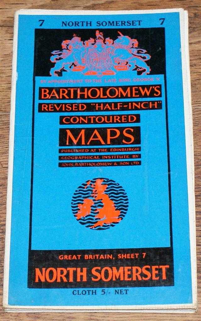
North Somerset - Bartholomew's Revised "Half-Inch" Contoured Maps, Great Britain Sheet 7
John Bartholomew & Son Ltd. · 1960
£8.00 (€9.59 | $10.55 | ¥1,682)
John Bartholomew & Son Ltd. Edinburgh, 1960. Revised Edition, Softcover. Very Good Condition/No Dust Jacket. Single sheet map is cloth backed and has blue card covers. Sheet is folded as for original sale. Scale 1:126,720 or Half-Inch to Mile. Map is coloured according to cont...
1884 Blackie's Map of Marocco, Algeria and Tunis
W. G. Blackie · 1884
£16.00 (€19.18 | $21.10 | ¥3,364)
Map Blackie & Son, London, Glasgow, Edinburgh and Dublin, 1884. Early Edition, Softcover, Illustrated by: Drawn and Engraved by J. Bartholomew. Very Good Condition/No Dust Jacket. Disbound map from the 1884 "Comprehensive Atlas & Geography of the World: Comprising an Extensive...

1884 Blackie's Map of Western Africa
W. G. Blackie · 1884
£16.00 (€19.18 | $21.10 | ¥3,364)
Map Blackie & Son, London, Glasgow, Edinburgh and Dublin, 1884. Early Edition, Softcover, Illustrated by: Drawn and Engraved by J. Bartholomew. Very Good Condition/No Dust Jacket. Disbound map from the 1884 "Comprehensive Atlas & Geography of the World: Comprising an Extensive...
1884 Blackie's Map of Canada - The Provinces of Quebec, Nova Scotia, New Brunswick, Prince Edward Island and Newfoundland
W. G. Blackie · 1884
£17.00 (€20.38 | $22.41 | ¥3,574)
Map Blackie & Son, London, Glasgow, Edinburgh and Dublin, 1884. Early Edition, Softcover, Illustrated by: Drawn and Engraved by J. Bartholomew. Very Good Condition/No Dust Jacket. Disbound map from the 1884 "Comprehensive Atlas & Geography of the World: Comprising an Extensive...
1884 Blackie's Map of Canada - The Province of Ontario and part of Quebec
W. G. Blackie · 1884
£17.00 (€20.38 | $22.41 | ¥3,574)
Map Blackie & Son, London, Glasgow, Edinburgh and Dublin, 1884. Early Edition, Softcover, Illustrated by: Drawn and Engraved by J. Bartholomew. Very Good Condition/No Dust Jacket. Disbound map from the 1884 "Comprehensive Atlas & Geography of the World: Comprising an Extensive...
1884 Blackie's Map of Central Europe, showing the Principal Railways and the Political Boundaries
W. G. Blackie · 1884
£18.00 (€21.58 | $23.73 | ¥3,784)
Map Blackie & Son, London, Glasgow, Edinburgh and Dublin, 1884. Early Edition, Softcover, Illustrated by: Drawn and Engraved by J. Bartholomew. Very Good Condition/No Dust Jacket. Disbound map from the 1884 "Comprehensive Atlas & Geography of the World: Comprising an Extensive...
1884 Blackie's Map of Switzerland
W. G. Blackie · 1884
£18.00 (€21.58 | $23.73 | ¥3,784)
Map Blackie & Son, London, Glasgow, Edinburgh and Dublin, 1884. Early Edition, Softcover, Illustrated by: Drawn and Engraved by J. Bartholomew. Very Good Condition/No Dust Jacket. Disbound map from the 1884 "Comprehensive Atlas & Geography of the World: Comprising an Extensive...
1884 Blackie's Map of Turkey, Greece, Roumania, Servia, Bulgaria, Bosnia & Montenegro
W. G. Blackie · 1884
£18.00 (€21.58 | $23.73 | ¥3,784)
Map Blackie & Son, London, Glasgow, Edinburgh and Dublin, 1884. Early Edition, Softcover, Illustrated by: Drawn and Engraved by J. Bartholomew. Very Good Condition/No Dust Jacket. Disbound map from the 1884 "Comprehensive Atlas & Geography of the World: Comprising an Extensive...
The Universal Gazetteer or Dictionary of Descriptive and Physical Geography, compiled from the Most Recent Authorities, Illustrate by Numerous Engravngs
James Bryce (later Viscount Bryce) · 1862
£146.00 (€175.05 | $192.50 | ¥30,694)
Griffin, Bohn, and Company, London, 1862. Third Edition, thoroughly revised, Hardcover. Fair Condition/No Dust Jacket. Includes annex at rear, Key to the Pronunciation by F A Wolski. Brown half-leather with black spine label and decorated spine, rear cover is detached, marbled...
The Empire Beyond the Seas (Collins' 'Reason Why' Geography Series)
T W F Parkinson · 1923
£18.00 (€21.58 | $23.73 | ¥3,784)
Collins' Clear-Type Press, London and Glagow, 1923. First Edition, Hardcover. Good Condition/No Dust Jacket. Blue decorated covers are darkened with bumped corners and spine-ends, sound binding, school stamp on darkened front end-paper, pages are a little darkened. No dust-jac...
Above the World, Stunning Satellite Images From Above Earth
NPA Group · 2004
£23.00 (€27.58 | $30.33 | ¥4,835)
Cassell Illustrated, Octopus Publishing, London, 2004. First Edition, Hardcover. Very Good Condition/No Dust Jacket. 9781844031818 Lower corners of black covers are bumped. Black covers with silver lettering on the spine. Fresh covers, sound binding, clean pages and end-papers...
New Worlds, Maps from the Age of Discovery
Ashley and Miles Baynton-Williams · 2006
£34.00 (€40.76 | $44.83 | ¥7,148)
Map Quercus, London, 2006. First Edition, Hardcover. Near Fine Condition/Near Fine. 9781905204809 Small scuff on dust-jacket at head of spine area. Packed weight approx. 4-5 kg. Item Type: Map. Crisp clean unclipped dust-jacket, fresh covers with gilt lettering on spine, tight...
Antique Maps
Carl Moreland and David Bannister · 1989
£12.00 (€14.39 | $15.82 | ¥2,523)
Phaidon, 1989. Third Edition, Softcover. Near Fine Condition/No Dust Jacket. 9780714829548 Crisp clean covers, tight binding, clean pages and inside covers. No dust jacket, as published. Previous owner's name, Kerry Downes, in pencil at the front. Quantity Available: 1. Shippe...

Map of India - disbound sheet from 1857 "University Atlas"
Edward Stanford, J. & C. Walker · 1857
£18.00 (€21.58 | $23.73 | ¥3,784)
Edward Stanford, London, 1857. First Edition, Softcover. Fair Condition/No Dust Jacket. Disbound single Sheet Map with horizontal centre fold from "The University Atlas of Classical and Modern Geography, including all the Recent Geographical Discoveries". Sheet is heavily foxe...
Nautical Chart No. AUS 384 Papua New Guinea - North East Coast, Cape Vogel to Cape Nelson including Trobriand Islands
Admiralty · 2005
£26.00 (€31.17 | $34.28 | ¥5,466)
Admiralty, 2005. Revised Edition, Softcover. Very Good Condition/No Dust Jacket. Crisp and clean colour chart with two vertical folds. Nautical Chart No. AUS 384 Papua New Guinea - North East Coast, Cape Vogel to Cape Nelson including Trobriand Islands. Copyright 1992 with sma...