
Bailgate Books Ltd
Libri
495 libri di Bailgate Books Ltd
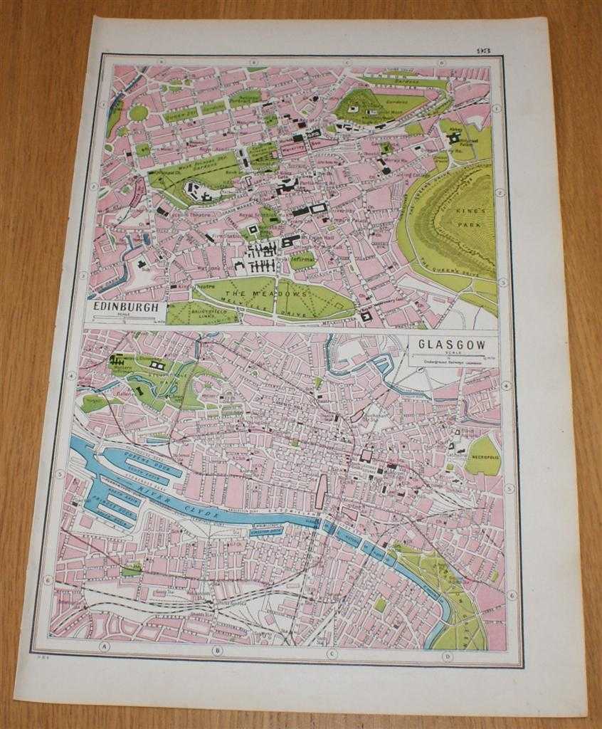
Street Plans of Edinburgh and Glasgow from Harmsworth's 1922 Atlas of the World - Single Sheet
Edited by J. A. Hammerton; Miss H. B. Leach, H. W. Cribb and J. T. Rankin · 1922
£13.00 (€15.59 | $17.14 | ¥2,733)
The Educational Book Co. Ltd. London, 1922. Early Edition, Softcover. Very Good Condition/No Dust Jacket. Single disbound map page from Harmsworth's Atlas of the World and Pictorial Gazetteer. Single sheet only which is divided into 2 panels, plans are in colour and sheet is s...
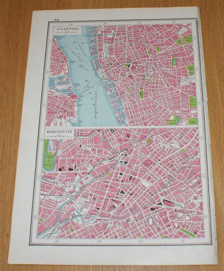
Street Plans of Liverpool and Manchester from Harmsworth's 1922 Atlas of the World - Single Sheet
Edited by J. A. Hammerton; Miss H. B. Leach, H. W. Cribb and J. T. Rankin · 1922
£13.00 (€15.59 | $17.14 | ¥2,733)
The Educational Book Co. Ltd. London, 1922. Early Edition, Softcover. Very Good Condition/No Dust Jacket. Single disbound map page from Harmsworth's Atlas of the World and Pictorial Gazetteer. Single sheet only which is divided into 2 panels, plans are in colour and sheet is s...

Street Plan of New York (USA) from Harmsworth's 1922 Atlas of the World - Single Sheet with two plans - Greater New York and Central New York
Edited by J. A. Hammerton; Miss H. B. Leach, H. W. Cribb and J. T. Rankin · 1922
£13.00 (€15.59 | $17.14 | ¥2,733)
The Educational Book Co. Ltd. London, 1922. Early Edition, Softcover. Very Good Condition/No Dust Jacket. Single disbound map page from Harmsworth's Atlas of the World and Pictorial Gazetteer. Single sheet only which is divided into 2 panels, plans are in colour and sheet is s...

Street Plans of Cities in Australia - Sydney, Brisbane, Melbourne and Canberra, with map of Federal Territory, from Harmsworth's 1922 Atlas of the World - Single Sheet
Edited by J. A. Hammerton; Miss H. B. Leach, H. W. Cribb and J. T. Rankin · 1922
£13.00 (€15.59 | $17.14 | ¥2,733)
The Educational Book Co. Ltd. London, 1922. Early Edition, Softcover. Very Good Condition/No Dust Jacket. Single disbound map page from Harmsworth's Atlas of the World and Pictorial Gazetteer. Single sheet only which is divided into 5 panels, plans are in colour and sheet is s...

Street Plans of Cities in Italy - Rome (Ancient and Modern), Naples, Venice, Milan and Turin from Harmsworth's 1922 Atlas of the World - Single Sheet
Edited by J. A. Hammerton; Miss H. B. Leach, H. W. Cribb and J. T. Rankin · 1922
£13.00 (€15.59 | $17.14 | ¥2,733)
The Educational Book Co. Ltd. London, 1922. Early Edition, Softcover. Very Good Condition/No Dust Jacket. Single disbound map page from Harmsworth's Atlas of the World and Pictorial Gazetteer. Single sheet only which is divided into 6 panels, plans are in colour and sheet is s...

Street Plans of Sheffield, Leeds, Birmingham and Newcastle on Tyne from Harmsworth's 1922 Atlas of the World - Single Sheet
Edited by J. A. Hammerton; Miss H. B. Leach, H. W. Cribb and J. T. Rankin · 1922
£13.00 (€15.59 | $17.14 | ¥2,733)
The Educational Book Co. Ltd. London, 1922. Early Edition, Softcover. Very Good Condition/No Dust Jacket. Single disbound map page from Harmsworth's Atlas of the World and Pictorial Gazetteer. Single sheet only, divided into 4 panels, plans are in colour and sheet is suitable ...

Plan of London with Railways (including Underground) from Harmsworth's 1922 Atlas of the World
Edited by J. A. Hammerton; Miss H. B. Leach, H. W. Cribb and J. T. Rankin · 1922
£13.00 (€15.59 | $17.14 | ¥2,733)
The Educational Book Co. Ltd. London, 1922. Early Edition, Softcover. Very Good Condition/No Dust Jacket. Single disbound map page from Harmsworth's Atlas of the World and Pictorial Gazetteer. Plan is in colour and suitable for framing. Page size is approximately 24.5 x 37cm, ...

Street Plan of Central London from Harmsworth's 1922 Atlas of the World
Edited by J. A. Hammerton; Miss H. B. Leach, H. W. Cribb and J. T. Rankin · 1922
£13.00 (€15.59 | $17.14 | ¥2,733)
The Educational Book Co. Ltd. London, 1922. Early Edition, Softcover. Very Good Condition/No Dust Jacket. Single disbound map page from Harmsworth's Atlas of the World and Pictorial Gazetteer. Plan is in colour and suitable for framing. Page size is approximately 24.5 x 37cm, ...

Sheet 144 - Cheltenham and Evesham, One-Inch Map of Great Britain Seventh Series
Ordnance Survey · 1955
£5.00 (€5.99 | $6.59 | ¥1,051)
Map Ordnance Survey, Chessington, 1955. Revised Edition, Softcover. Very Good Condition/No Dust Jacket. Cloth backed folded colour map sheet with card covers. Covers are worn at the edges with some small nicks. Covers are a little marked and darkened. Some folds on the map she...

Cambridge - Bartholomew's Revised "Half-Inch" Contoured Maps of Great Britain, Sheet 20
John Bartholomew & Son Ltd. · 1947
£19.50 (€23.38 | $25.71 | ¥4,100)
John Bartholomew & Son Ltd. Edinburgh, 1947. Revised Edition, Softcover. Very Good Condition/No Dust Jacket. Single sheet map is backed with cloth and has blue card covers. Sheet is folded as for original sale. Scale 1:126,720 or Half Inch to the Mile. Map is coloured accordin...

North Wales - Bartholomew's Revised "Half-Inch" Contoured Maps, Great Britain Sheet 27
John Bartholomew & Son Ltd. · 1948
£10.50 (€12.59 | $13.84 | ¥2,207)
John Bartholomew & Son Ltd. Edinburgh, 1948. Revised Edition, Softcover. Very Good Condition/No Dust Jacket. Single sheet map is backed with cloth and has blue card covers. Sheet is folded as for original sale. Scale 1:126,720 or Half Inch to the Mile. Map is coloured accordin...

North Shropshire - Bartholomew's Revised "Half-Inch" Contoured Maps of England and Wales, Sheet 12 (F3)
John Bartholomew & Son Ltd. · 1936
£7.50 (€8.99 | $9.89 | ¥1,577)
John Bartholomew & Son Ltd. Edinburgh, 1936. Revised Edition, Softcover. Very Good Condition/No Dust Jacket. Single sheet map is dissected and mounted on cloth and has blue card covers. Sheet is folded as for original sale. Scale 1:126,720 or 2 Miles to an Inch. Map is coloure...

Vale of Severn - Bartholomew's Revised "Half-Inch" Contoured Maps of Great Britain, Sheet 18
John Bartholomew & Son Ltd. · 1949
£19.00 (€22.78 | $25.05 | ¥3,994)
John Bartholomew & Son Ltd. Edinburgh, 1949. Revised Edition, Softcover. Very Good Condition/No Dust Jacket. Single sheet map is backed with cloth and has blue card covers. Sheet is folded as for original sale. Scale 1:126,720 or Half Inch to the Mile. Map is coloured accordin...

Central Wales - Bartholomew's Revised "Half-Inch" Contoured Maps of England and Wales, Sheet 16
John Bartholomew & Son Ltd. · 1935
£7.00 (€8.39 | $9.23 | ¥1,472)
John Bartholomew & Son Ltd. Edinburgh, 1935. Revised Edition, Softcover. Good Condition/No Dust Jacket. Single sheet map is backed with cloth and has blue card covers. Sheet is folded as for original sale. Scale 1:126,720 or 2 Miles to an Inch. Map is coloured according to con...

Lincolnshire - Bartholomew's Revised "Half-Inch" Contoured Maps of England & Wales, Sheet 10 (C5)
John Bartholomew & Son Ltd. · 1936
£16.50 (€19.78 | $21.75 | ¥3,469)
John Bartholomew & Son Ltd. Edinburgh, 1936. Revised Edition, Softcover. Very Good Condition/No Dust Jacket. Single sheet map is backed with cloth and has blue card covers. Sheet is folded as for original sale. Scale 1:126,720 or 2 Miles to an Inch. Map is coloured according t...
Cardigan - Bartholomew's Revised "Half-Inch" Contoured Maps of England and Wales, Sheet 22 (E4)
John Bartholomew & Son Ltd. · 1938
£5.00 (€5.99 | $6.59 | ¥1,051)
John Bartholomew & Son Ltd. Edinburgh, 1938. Revised Edition, Softcover. Very Good Condition/No Dust Jacket. Single sheet map is cloth backed and has blue card covers. Sheet is folded as for original sale. Scale 1:126,720 or 2 Miles to an Inch. Map is coloured according to con...

Exmoor - Bartholomew's Revised "Half-Inch" Contoured Map of England & Wales, Sheet 35 (A3)
John Bartholomew & Son Ltd. · 1939
£9.50 (€11.39 | $12.53 | ¥1,997)
John Bartholomew & Son Ltd. Edinburgh, 1939. Revised Edition, Softcover. Very Good Condition/No Dust Jacket. Single sheet map is mounted on cloth and has blue card covers. Sheet is folded as for original sale. Scale 1:126,720 or 2 Miles to an Inch. Map is coloured according to...

North Somerset - Bartholomew's Revised "Half-Inch" Contoured Maps of Great Britain, Sheet 7
John Bartholomew & Son Ltd. · 1947
£9.50 (€11.39 | $12.53 | ¥1,997)
John Bartholomew & Son Ltd. Edinburgh, 1947. Revised Edition, Softcover. Very Good Condition/No Dust Jacket. Single sheet map is cloth backed and has blue card covers. Sheet is folded as for original sale. Scale 1:126,720 or Half-Inch to the Mile. Map is coloured according to ...
Teesdale - Bartholomew's Revised "Half-Inch" Contoured Map of England & Wales, Sheet 4
John Bartholomew & Son Ltd. · 1932
£5.50 (€6.59 | $7.25 | ¥1,156)
John Bartholomew & Son Ltd. Edinburgh, 1932. Revised Edition, Softcover. Very Good Condition/No Dust Jacket. Single sheet map is dissected and mounted on cloth and has blue card covers. Sheet is folded as for original sale. Scale 1:126,720 or 2 Miles to an Inch. Map is coloure...
Peterhead & Banff - Bartholomew's New Reduced Survey of Scotland, Sheet 22, Half Inch to Mile, Coloured for Tourists and Cyclists
John Bartholomew & Son Ltd. · 1912
£8.00 (€9.59 | $10.55 | ¥1,682)
John Bartholomew & Son Ltd. Edinburgh, 1912. Revised Edition, Softcover. Very Good Condition/No Dust Jacket. Single sheet map is dissected and mounted on cloth and has blue card covers. Sheet is folded as for original sale. Scale 1:126,720 or Half Inch to Mile. Map is coloured...