
Viaggi e geografia
Letteratura di viaggio, esplorazioni, carte geografiche e topografia.
Risultati della ricerca
107376 libri in Viaggi e geografia

Wandelingen in en om Geneve
BONDAM, H.C.C., · 1882 · Antiquariaat Goltzius
€28.75 ($31.69 | £23.98 | ¥5,061)
Leiden, A.W. Sijthoff, 1882, Het leeskabinet, two exerpts of a travel story written by H.C.C. Bondam with three illustrations (S. Lankhout & Co, Den Haag (lithograph), no binding, loose pages but complete.
Twee particuliere correpondentien uit den Franschen tijd, Reizen in 1799-1801. Een Garde d'Honneur in 1813 door P. van Eeghen
EEGHEN, P. VAN, · 1895 · Antiquariaat Goltzius
€143.75 ($158.44 | £119.91 | ¥25,304)
{Amsterdam, 1895, privately published?] 48 pages, original paper binding, the author Pieter van Eeghen Chz. (1844-1907) describes the correspondence of Syds Banga and Johannes Stinstra (1708-1790). Interesting view on travel in days of the Dutch Bataafse republiek and under Fr...
Climats Géologie, Faune et Géographie Botanique du Brésil
LIAIS, EMMANUEL, · 1872 · Antiquariaat Goltzius
€230.00 ($253.51 | £191.85 | ¥40,487)
Paris, GARNIER Freres, 1872, 640 pages and folding map, half linnen binding, provenance from the library of Geologisch Instituut Amsterdam, library stamps on spine and on several pages. Good copy. Scarce.
De Bussy's atlas van Nederland voor kantoor, school en thuis
1923 · Antiquariaat Goltzius
€57.50 ($63.38 | £47.96 | ¥10,122)
{1923], large folio atlas of the Netherlands. Haarlem edition: all plates have advertisments from the region of Haarlem, original binding, not in a good state, bloc is loose, textpages missing. Plates of the Netherlands and provinces are coloured
Plattegrond van Valkenburg,
1880 · Antiquariaat Goltzius
€34.50 ($38.03 | £28.78 | ¥6,073)
[no date, no publisher], 1880-1900, small printed map of the city of Valkenburg on linnen. 22x21cm, some minor damage to the map. Attractive
Kaart van Drenthe, ontworpen en getekend door J. Kuyper
KUYPER, J., · 1888 · Antiquariaat Goltzius
€143.75 ($158.44 | £119.91 | ¥25,304)
Leeuwarden, Hugo Suringar, 1888, 7th edition, map of Drenthe in original folder, with accents in colour, 43x53cm. attractive map of drenthe. 125
Reizen van Lemuel Gulliver naar verschillende onbekende volkeren der aarde door Jonathan Swift, uit het Engelsch vertaald, met ophelderende aanteekeningen en een levensschets van den schrijver, door J.W.N. Mosselmans (eerste en tweede deel)
SWIFT, JONATHAN, · 1862 · Antiquariaat Goltzius
€40.25 ($44.36 | £33.57 | ¥7,085)
Haarlem, A.C. Kruseman, 1862, two volumes, 241 (three last pages in photocopy)+191 pages, original paper bindings with text (damaged, back of 1stvolume missing, back of seond volume loose), 12x18 cm, lithograph portrait of Jonathan Swift by D.J. Sluyter with waterstains
W. Drugulin's Historischer Bilderatlas. Verzeichnis einer Sammlung von Einzelblättern zur Cultur- und Staatengeschichte von fünfzehnten bis in das neunzehnte Jahrhundert. Zweiter Theil: Chronik in Flugblättern.
DRUGULIN, W., · 1867 · Antiquariaat Goltzius
€57.50 ($63.38 | £47.96 | ¥10,122)
Leipzig, Leipziger Kunst-Comptoir, 1867, 500 pages, original paper on boards binding with some damage mostly on the spine. By insertions in the book, the text has been updated.
De verbetering onzer rivieren en bedijkingen in verband tot de voorkoming van doorbraken en overstroomingen en gepaard met doelmatige verbetring en waardevermeerdering der polders door C. Schiffer, lid van de Tweede Kamer der Staten-Generaal
SCHIFFER, C, · 1851 · Antiquariaat Goltzius
€172.50 ($190.13 | £143.89 | ¥30,365)
's Gravenhage, Gebroeders Belinfante, 1851, 132 pages with same minor damage throughout, original paper binding, spine with contempary repair, from the library of Hoogheemraadschap van Rijnland, no map. interesting thoughts of a member of the Dutch parliament on rivers and dik...
De eerste spoortrein in Nederland
1939 · Antiquariaat Goltzius
€258.75 ($285.20 | £215.84 | ¥45,548)
Utrecht, may 1939, 5 pages typewritten, in paper binding, with 6 original photographs of the replica of the first steamengine (De Arend) built in 1938 (and still existing in the Spoorwegmuseum in Utrecht) and wagons in the Netherlands. no author known. The story relates to the...
Rapport der hoofd-ingenieurs en ingenieurs van den waterstaat in het 9e, 10e en 8e district omtrent eene verbetering van de bestaande Keulsche Vaart, van Amsterdam langs Utrecht, Vreeswijk, Vianen en Gorinchem.
1878 · Antiquariaat Goltzius
€178.25 ($196.47 | £148.69 | ¥31,377)
Den Haag, Algemene Landsdrukkerij, 1878, 16 pages with very large folding map,original wrappers in used state, edges damaged, scarce. This document concerns the so called Keulsche Vaart, which was the waterway between Amsterdam and Cologne (Keulen). Started by King Willem I an...
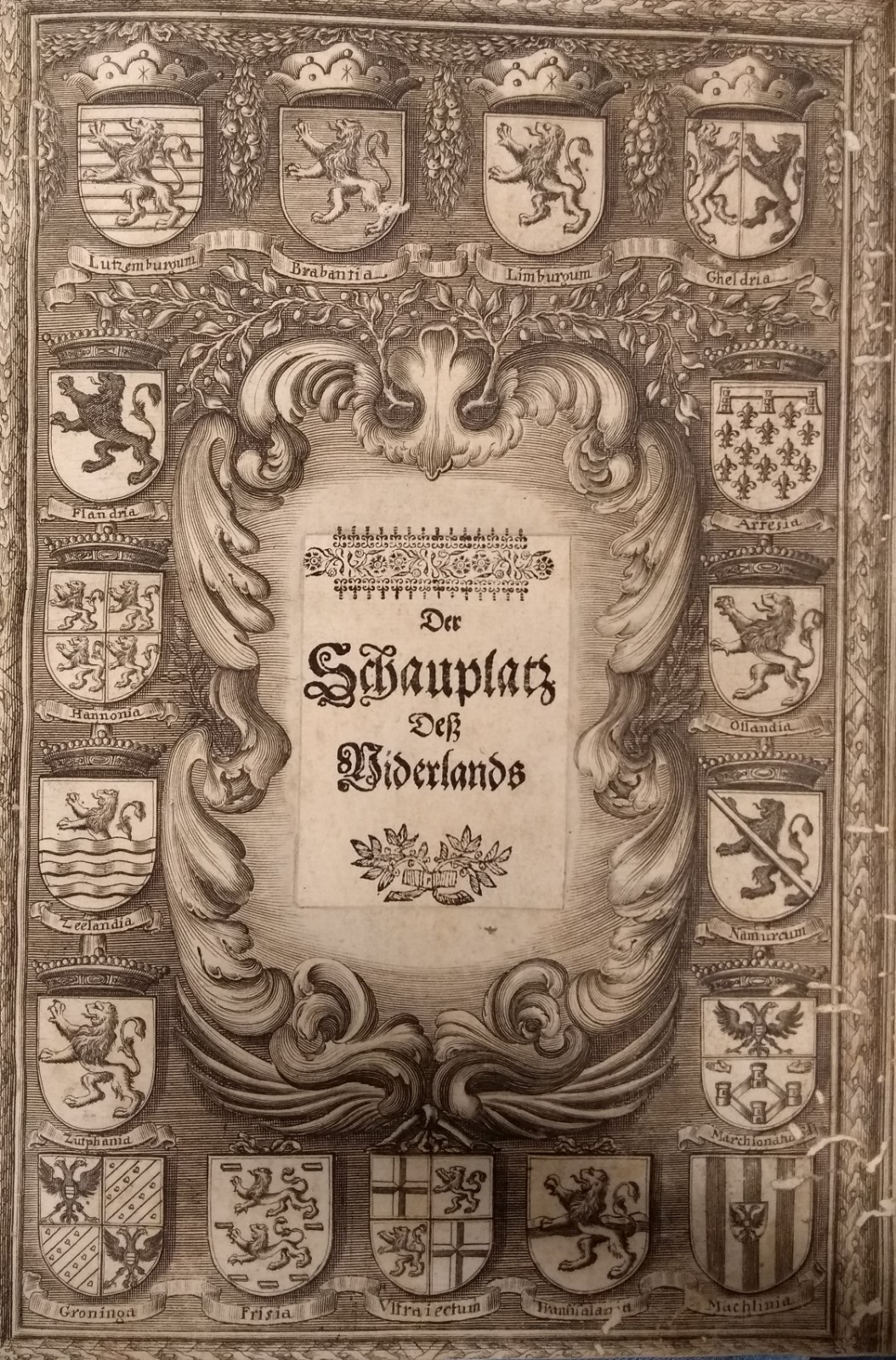
Schau-Platz desz Niederlandes. Oder: Es sey die Beschreibung der siebenzehen Provincien
[Gualdo Priorato, G.] · 1673 · Antiquariaat Goltzius
€1,144.25 ($1,261.20 | £954.47 | ¥201,421)
Wien, Michael Thurnmayer, 1673, Folio, 31x21.5 cm, hardcover, marbled edges, some pencil markings, some worming in the margins of the first and last few pages, solid construction, good condition, 157 pages, engraved half title page (showing the weapons of the 17 regions of the...
Toeristen-Gids voor 1923 with a map of the island of Walcheren
1923 · Antiquariaat Goltzius
€172.50 ($190.13 | £143.89 | ¥30,365)
Middelburg, F.B. den Boer, 1923, very large touristguide with many illustrations and advertisments, text in Dutch, French and English, suggestions for 8 day trips in Zeeland. Many illustrations of people in traditional costumes. Scarce.
C.A.T.A. Tours, Bruges
1920 · Antiquariaat Goltzius
€40.25 ($44.36 | £33.57 | ¥7,085)
Bruges, appr. 1920, guide in English to the city of Bruges (Brugge) as published by touring compant C.A.T.A. Tours with loose advertisment of the same company with pictures of their 'Cars de luxe\"including a Lancia 22 seater, G.M.C. and 6 cyl Minerva 7 seater. Many illustrat...
The tourists' Shilling Handy Guide to Scotland, with new charts and illustrations, eleventh edition, revised and enlarged
1880 · Antiquariaat Goltzius
€143.75 ($158.44 | £119.91 | ¥25,304)
Edinburgh, William Paterson, 1880. 160 pages text with many illustrations and maps and many pages of advertisements. Original paper binding. Some damage to the binding as may be expected, last pages loose. Soiled front. Fair copy of scarce edition of this travel guide.
Naar Italië, een handboekje voor beoefenaars van de Italiaansche taal en voor hen, die Italië wenschen te bezoeken, naar het hoogduitsch
GOLDSCHMIDT, BRUIN, SERVAAS DE;, · 1900 · Antiquariaat Goltzius
€17.25 ($19.01 | £14.39 | ¥3,037)
Gouda, G.B. van Goor Zonen, (appr. 1900), tweede geheelherziene en veel verbeterede druk, 2nd edition, 132 pages. Small traveldictionary for the Italian language with grammar, sentences and many words. It gives an interesting insight in life travelling around 1900: \"I would l...
Tabula qua Graecia Superior, qualis tempore belli Peloponnesiaci ineuntis fuit descripta est C. Odofredo Muller with Zur Karte des Nördlichen Griecnlands von K. D. Müller, beilage zu dem Werke desselben Verfassers die Dorier
MULLER, K. OTTFRIED, · 1831 · Antiquariaat Goltzius
€143.75 ($158.44 | £119.91 | ¥25,304)
Map: J&C Walker sculpsit, paper on linnen, in original paper folder. Book: Breslau, Josef Max und Komp., 1831. 37 pages, original marbled paper binding, This early 19th century detailed and hand coloured map of the north of Greece and the accompagnying bookare rarely found to...
Reizen van Nederlanders rondom de wereld. Van Noord, Schouten en Le Maire, Hermiet, Abel Tasman.
1841 · Antiquariaat Goltzius
€109.25 ($120.42 | £91.13 | ¥19,231)
Den Haag ('s-Gravenhage), Nederlandsche Maatschappij van Schoone Kunsten, Bestuurder, J.J. van Ryckevorsel, 1841, 8.5x13 cm, paper binding, 93 + 8 pp., Good, illustrated front cover, illustrated title page, 13 illustrations (including some decorative vignettes) l Little book a...
Photograph, foto, Garderen, church, kerk, pastorie, Dorpsweg, Stroe
0 · Antiquariaat Goltzius
€23.00 ($25.35 | £19.19 | ¥4,049)
Two undated photographs of the village of Garderen (province Gelderland). One depicts the Hervormde Kerk with the pastorie at the Dorpsweg on the right. The other depicts the road through the woods between Garderen en Stroe. Late 19th, early 20th century.
Haarlem (prov. Noord-Holland). Origineel gelithografeerd kaartje uit de Gemeenteatlas ca. 1868, 17x22 cm.
Kuyper, J. · 0 · Antiquariaat Goltzius
€86.25 ($95.07 | £71.95 | ¥15,183)