
Viaggi e geografia
Letteratura di viaggio, esplorazioni, carte geografiche e topografia.
Risultati della ricerca
107384 libri in Viaggi e geografia

Nieuwe kaart van het Westelykste Deel der Weereld, dienende tot aanwijzing van de Scheepstogten der Nederlanderen naar Westindie
TIRION, IS., · 1754 · Antiquariaat Goltzius
€230.00 ($253.49 | £191.88 | ¥40,479)
Map of the western hemisphere, showing the Americas, and a part of Europe and Africa in the right edge. The coast of the South American continent is mostly complete, but North America shows only the east coast. Engraving on hand laid paper, sheet size 394 x 363 mm., platemark ...

Oude kaart der nu Vereenigde Nederlanden tot opheldering der Vaderlandsche historie in de Middeleeuwe
TIRION, IS., · 1749 · Antiquariaat Goltzius
€287.50 ($316.86 | £239.85 | ¥50,599)
Historical map of the Netherlands. Engraving on hand laid paper, sheet size 478 x 333 mm., platemark 328 x 288 mm. Engraving published by Is. Tirion in Amsterdam, 1749. This map originates from the multi-volume publication 'Vaderlandsche historie, vervattende de geschiedeniss...

Nieuwe kaart van het Oostelykste Deel der Weereld
TIRION, IS., · 1753 · Antiquariaat Goltzius
€230.00 ($253.49 | £191.88 | ¥40,479)
Map of the eastern hemisphere, from Europe and Iceland to Siberia and Indonesia, with the then discovered coast of Australia. Engraving on hand laid paper, sheet size 403 x 348 mm., platemark 370 x 324 mm. Engraving published by Is. Tirion in Amsterdam, 1753. This map origina...

De stad Goes
BYE, C. DE, · 1696 · Antiquariaat Goltzius
€172.50 ($190.12 | £143.91 | ¥30,359)
Plan of the Dutch city Goes, in Zeeland. Two putti hold a shield with the coat of arms of the city. A keyed legend with 30 entries lower left. Engraving on hand laid paper, sheet size 443 x 392 mm., platemark 340 x 277 mm. Made by C. de Bye, ca. 1696. This map was published i...

Morfologie Natuurlijk.
1999 · Antiquariaat Goltzius
€34.50 ($38.02 | £28.78 | ¥6,072)
Arnhem, Rijkswaterstaat, 1999, 28pp. original illustrated softcover binding.

Map of Boezemgebied in Holland (van Rijnlandsboezoem) voormalige en tegenwoordige toestand der Rijnverdeeling 1:100.000 1696-1699 with indicated later changes.
0 · Antiquariaat Goltzius
€46.00 ($50.70 | £38.38 | ¥8,096)
Chromolithograph Braakensiek, Amsterdam, published by Thieme Zutphen, 54x45cm, attractive map with insets of 'doorsnede polders\" and : een gedeelte van het Hollands Polderland (Wassenaar, Zoetermeer). with library stamp on front corner of Kaarten archief Geografisch Instituut...
Map of Rivier De Waal dated 1908 no. 11.
0 · Antiquariaat Goltzius
€28.75 ($31.69 | £23.99 | ¥5,060)
Lithograph Langenhuysen, Den Haag, 32x38cm, tear in top of fold. 1:10.000 detailed map of de Waal river from Ztten/Herveld.

Friesland, met de Zee ten Westen in haar stroomen en zanden nooit dus uitgegeeven
OTTENS, FREDERIK, · 1717 · Antiquariaat Goltzius
€201.25 ($221.80 | £167.90 | ¥35,419)
Detailed antique map of the Dutch province Friesland, with a cartouche in the right edge. The area covered spans from Vlieland and Terschelling (top left) to the Lauwersmeer (here Lauwer Zee, top right) and Medemblik and Enkhuizen lower left. Engraving on hand laid paper, shee...
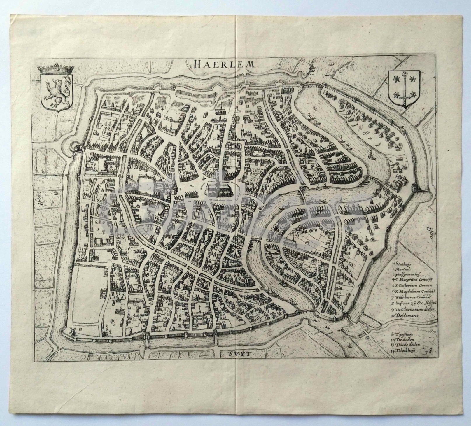
Map of Haarlem
GUICCIARDINI, LUDOVICO, · 1612 · Antiquariaat Goltzius
€230.00 ($253.49 | £191.88 | ¥40,479)
Titled 'Haerlem', with two coats of arms and a 14-line legend, the number 38 in the lower right corner. Engraving on laid paper, sheet size 345 x 306 mm., platemark 313 x 234 mm. This map is from the famous book 'Descrittione di Tutti I Paesi Bassi [...]', published between 16...

Map of Louvain
GUICCIARDINI, LUDOVICO, · 1581 · Antiquariaat Goltzius
€143.75 ($158.43 | £119.93 | ¥25,300)
Caption: 'Lovanium Brabanticarum orbium caput [...]'. Leuven, or Louvain, in Belgium. Engraving on laid paper, with old colouring, sheet size 377 x 296 mm., image size 320 x 238 mm. This map is from the famous book 'Descrittione di M. Lodovico Guicciardini patritio Fiorentino ...

Bird's eye map of Antwerp
GUICCIARDINI, LUDOVICO, · 1581 · Antiquariaat Goltzius
€143.75 ($158.43 | £119.93 | ¥25,300)
Caption: 'Antwerpiae nobilissimi totius orbis terraru[m] emporii typus anno M.D.LXXXI'. Engraving on laid paper, with old colouring, sheet size 364 x 294 mm., image size 324 x 238 mm. This map is from the book 'Descrittione di M. Lodovico Guicciardini patritio Fiorentino di Tu...

Beschrijving van de Noorder Ij- en Zeedijken deel 1 en 2.
2004 · Antiquariaat Goltzius
€51.75 ($57.04 | £43.17 | ¥9,108)
Haarlem, Provincie Noord-Holland, 2004, 56pp. illustrated, two parts in one volume, original illustrated binding, bookplate of Prof. G.P. van de Ven.
Hoogheemraadschap van Rijland. waterstaatkundige indeling. WBP 92 kaart 1 evaluatie 1995/waterstaatkundige indeling 1985.
0 · Antiquariaat Goltzius
€17.25 ($19.01 | £14.39 | ¥3,036)
two maps colourprinted, 60x40cm.
Topografische kaarten en plattegronden van de Hattinga's 1724-1755. Map 3: Kaarten van Zeeland
HOOGENDOORN-BEKS, W.J.M. & J.C.M. HATTINGA VERSCHURE, · 1977 · Antiquariaat Goltzius
€28.75 ($31.69 | £23.99 | ¥5,060)
Alphen aan den Rijn, Uitgeverij Canaletto, 1977, 4 pages text, 8 maps and a map of Breda.
Kabinetskaart van de Oostenrijkse Nederlanden opgenomen op initiatief van Graaf de Ferraris. Brussel
1965 · Antiquariaat Goltzius
€28.75 ($31.69 | £23.99 | ¥5,060)
Brussel, Pro Civitate, 1965, text and 5 maps of the city of Brussels as it existed in the Austrian low countries 1771-1775.

Polders! Gedicht Nederland
GEUZE, A.& FEDDES, FRED E.A., · 2005 · Antiquariaat Goltzius
€46.00 ($50.70 | £38.38 | ¥8,096)
Rotterdam, NAi Uitgevers, 2005, harddcover, 400 pp. many illustrations, one loose fold out map, from the library of Prof. G.P. van de Ven.
Polders in cultuur gebracht - Ontginning en tijdelijke staatsexploitatie van de IJsselmeerpolders
GEURTS, A.J.;, · 2000 · Antiquariaat Goltzius
€86.25 ($95.06 | £71.96 | ¥15,180)
Stichting Uitgeverij De Twaalfde Provincie, 2000, 336pp., original hardcover illustrated binding, many illustrations, scarce.
Tijdschrift voor Waterstaatsgeschiedenis 1992-2002
1992 · Antiquariaat Goltzius
€69.00 ($76.05 | £57.57 | ¥12,144)
Complete set in two identical red linen hardcover volumes with gilt titles on spine of this important periodical on the history of watermanagement in the Netherlands. Illustrated. This collection starts at the first published periodical in 1992 up to 2002.
WaterKader, vierde nota waterhuishouding Regeringsbeslissing. NW4
BEESEN, A.H.G.C. VAN DER (ED.), · 1998 · Antiquariaat Goltzius
€28.75 ($31.69 | £23.99 | ¥5,060)
Ministerie van Verkeer en Waterstaat december, 1998, 162pp. illustrated, original illustrated hardcover binding.
Urban water in Japan.
GRAAF, R. DE, HOOIMEIJER, F., · 2008 · Antiquariaat Goltzius
€51.75 ($57.04 | £43.17 | ¥9,108)
London, Taylor & Francis, 2008, 227pp. illustrated, original hardcover illustrated binding.