
Carte geografiche e topografia
Risultati della ricerca
84168 libri in Carte geografiche e topografia

De Zuid-Afrikaansche Republiek verslag uitgebracht door den consul van Belgie te Pretoria. (Vertaald)
1889 · Antiquariaat Goltzius
€51.75 ($57.04 | £43.17 | ¥9,110)
Brussel, Consulaat Generaal van de Zuid-Afrikaansche Republiek, [1889], 47 pages, original paper softcover binding, from the library of Dr Abraham Kuyperstichting (stamps and stickers on front and titlepage), South Africa.
Verhandelingen over de verbetering der ontlastinge van Rhijnlands boezem-water
1772 · Antiquariaat Goltzius
€569.25 ($627.43 | £474.84 | ¥100,205)
Convolute containing: 1. Twee verhandelingen over de verbetering der ontlastinge van Rhynlands boezem-water; en het project der doorgravinge uit het Wyker-Meir naa de Noord-Zee, Haarlem, J. Bosch, 1772, 8vo., 122 pp. 2. Derde verhandeling over de verbetering der ontlastinge va...
Vrije gedachten van een Ingeland van Rijnland, over de verhandeling van droogmaking des Haarlemmer Meers.
LYNDEN VAN HEMMEN, F.G. BARON VAN,, · 1821 · Antiquariaat Goltzius
€80.50 ($88.73 | £67.15 | ¥14,170)
Leyden, D. du Mortier en zoon, 1821, 8vo., speckled paper covered boards, 123 pp., smudged and uncut edged, fold in the front cover, printwork in good condition.
Verhandeling over den Rhijnlandschen Slaaperdijk bij Spaarndam, met betrekking tot deszelfs gevolgen zo voor den Waterstaat van Rhijnland als voor de stad Amsterdam.
CONRAD, F.W., · 1802 · Antiquariaat Goltzius
€143.75 ($158.44 | £119.91 | ¥25,304)
Haarlem, A. Loosjes, 1802, 8vo., speckled paper binding with faded title strip on spine and a note in pencil on the front (duplicaat), 58 pp. plus 6 large fold out pages showing tables and charts and 1 map (of 2, so one is missing), considerable water damage throughout the boo...
Alphabetisch register van alle bewoonde oorden des Rijks. Zijnde een vervolg op de Itineraire voor marscheerende troepen in het Koningrijk der Nederlanden. Te zamengesteld bij het Topografisch Bureau van het Departement van Oorlog, in verband met de bij dat bureau mede vervaardigde etappe-kaart van het rijk.
1850 · Antiquariaat Goltzius
€143.75 ($158.44 | £119.91 | ¥25,304)
's Gravenhage, Erven Doorman Boekhandelaren van Z.M. den Koning, 1850, X,445+3 pages, half leather binding, top of tooled spine with gilt lettering and ornaments damaged.
Teekenatlas van Nederl. Oost-Indië voor de Lagere School
GERARDS, W.J., · 0 · Antiquariaat Goltzius
€86.25 ($95.07 | £71.95 | ¥15,183)
Heerenveen, Land's Schoolboekhandel, [no date], 15th edition, 18 coloured maps of Dutch East Indies/Nederlands Indië (Indonesia), original illustrated paper on board binding, some ink stains on front and bottom corner of all pages. some ink lining on titlepage. Attractive atla...
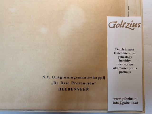
Atlas van (eigendommen van) de N.V. Ontginningsmaatschappij \"De Drie Provinciën\" te Heerenveen
1943 · Antiquariaat Goltzius
€172.50 ($190.13 | £143.89 | ¥30,365)
Topografische dienst, uitgave 1943, 32x50cm, gedeeltelijke atlas ingebonden door de voornoemde ontginningsmaatschappij, kaarten genummerd van nr. 13 Buitenpaal tot nr. 18 Oosterstrand, Nr. 26 Hollummerduinen tot nr. 30 Brakzand, nr. 41 Hoog Wier tot nr. 44 Anjum, nr. 56 Abt. t...
Geographie Historique l'histoire de la formation territoriale des pays civilises et l'histoire de la civilisation 48 lecons - 48 cartes coloriees 5 figures, lexique, table alphabetique
FONCIN, P., · 1888 · Antiquariaat Goltzius
€57.50 ($63.38 | £47.96 | ¥10,122)
Paris, Armand Colin, 1888, 136 pages, original paper on board binding with lettering on front, linnen spine, all maps in colour. Good copy.
National Maritime Museum Catalogue of the Library, Volume Three: Atlases & Cartography - Parts One and Two
1971 · Antiquariaat Goltzius
€57.50 ($63.38 | £47.96 | ¥10,122)
london, her Majesty's stationary office, 1971, 1166 pages, many illustrations, complete in two volumes, original linnen binding with dustwrappers (some wear and tear), bookplate of C. Koeman.
Boerderij- en veldnamen in Eibergen
WESSELINK, E.H. [ED.], · 2004 · Antiquariaat Goltzius
€28.75 ($31.69 | £23.98 | ¥5,061)
Doetinchem, 2004, 192 pages, many maps and illustrations25

Maatschappij tot exploitatie van Bouwterreinen Crailoo (Bussum, Blaricum)
1902 · Antiquariaat Goltzius
€172.50 ($190.13 | £143.89 | ¥30,365)
Bussum, 1902, salesbrochure for a plan of development of Crailoo in Bussum/Blaricum/het Gooi. This plan was never executed. Many illustrations and sales information. In 1902 werd de Maatschappij tot Exploitatie van Bouwterreinen 'Crailoo opgericht door P. Langerhuizen na een ...
Kasteelen-Kalender 1919, 1920, 1921, 1922, 1930
0 · Antiquariaat Goltzius
€40.25 ($44.36 | £33.57 | ¥7,085)
Den Haag, Weenenk en Snel,years as mentioned illustrated weekly calender depicting Dutch castles, all complete. Some miss the titlepage. Scarce. Price per piece.
De tentoonstelling en het congres voor aardrijkskunde te Parijs in 1875, door N.W. Posthumus.
POSTHUMUS, N.W., · 1876 · Antiquariaat Goltzius
€40.25 ($44.36 | £33.57 | ¥7,085)
Amsterdam, C.F. Stemler, 1876, 61 pages, original soft cover paper binding with lettering,
Lisse, een studie van sociaal-economische structuur en de stedebouwkundige problemen
1958 · Antiquariaat Goltzius
€57.50 ($63.38 | £47.96 | ¥10,122)
landbouw -Economisch Instituut, 1958, 58 pages, with apendices and maps, scarce.
Climats Géologie, Faune et Géographie Botanique du Brésil
LIAIS, EMMANUEL, · 1872 · Antiquariaat Goltzius
€230.00 ($253.51 | £191.85 | ¥40,487)
Paris, GARNIER Freres, 1872, 640 pages and folding map, half linnen binding, provenance from the library of Geologisch Instituut Amsterdam, library stamps on spine and on several pages. Good copy. Scarce.
De Bussy's atlas van Nederland voor kantoor, school en thuis
1923 · Antiquariaat Goltzius
€57.50 ($63.38 | £47.96 | ¥10,122)
{1923], large folio atlas of the Netherlands. Haarlem edition: all plates have advertisments from the region of Haarlem, original binding, not in a good state, bloc is loose, textpages missing. Plates of the Netherlands and provinces are coloured
Plattegrond van Valkenburg,
1880 · Antiquariaat Goltzius
€34.50 ($38.03 | £28.78 | ¥6,073)
[no date, no publisher], 1880-1900, small printed map of the city of Valkenburg on linnen. 22x21cm, some minor damage to the map. Attractive
Kaart van Drenthe, ontworpen en getekend door J. Kuyper
KUYPER, J., · 1888 · Antiquariaat Goltzius
€143.75 ($158.44 | £119.91 | ¥25,304)
Leeuwarden, Hugo Suringar, 1888, 7th edition, map of Drenthe in original folder, with accents in colour, 43x53cm. attractive map of drenthe. 125
W. Drugulin's Historischer Bilderatlas. Verzeichnis einer Sammlung von Einzelblättern zur Cultur- und Staatengeschichte von fünfzehnten bis in das neunzehnte Jahrhundert. Zweiter Theil: Chronik in Flugblättern.
DRUGULIN, W., · 1867 · Antiquariaat Goltzius
€57.50 ($63.38 | £47.96 | ¥10,122)
Leipzig, Leipziger Kunst-Comptoir, 1867, 500 pages, original paper on boards binding with some damage mostly on the spine. By insertions in the book, the text has been updated.
De verbetering onzer rivieren en bedijkingen in verband tot de voorkoming van doorbraken en overstroomingen en gepaard met doelmatige verbetring en waardevermeerdering der polders door C. Schiffer, lid van de Tweede Kamer der Staten-Generaal
SCHIFFER, C, · 1851 · Antiquariaat Goltzius
€172.50 ($190.13 | £143.89 | ¥30,365)
's Gravenhage, Gebroeders Belinfante, 1851, 132 pages with same minor damage throughout, original paper binding, spine with contempary repair, from the library of Hoogheemraadschap van Rijnland, no map. interesting thoughts of a member of the Dutch parliament on rivers and dik...