
Carte geografiche e topografia
Risultati della ricerca
84168 libri in Carte geografiche e topografia

de genese van het landschap in het zuiden van de provincie Utrecht.
BERENDSEN, H.J.A., · 1982 · Antiquariaat Goltzius
€189.75 ($209.14 | £158.28 | ¥33,402)
Utrecht, Geografisch Instituut Rijks8universiteit Utrecht, 1982, Utrechtste Geografische Studies 25, 257pp. original softcover binding, complete set in two volumes, book and folder with 5 large fold out maps and legenda. Library stamp of Stichting film en wetenschap. Bookplate...

De oeververdediging in Zeeland sedert 1860. 3e stuk. De linkderoever der Westerschelde voor het waterschap de Vereenigde Polders van Ossenisse.
HOGERWAARD, M.B.G.,, · 1884 · Antiquariaat Goltzius
€109.25 ($120.42 | £91.13 | ¥19,231)
Middelburg, Van Benthem & Jutting, 1884, 18pp. 5 fold out lithograph maps, original paper softcover binding, spine reinforced, some wear and tear to binding. Handwritten \"Van den Schrijver\" on front. Bookplate of G.P. van de Ven.

Aan de Wieg van het Waterschap. Inventarisatie van dijken, kaden, watergangen in het Gelders rivierengebied. Ontwerphandreikingen voor wateropgaven.
2009 · Antiquariaat Goltzius
€51.75 ($57.04 | £43.17 | ¥9,110)
Gelderland, waterschap/Provincie, 2009, 65pp. original softcover binding, 4 fold out maps.

Beschrijving van de provincie Zeeland, behorende bij de 5e editie van de waterstaatskaart.
RIJKSWATERSTAAT, · 1984 · Antiquariaat Goltzius
€46.00 ($50.70 | £38.37 | ¥8,097)
Delft, Rijkswaterstaat Meetkundige dienst, 1984, 47 pp., original softcover binding, many ilustrations, 5 fold out maps.
Beschrijving van de provincie Zeeland, behorende bij de waterstaatskaart.
RIJKSWATERSTAAT, · 1971 · Antiquariaat Goltzius
€28.75 ($31.69 | £23.98 | ¥5,061)
1971. SDU, 's-Gravenhage. 139 pp., original linen binding, with original dustwrapper, many ilustrations, 16 fold out maps.
Historische Atlas van de Biesbosch
WIJK, W. VAN, · 2012 · Antiquariaat Goltzius
€28.75 ($31.69 | £23.98 | ¥5,061)
Zwolle, Uitgeverij WBOOKS, 2012, 208pp. many illustrations, original hardcover binding.

De Verbetering van de Maas voor groote Afvoeren.
LELY, C.W., · 1926 · Antiquariaat Goltzius
€230.00 ($253.51 | £191.85 | ¥40,487)
's Gravenhage, Algemeene Landsdrukkerij, 1926, 109pp. with 24 appendices (nr 23 with a-p parts). Written by Cornelis Willem Lely (Deventer, 9 juni 1885 - Liverpool, 8 april 1932).

Rapport der Linge Commissie in overleg tussen Gedeputeerde staten der Provincies Gelderland en Zuid Holland Ingesteld bij besluit (...) van 29 april 1924, no 130, gewijzigd bij besluit van 17 juni 1924 no. 249. Bijlage notulen zomerzitting 1927.
1927 · Antiquariaat Goltzius
€74.75 ($82.39 | £62.35 | ¥13,158)
Arnhem, Electrische drukkerij, 1927, 237pp. original half linen binding, with a folder part in the back with a collection of maps and charts. Bookplate of Prof. G.P. van de Ven.
Nimwegen. Niederrheinischer stadteatlas, IIe Reihe, 1. Heft: Nimwegen.
GORISSEN, F., · 1956 · Antiquariaat Goltzius
€172.50 ($190.13 | £143.89 | ¥30,365)
Kleve, Boss, 1956, 154 (index)pp. many illustrations, original linen binding, gilt lettering on spine and front. text in Dutch. Historical atlas of Nijmegen.

Verhandeling over den staat van den Ryn, de Waal, de Maas en den IJssel en de langs deze rivieren gelegen polders, benevens middelen tot verbetering derzelve.
RECHTEREN, J. H. VAN., · 1830 · Antiquariaat Goltzius
€316.25 ($348.57 | £263.80 | ¥55,669)
Nijmegen, J. C. Vieweg en Zoon, 1830.Original wrappers. x,156,(2) pp.; with engraved and handcoloured folding map [90x32 cm] in rear.; 26.5x22 cm. Text in Dutch / Nederlands. Very good solid and clean copy. From the library of Prof. Dr. G.P. van de Ven. Gerard van de Ven (1941...

Memorie van het Kollegie van den Lekdijk Bovendams over het Rapport aan den Koning uitgebracht door de Kommissie tot Onderzoek der beste Rivierafleidingen.
1828 · Antiquariaat Goltzius
€80.50 ($88.73 | £67.15 | ¥14,170)
Utrecht, Wed. P. Muntendam & Zoon, 1828.42 (4) pp contemporary softcover paper binding. Last page torn, internal binding coming loose.

Onderzoek over de oude en tegenwoordige Natuurlyke Gesteldheyd van Holland, dog voornamentlyk West-Vriesland, ten opzigte van deszelfs rivieren en Landen; Aanwas, Ophooging, Zakking, Laagte en Dykagie; Mitsgaders eene Verhandelinge over de Gedaante, Aart en Eygenschappen der Zee of Koker Wormen, en de Hulpmiddelen tegen dezelve: Als mede de Middelen tot Verbetering en Versterking der Zee-weeringen (...)
EPIE, ZACHARIAS L', · 1734 · Antiquariaat Goltzius
€747.50 ($823.90 | £623.52 | ¥131,582)
Amsterdam, By de Erven van J. Ratelband en Comp., 1734, 8vo., later half vellum and decorative paper binding, with title in black lettering on spine, [20]+256+[8], some browning on the first and last pages and remnants of flyleaf visible on the titlepage of but otherwise in go...
Atlas of World Exploration.
FERNANDEZ-ARMESTO, F., · 1991 · Antiquariaat Goltzius
€34.50 ($38.03 | £28.78 | ¥6,073)
London, Times books, 1991, 286pp. original linen binding, original dustwrapper in very good state, many illustrations and charts.

De verbetering onzer rivieren en bedijkingen in verband tot de voorkoming van doorbraken en overstroomingen en gepaard met doelmatige verbetring en waardevermeerdering der polders door C. Schiffer, lid van de Tweede Kamer der Staten-Generaal
SCHIFFER, C, · 1851 · Antiquariaat Goltzius
€230.00 ($253.51 | £191.85 | ¥40,487)
's Gravenhage, Gebroeders Belinfante, 1851, 132 pp., library stamps on titlepage, modern half linen binding, marbled boards, gilt lettering on spine, from the library of Departement van Defensie/Nederlandsche Marine and Prof. G.P. van de Ven. no map. Interesting thoughts of a ...

Het landschap van de IJsselmeerpolders, planning, inrichting en vormgeving.
BOCK, M. A.O., · 1994 · Antiquariaat Goltzius
€172.50 ($190.13 | £143.89 | ¥30,365)
Rotterdam/Den Haag, NAI/EFL, 1994, 322pp. many illustrations and maps, original linen binding, original dustjacket in good state. Written by Zef Hemel, who won a price with this publication. Scarce.

Luchtfoto atlas. Complete set in 14 volumes of all Dutch provinces.
2004 · Antiquariaat Goltzius
€172.50 ($190.13 | £143.89 | ¥30,365)
Landsmeer, 12 Provincien, 2004-2005, 14 volumes, many illustrations, aerial photography and maps, complete set of all atlasses with aerial photographs. Flecoland, Utrecht, Zeeland, Limburg, Noord-Brabant Oost, Noord-Brabant West, Zuid-Holland, Overijssel, Drenthe, Noord-Holla...
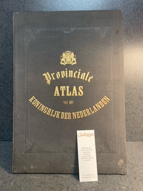
Kaarten der provinciën van het Koningrijk der Nederlanden : vervaardigd naar de groote topographische en militaire kaart van het Ministerie van Oorlog en naar Schetsen der gemeenten door P.H. Witkamp / door J. Smulders & Co. ... ; met bijvoeging van uitvoerige statistieke opgave van P.H. Witkamp.
WITKAMP, P.H., · 1866 · Antiquariaat Goltzius
€805.00 ($887.28 | £671.49 | ¥141,704)
's Gravenhage, H. Bogaerts/J. Smulders & Co., [1866-67], largo folio: 51x37cm, based on the statistical information of Pieter Harmen Witkamp (1816-1892), 10 lithograph maps, handcoloured borders, coats of arms and other details, textpages describing the individual provinces, ...

Der Rhein. Ausbau, Verkehr, Verwaltung.
1951 · Antiquariaat Goltzius
€63.25 ($69.71 | £52.76 | ¥11,134)
Duisburg, 1951, 4°. 477pp. with many illustrations, charts and maps, original half linenn binding (minor hole in spine on front), marbled boards, bookplates of NRM and Prof. G.P. van de Ven.

Fens and Bogs in the Netherlands: Vegetation, History, Nutrient Dynamics and Conservation.
VERHOEVEN, J. T. A., · 1992 · Antiquariaat Goltzius
€230.00 ($253.51 | £191.85 | ¥40,487)
Dordrecht, Kluwer, 1992, 491pp. many illustrations, maps and charts, original linen hardcover binding, very good book on the fens and bogs of the Netherlands. From the library of Prof. Dr. G.P. van de Ven. Gerard van de Ven (1941-2017) was a prominent Dutch scholar, author and...
Topographical map of The Netherlands, topografische kaart van Nederland. Military map of the Netherlands. Bonnebladen.
1928 · Antiquariaat Goltzius
€40.25 ($44.36 | £33.57 | ¥7,085)
One page printed chromo topographical map paper on linen, 50x80cm. a so called bonneblad, based on the projection of Bonne. Attractive topographical maps in colour. scale 1:25000. The following maps are present: No. 34 Groenlo, No. 46 West Vierlingsbeek (verkend 1928, 1934 en...