
Carte geografiche e topografia
Risultati della ricerca
84168 libri in Carte geografiche e topografia

Advies Integrale Verkenning Benedenrivieren. Vergroting van de afvoercapaciteit in de benedenloop van Rijn en Maas with bijlage.
2000 · Antiquariaat Goltzius
€46.00 ($50.70 | £38.37 | ¥8,097)
Rotterdam, 2000, complete set in two parts with original folder. Many charts, maps and illustrations. Edges of folder frayed.
Grondverliezen in Zeeland. De oevers van de Watering van Scherpenisse en Wissenkerke (1:80.000). Voormalige en tegenwoordige toestand der Rijnverdeeling 1:125.000. Een gedeelte van het Hollandsche polderland. Doorsnede over polders, enz. Lekdijk bovendams (bij Vreeswijk).
0 · Antiquariaat Goltzius
€46.00 ($50.70 | £38.37 | ¥8,097)
Chromolithograph Senefelder, Amsterdam, published by Thieme Zutphen, 36x45cm, attractive map with insets of 'doorsnede polders\" and \"een gedeelte van het Hollandsche Polderland (Wassenaar, Zoetermeer), with library stamp on front corner of Kaarten archief Geografisch Institu...
Bodemkaart van Nederland 1:250.000
1985 · Antiquariaat Goltzius
€28.75 ($31.69 | £23.98 | ¥5,061)
Wageningen, Stichting voor bodemkartering,1985, Set of 4 maps in plastic original folder with textbook. Complete set.

Overzichtskaart van de boezemwateren, polders en wegen in Rijnland op de schaal van 1 a 50.000 herzien in 1917 bewerkt en gedrukt op last van het Hoogheemraadschap van Rijnland.
1917 · Antiquariaat Goltzius
€661.25 ($728.83 | £551.58 | ¥116,399)
Leiden, P.J. Mulder & Zoon, [1917], softcover folded large paper binding (damaged) with the complete set of detailed chromolithograph maps of the complete area of the Hoogheemraadschap van Rijnland. 10 maps 83x127 and printed in 5 colours. Scarce.

Topographische kaart van de Veluwe en Veluwe-zoom door M.J. de Man. (1802-1812). Inleiding door K. Zandvliet.
1984 · Antiquariaat Goltzius
€402.50 ($443.64 | £335.74 | ¥70,852)
Alphen aan den Rijn, Canaletto, 1984, 39pp. text with illustrations, in oblong white folder (some soiling to folder) with complete set of coloured reproduced maps.

Kaart van de hoofdrivieren op de schaal van 1:10.000: serie de O. en N. Merwede: Kaart van de rivieren de Oude en Nieuwe Merwede en de killen in het Bergsche veld in negen bladen. OPgemeten en vervaardigd door de landmeters E. Olivier Dz. en F.F. J. Machen.
1857 · Antiquariaat Goltzius
€2,070.00 ($2,281.57 | £1,726.68 | ¥364,381)
[Den Haag], Ministerie van Oorlog, Topografisch Bureau, [1857-1858], 10 large fold out maps 67x91cm in original folder. Detailed and chromolithograph maps of the Merwede river. Library stamp of Geografisch Instituut Utrecht on endpaper. Linen folder, some waterstains on bottom...

Naaukeurige aftekening van den loop der rivieren by Schenkenschans
TIRION, IS., · 1741 · Antiquariaat Goltzius
€109.25 ($120.42 | £91.13 | ¥19,231)
Map of the region around Schenkenschanz, which includes Pannerden, Zevenaar, Herwen and the castle at Elten. Engraving on hand laid paper, sheet size 302 x 211 mm., platemark 281 x 155 mm. Anonymous engraving, published by Isaak Tirion in 'Tegenwoordige staat der Vereenigde Ne...

Nieuwe kaart van Groningen
JAGEN, JAN VAN, · 1707 · Antiquariaat Goltzius
€201.25 ($221.82 | £167.87 | ¥35,426)
Map of the Dutch province of Groningen. Engraving on hand laid paper, with hand colouring. Sheet size 435 x 364 mm., platemark 420 x 350 mm. Made by Jan van Jagen (1707-1800) after J.C. Roeder, and published in Jacobus Kok, 'Vaderlandsch Woordenboek', Amsterdam: Johannes Alla...

Het belegh der stadt Groningen in den Jaare MDXCIV
LUYKEN, JAN, · 1594 · Antiquariaat Goltzius
€143.75 ($158.44 | £119.91 | ¥25,304)
A plan of the siege of Groningen in 1594. The besieging force in the lower right corner. An inset with the Sint Walburgskerk lower right, a legend with coat of arms top right. A few important buildings are depicted in the plan. Etching and engraving on hand laid paper, sheet s...

De Stadt Zieric-Zee in Plattegront
ANONYMOUS, · 1721 · Antiquariaat Goltzius
€132.25 ($145.77 | £110.32 | ¥23,280)
A plan of the city Zierikzee in Zeeland, the Netherlands. Etching and engraving on hand laid paper, sheet size 431 x 293 mm., platemark 425 x 280 mm. Originally made for Smallegange's 'Kroniek van Zeeland'. This later version was made for Hugo Franciscus van Heussen's 'Oudhede...

Nieuwe kaart van het Westelykste Deel der Weereld, dienende tot aanwijzing van de Scheepstogten der Nederlanderen naar Westindie
TIRION, IS., · 1754 · Antiquariaat Goltzius
€230.00 ($253.51 | £191.85 | ¥40,487)
Map of the western hemisphere, showing the Americas, and a part of Europe and Africa in the right edge. The coast of the South American continent is mostly complete, but North America shows only the east coast. Engraving on hand laid paper, sheet size 394 x 363 mm., platemark ...

Oude kaart der nu Vereenigde Nederlanden tot opheldering der Vaderlandsche historie in de Middeleeuwe
TIRION, IS., · 1749 · Antiquariaat Goltzius
€287.50 ($316.88 | £239.82 | ¥50,608)
Historical map of the Netherlands. Engraving on hand laid paper, sheet size 478 x 333 mm., platemark 328 x 288 mm. Engraving published by Is. Tirion in Amsterdam, 1749. This map originates from the multi-volume publication 'Vaderlandsche historie, vervattende de geschiedeniss...

Nieuwe kaart van het Oostelykste Deel der Weereld
TIRION, IS., · 1753 · Antiquariaat Goltzius
€230.00 ($253.51 | £191.85 | ¥40,487)
Map of the eastern hemisphere, from Europe and Iceland to Siberia and Indonesia, with the then discovered coast of Australia. Engraving on hand laid paper, sheet size 403 x 348 mm., platemark 370 x 324 mm. Engraving published by Is. Tirion in Amsterdam, 1753. This map origina...

De stad Goes
BYE, C. DE, · 1696 · Antiquariaat Goltzius
€172.50 ($190.13 | £143.89 | ¥30,365)
Plan of the Dutch city Goes, in Zeeland. Two putti hold a shield with the coat of arms of the city. A keyed legend with 30 entries lower left. Engraving on hand laid paper, sheet size 443 x 392 mm., platemark 340 x 277 mm. Made by C. de Bye, ca. 1696. This map was published i...
Morfologie Natuurlijk.
1999 · Antiquariaat Goltzius
€34.50 ($38.03 | £28.78 | ¥6,073)
Arnhem, Rijkswaterstaat, 1999, 28pp. original illustrated softcover binding.

Map of Boezemgebied in Holland (van Rijnlandsboezoem) voormalige en tegenwoordige toestand der Rijnverdeeling 1:100.000 1696-1699 with indicated later changes.
0 · Antiquariaat Goltzius
€46.00 ($50.70 | £38.37 | ¥8,097)
Chromolithograph Braakensiek, Amsterdam, published by Thieme Zutphen, 54x45cm, attractive map with insets of 'doorsnede polders\" and : een gedeelte van het Hollands Polderland (Wassenaar, Zoetermeer). with library stamp on front corner of Kaarten archief Geografisch Instituut...
Map of Rivier De Waal dated 1908 no. 11.
0 · Antiquariaat Goltzius
€28.75 ($31.69 | £23.98 | ¥5,061)
Lithograph Langenhuysen, Den Haag, 32x38cm, tear in top of fold. 1:10.000 detailed map of de Waal river from Ztten/Herveld.

Friesland, met de Zee ten Westen in haar stroomen en zanden nooit dus uitgegeeven
OTTENS, FREDERIK, · 1717 · Antiquariaat Goltzius
€201.25 ($221.82 | £167.87 | ¥35,426)
Detailed antique map of the Dutch province Friesland, with a cartouche in the right edge. The area covered spans from Vlieland and Terschelling (top left) to the Lauwersmeer (here Lauwer Zee, top right) and Medemblik and Enkhuizen lower left. Engraving on hand laid paper, shee...
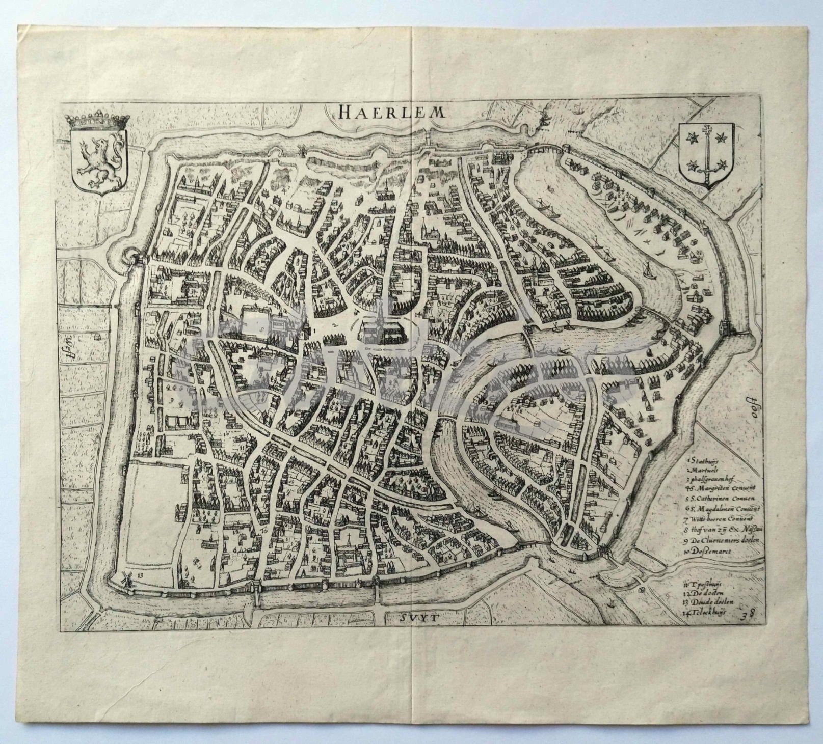
Map of Haarlem
GUICCIARDINI, LUDOVICO, · 1612 · Antiquariaat Goltzius
€230.00 ($253.51 | £191.85 | ¥40,487)
Titled 'Haerlem', with two coats of arms and a 14-line legend, the number 38 in the lower right corner. Engraving on laid paper, sheet size 345 x 306 mm., platemark 313 x 234 mm. This map is from the famous book 'Descrittione di Tutti I Paesi Bassi [...]', published between 16...

Map of Louvain
GUICCIARDINI, LUDOVICO, · 1581 · Antiquariaat Goltzius
€143.75 ($158.44 | £119.91 | ¥25,304)
Caption: 'Lovanium Brabanticarum orbium caput [...]'. Leuven, or Louvain, in Belgium. Engraving on laid paper, with old colouring, sheet size 377 x 296 mm., image size 320 x 238 mm. This map is from the famous book 'Descrittione di M. Lodovico Guicciardini patritio Fiorentino ...