
Carte geografiche e topografia
Risultati della ricerca
84168 libri in Carte geografiche e topografia

Handbuch der Vermessungskunde. Feld- und Land-Messung. Zweiter Band.
JORDAN, W., · 1914 · Antiquariaat Goltzius
€28.75 ($31.69 | £23.98 | ¥5,061)
Stuttgart, J.B. Metzlerscher Buchhandlung, 1914, 8th edition, x,938+55pp, many plates in the text, half leather binding.
Handbuch der Vermessungskunde. Landes- Vermessungskunde und grundaufgaben der Erd-Messung. Dritter band.
JORDAN, W., · 1896 · Antiquariaat Goltzius
€28.75 ($31.69 | £23.98 | ¥5,061)
Stuttgart, J.B. Metzlerscher Buchhandlung, 1896, 4th edition, xx,593+64pp, tooled linen binding.
Handbuch der Vermessungskunde. Feld- und Land-Messung. Zweiter Band.
JORDAN, W., · 1897 · Antiquariaat Goltzius
€28.75 ($31.69 | £23.98 | ¥5,061)
Stuttgart, J.B. Metzlerscher Buchhandlung, 1897, 5th edition, xii,785+47pp, 635 plates in the text, half linen binding, marbled boards.
Handbuch der Vermessungskunde. Ausgleichungs-rechnung nach der methode der kleinsten quadrate. Erster band.
JORDAN, W., · 1904 · Antiquariaat Goltzius
€28.75 ($31.69 | £23.98 | ¥5,061)
Stuttgart, J.B. Metzlerscher Buchhandlung, 1904, 5th edition, xi,582+21pp, tooled linen binding.
Handbuch der Vermessungskunde. Ausgleichungs-rechnung nach der methode der kleinsten quadrate.. Erster band.
JORDAN, W., · 1895 · Antiquariaat Goltzius
€28.75 ($31.69 | £23.98 | ¥5,061)
Stuttgart, J.B. Metzlerscher Buchhandlung, 1895, 4th edition, x,574+21pp, tooled linen binding.

Handbuch der Vermessungskunde. Landes- Vermessungskunde und grundaufgaben der Erd-Messung. Dritter band.
JORDAN, W., · 1890 · Antiquariaat Goltzius
€172.50 ($190.13 | £143.89 | ¥30,365)
Stuttgart, J.B. Metzlerscher Buchhandlung, 1890, 3rd edition, viii,549+48pp and appr. 250 plates, half leather binding (some damage) marbled boards.

Atlas van LXIII Platen, behoorende bij de Handleiding tot de Kennis der Burgerlijke en Militaire Bouwkunst. Bouwkundige leercursus ten gebruike der Koninklijke Militaire Akademie. Plate-volume only
1863 · Antiquariaat Goltzius
€172.50 ($190.13 | £143.89 | ¥30,365)
Breda, Koninklijke Militaire Akademie, 1863, 3rd improved ed., plate-vol. only, 13 text-pag. (\"verklaring der platen\") and 63 lithographed plates with military architectural illustrations by Franciscus Josephus Ensinck (1806 - 1883). Half leather bi9nding, gilt title on spin...

Kramers' geographisch woordenboek der geheele aarde. Tweede druk geheel herzien en naar de beste bronnen bewerkt, aangevangen door wijlen J. Jurrius (...) en voortgezet door E. Zuidema (...).
JURRIUS, J., · 1878 · Antiquariaat Goltzius
€86.25 ($95.07 | £71.95 | ¥15,183)
Gouda, G.B. van Goor Zonen, [1878-1883], 2nd edition, complete set of 2 volumes of this dictionary, 1196 pp. Attractive half leather and brown linen bindings with elaborate gold tooled decorations on the spine, blind and gold tooling on the front and back. Some wear to the cor...

Waterbouwkunde 1e deel, Atlas van C platen behoorende bij de handleiding tot de kennis der waterbouwkunde. Complete set in two volumes.
HENKET, N.H., DR. CH. M. SCHOLS., J.M. TELDERS. ( BEWERKT DOOR C. LELY ), · 1864 · Antiquariaat Goltzius
€287.50 ($316.88 | £239.82 | ¥50,608)
Breda, Broese & Comp., Koninklijke Militaire Akademie, 1864, 3rd edition, complete set in two large folio volumes, first volume: index with lithograph plates I-XLVII, second volume: index with lithograph plates I-LIII. First volume concerns, roads, railways, bridges, tollgate...

Geography Anatomiz'd : Or, the Geographical Grammar. Being a Short and Exact Analysis of the Whole Body of Modern Geography, by Pat. Gordon, . the Twelfth Edition Corrected and somewhat enlarged. with a New Maps by Mr. Senex.
GORDON, P., · 1733 · Antiquariaat Goltzius
€575.00 ($633.77 | £479.63 | ¥101,217)
London, John & Paul Knapton [et al.],1733, (25)+432pp. complete with 16 very attractive fold out engraved maps, full tooled calf leather binding, some damage and wear and tear to spine, remnants of library ticket on bottom of spine, title on ticket on spine, engraved armorial ...
Atlas topographique du traité théorique et pratique des Operations secondaires de la Guerre.
1825 · Antiquariaat Goltzius
€28.75 ($31.69 | £23.98 | ¥5,061)
[Paris, Chez Treuttel et Würtz, 1825]. lacks titlepage, from the library of Hoogere Krijgsschool (KMA, Breda), half linen binding, marbled boards, some damage to spine, text volume only, not the 44 plates.

Stukken betreffende de verbinding van de Drentsche kanalen onderling, en met de Eems
1872 · Antiquariaat Goltzius
€57.50 ($63.38 | £47.96 | ¥10,122)
Assen, Willinge Gratama, 1872, vii, 85 pp. attractive modern half linen binding, marbled boards, original front and back retained in the binding (damaged and soiled) 23,5 x 14,5 cm., library stamp and name in ink on titlepage, collectors stamp on modern free endpaper P. Schutr...
Beschrijving van alle landen, staten en rijken der aarde. Aardrijkskundig handboek volgens de jongste toestanden.
KREENEN, J.J., · 1871 · Antiquariaat Goltzius
€23.00 ($25.35 | £19.19 | ¥4,049)
Zwolle, Van Hoogstraten en Gorter, 1871, 5th volume only, 1064pp. half linen binding, spine gone.

Sleeswijk's kaart van Nederland voor handel en verkeer.
1933 · Antiquariaat Goltzius
€46.00 ($50.70 | £38.37 | ¥8,097)
Bussum, J.A. Sleeswijk, [prior to 1933 as the Afsluitdijk is not present], large fold out chromolithograph map by J. Smulders Den Haag, of the Netherlands (some damage to the folds and corners) showing the entire country, its cities and villages, roads, railroads and waterways...

Velhagen & Klasings Kleiner Handatlas in 108 Kartenseiten.
AMBROSIUS, E., · 1922 · Antiquariaat Goltzius
€57.50 ($63.38 | £47.96 | ¥10,122)
Bielefeld und Leipzig, Velhagen & Klasings, 3rd improved edition, 2. Ausgabe, 1922, 108 chromolithograph detailed maps, very good atlas. Binding is suffering interrnally, outside is clean, some plates are loose, some rust to metal parts of binding, original board folder which...

De geschiedenis en de beschrijving der Merwedetakken beneden Dordrecht / J. van Heurn
HEURN, J. VAN, · 1893 · Antiquariaat Goltzius
€86.25 ($95.07 | £71.95 | ¥15,183)
Rotterdam, W.J. van Hengel, 1893, 232pp. tear on titlepage, complete with 13 chromolithograph plates, Softcover paper binding, first few pages loose, binding damaged.

Map of Southeast Asia, including: Hindustan, Ceylon, Birma, Siam, Anam, Malacca, China, Philippines, Sumatra, Borneo, Java, Celebes, Moluccas.
PERTHES, JUSTUS, · 1835 · Antiquariaat Goltzius
€51.75 ($57.04 | £43.17 | ¥9,110)
No. XVIIb from: Stieler's Schul-Atlas, Gotha: Justus Perthes Verlag, [ca. 1835], hand coloured engraving on laid paper, 206 x 262 cm, soiling in lower margin, water stain lower right.

Beschryving der stadt Delft, behelzende een zeer naaukeurige en uitvoerige verhandeling van deszelfs eerste oorsprong. benaming, bevolking, aanwas, gelegenheid, prachtige en kunstige gedenkstukken en zeltzaamheden. (...)
Boitet, R. e.a. · 1729 · Antiquariaat Goltzius
€2,875.00 ($3,168.85 | £2,398.17 | ¥506,084)
Delft, Reinier Boitet, 1729. Folio, half leather binding with colourful marbled paper, ribbed spine, very good and complete copy, skillfully rebacked spine and restored corners. Comes with a restoration report (in Dutch) and a cutsom made acid free folder. (24)+804+(14) pag. ...
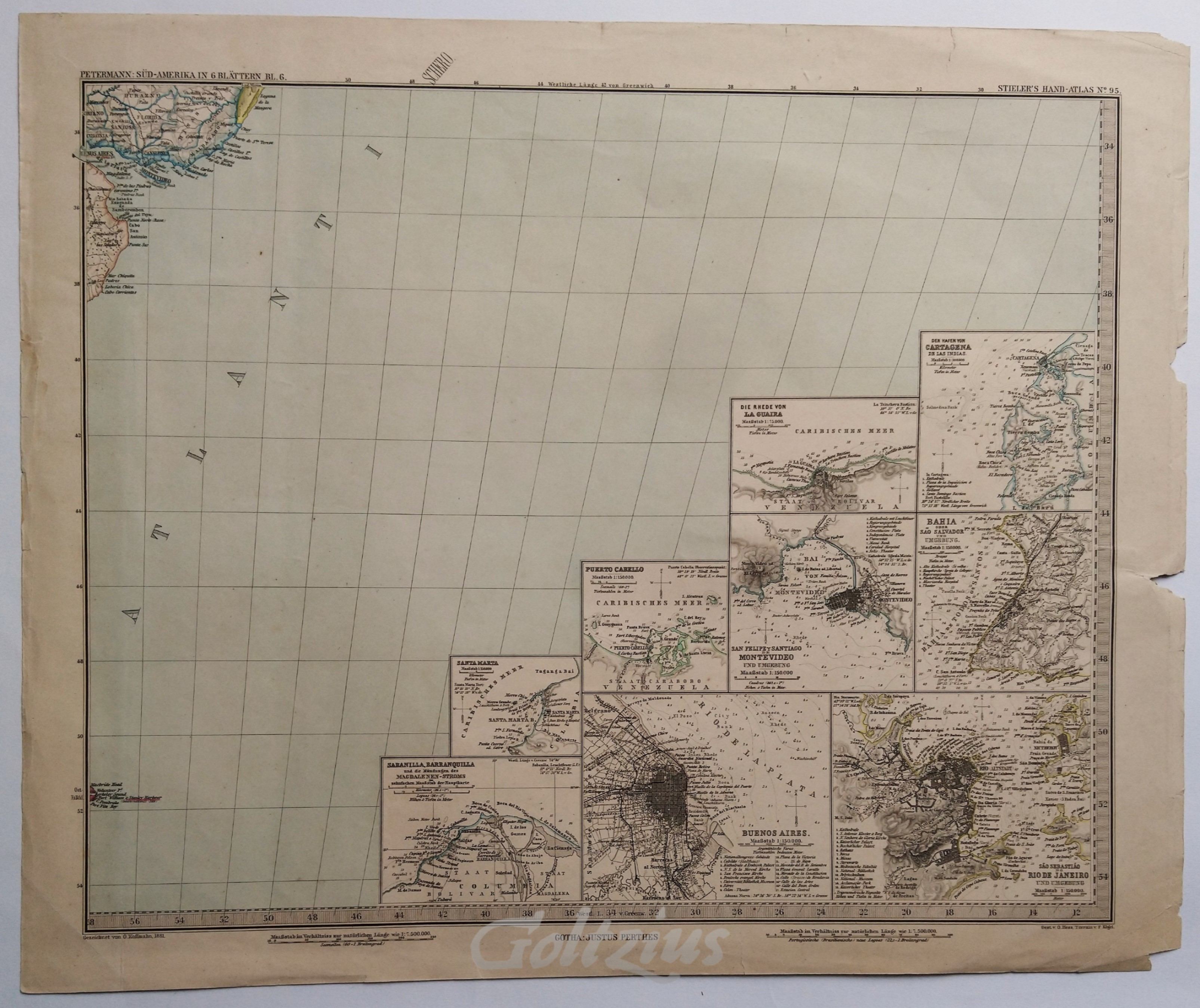
Sea chart of the Atlantic near Buenos Aires
KOFFMAHN, O., · 1881 · Antiquariaat Goltzius
€34.50 ($38.03 | £28.78 | ¥6,073)
A sea chart of the Atlantic Ocean near the coast of Bueons Aires (Argentina) and Montevideo (Uruguay). With nine inset maps in the lower right: city plans and depth charts of cities around this area (Cartagena, la Guaiara, San Salvador, Montevideo, Rio de Janeiro, Buenos Aires...

Rio de Janeiro und Umgebung
ANONYMOUS, · 1903 · Antiquariaat Goltzius
€57.50 ($63.38 | £47.96 | ¥10,122)
A map of the region directly around Rio de Janeiro (Brasil), indicating numerous forts, as well as a small inset map of the entire Guanabara Bay area. Colour lithograph on wove paper, sheet size 156 x 228 mm. This map, dated Febraury 1903, was taken from the 14th edition of Br...