
Ephemera
Ephemera a stampa, cartoline, manifesti e memorabilia stampati.
Risultati della ricerca
45746 libri in Ephemera

Germany. (19th Century Map)
19th Century English Artist · 1808 · Wittenborn Art Books
$125.00 (€113.42 | £94.62 | ¥19,961)
London: Charles Smith, [1808]. 24 x 15 inches. Very Good. Some wrinkling in left margin, not affecting image. 19th Century folded map, printed in color. Published January 6, 1808. Scarce. .
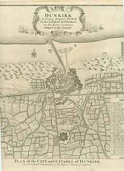
Plan of the City and Citadel of Dunkirk. Dunkirk, a Strong Seaport Town in the Earldom of Flanders, in the Low Countries Subject to the French. (18th Century Map)
James Basire Sr. (engraver) · 1740 · Wittenborn Art Books
$150.00 (€136.10 | £113.55 | ¥23,953)
[London]: 18th Century European Publisher, [1740s]. 21 x 17 inches. Very Good. Minor loss on bottom left corner, not affecting image. Half inch tears in bottom and right margins. Fine copperplate engraving. 18th Century, uncolored, folded map. Paul de Rapin's, The History of E...
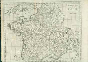
A New and Correct Map of France. (18th Century Map of Central Europe)
Rapin de Thoyras, Paul; Basire · 1745 · Wittenborn Art Books
$150.00 (€136.10 | £113.55 | ¥23,953)
[London]: James & Paul Knapton, [1745]. 15 x 18 inches. Very Good. Minor loss in top margin not affecting image. Copper engraving. 18th Century, uncolored, folded map of France showing the Channel and a part of English coast. Title cartouche in top right. Text above the title ...

Switzerland and the Alps of Savoy & Piedmont. (19th Century Map)
Keith Johnston (engraver) · 1851 · Wittenborn Art Books
$100.00 (€90.73 | £75.70 | ¥15,969)
Edinburgh: William Blackwood & Sons, [1851]. 24 x 19 inches. Very Good. Quarter inch tear in bottom margin along fold. 19th Century folded map printed in color, with hand colored borders. Inset of environs of Geneva. From Keith Johnston's General Atlas. .

Prussia. (19th Century Map)
Keith Johnston (engraver) · 1851 · Wittenborn Art Books
$100.00 (€90.73 | £75.70 | ¥15,969)
Edinburgh: William Blackwood & Sons, [1851]. 24 x 19 inches. Very Good. 19th Century folded map, printed in color, with hand colored borders. Inset of environs of Berlin & Potsdam. From Keith Johnston's General Atlas. .
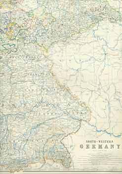
South-Western Germany. (19th Century Map)
Keith Johnston (engraver) · 1851 · Wittenborn Art Books
$100.00 (€90.73 | £75.70 | ¥15,969)
Edinburgh: William Blackwood & Sons, [1851]. 24 x 19 inches. Very Good. Half inch tear in top margin along fold. 19th Century folded map, printed in color, with hand colored borders. From Keith Johnston's General Atlas. .

Austrian Empire (Eastern Sheet). (19th Century Map)
Keith Johnston (engraver) · 1851 · Wittenborn Art Books
$100.00 (€90.73 | £75.70 | ¥15,969)
Edinburgh: William Blackwood & Sons, [1851]. 24 x 19 inches. Very Good. Half inch tear in right margin along fold. 19th Century folded map, printed in color, with hand colored borders. Inset of Continuation of Dalmatia. From Keith Johnston's General Atlas. .
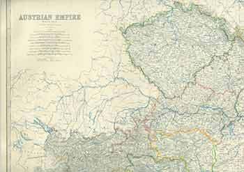
Austrian Empire. (19th Century Map)
Keith Johnston (engraver) · 1851 · Wittenborn Art Books
$100.00 (€90.73 | £75.70 | ¥15,969)
Edinburgh: William Blackwood & Sons, [1851]. 24 x 19 inches. Very Good. One inch tear in right margin along fold. 19th Century folded map, printed in color, with hand colored borders. Inset of Vienna (Wien) and its environs. .

Germany (Map)
J. Rapkin (Cartographer); N. Whittock (Illustrator); J. Rogers (Engraver) · 1860 · Wittenborn Art Books
$100.00 (€90.73 | £75.70 | ¥15,969)
London: John Tallis & Company, [1860s - 1890s?]. 11 x 14 inches. Very Good. Folded, hand-colored map of France. .

France (Map)
J. Rapkin (Cartographer); J. Wray (Illustrator); J. Rogers (Engraver) · 1860 · Wittenborn Art Books
$100.00 (€90.73 | £75.70 | ¥15,969)
London: John Tallis & Company, [1860s - 1890s?]. 11 x 14 inches. Very Good. Folded, hand-colored map of France. .

Turkey in Europe, & Greece. (19th Century Map)
Alex Findlay · 1800 · Wittenborn Art Books
$100.00 (€90.73 | £75.70 | ¥15,969)
Cheapside: T. Tegg, [1800s]. 12 x 10 inches. Very Good. 19th Century, folded map, printed in color. .
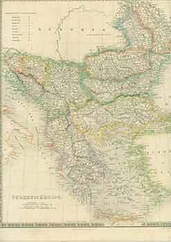
Turkey in Europe. (19th Century Map)
J. Dower (engraver) · 1800 · Wittenborn Art Books
$75.00 (€68.05 | £56.77 | ¥11,977)
London: Henry Teesdale, [1800s]. 15 x 19 inches. Good. Four inch tear at right, and two inch tear at left edges along fold. Some foxing, mostly along margins, not affecting image. 19th Century, folded map, printed in color. .

Sweden & Norway (Scandinavia). (19th Century Map)
Keith Johnston (engraver) · 1800 · Wittenborn Art Books
$100.00 (€90.73 | £75.70 | ¥15,969)
Edinburgh: W. & A. K. Johnston, [1800s]. 14 x 18 inches. Very Good+. 19th Century, folded map, printed in color. .

European Russia. (19th Century Map)
Keith Johnston (engraver) · 1800 · Wittenborn Art Books
$100.00 (€90.73 | £75.70 | ¥15,969)
Edinburgh: W. & A. K. Johnston, [1800s]. 14 x 18 inches. Very Good+. 19th Century, folded map, printed in color. .

European Russia. (19th Century Map)
Keith Johnston (engraver) · 1800 · Wittenborn Art Books
$100.00 (€90.73 | £75.70 | ¥15,969)
Edinburgh: William Blackwood & Sons, [1800s]. 14 x 18 inches. Very Good. Half inch tears in left and right margins along fold. 19th Century, folded map, printed in color. .

Russia and Europe. (19th Century Map)
J. Dower (engraver) · 1800 · Wittenborn Art Books
$100.00 (€90.73 | £75.70 | ¥15,969)
London: Henry Teesdale, [1800s]. 15 x 19 inches. Very Good. Three inch tear at right, and one inch tear at left edges along fold. 19th Century, folded map, printed in color. .

Austrian Dominions II. (19th Century Map)
J&C Walker (engraver) · 1832 · Wittenborn Art Books
$100.00 (€90.73 | £75.70 | ¥15,969)
London: Baldwin & Cradock, [1832]. 13 x 16 inches. Very Good. 19th Century map printed in color, with hand colored borders. Printed under the superintendence of the Society for the Diffusion of Useful Knowledge. Scarce. .
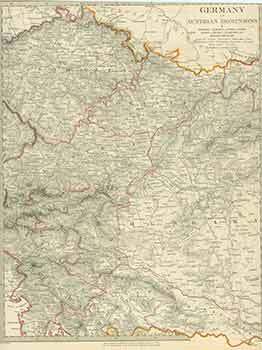
Germany IV Austrian Dominions. (19th Century Map)
J&C Walker (engraver) · 1832 · Wittenborn Art Books
$100.00 (€90.73 | £75.70 | ¥15,969)
London: Baldwin & Cradock, [1832]. 13 x 16 inches. Very Good. 19th Century map printed in color, with hand colored borders. Printed under the superintendence of the Society for the Diffusion of Useful Knowledge. Scarce. .

France. (19th Century Map)
J. Dower (engraver) · 1800 · Wittenborn Art Books
$100.00 (€90.73 | £75.70 | ¥15,969)
London: Henry Teesdale, [1800s]. 15 x 19 inches. Very Good. Half in tear at top and bottom edges along fold. 19th Century, folded map, printed in color. .
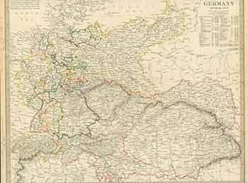
Germany General Map. (19th Century Map)
J&C Walker (engraver) · 1800 · Wittenborn Art Books
$100.00 (€90.73 | £75.70 | ¥15,969)
London: Society for the Diffusion of Useful Knowledge, [1800s]. 13 x 16 inches. Very Good. 19th Century map, printed in color. Scarce. .