
Ephemera
Ephemera a stampa, cartoline, manifesti e memorabilia stampati.
Risultati della ricerca
45746 libri in Ephemera

Mittel-ôstliches Deutschland (19th Century Map of Central Eastern Germany)
Ausfeld, Joh. Carl. (Johann Carl); A. Stieler (engraver) · 1850 · Wittenborn Art Books
$125.00 (€113.42 | £94.62 | ¥19,961)
Gotha, Germany: Justus Perthes Geographische Anstalt, [1850s?]. 14 x 17 inches. Very Good. Quarter inch tear in bottom margin, not affecting image. 19th Century folded map, printed in color, with hand colored borders. From Stieler's Hand-Atlas (No. 23). Text in German. Scarce....

Galizien, Ungarn Mit Slowenien Und Kroatien, Siebenbürgen (19th Century Map of Galicia, Hungary with Slovenia and Croatia, Transylvania)
Justus Perthes · 1850 · Wittenborn Art Books
$125.00 (€113.42 | £94.62 | ¥19,961)
Gotha, Germany: Justus Perthes Geographische Anstalt, [1850s?]. 14 x 17 inches. Very Good. Half inch tear in bottom margin, not affecting image. 19th Century folded map, printed in color, with hand colored borders. From Stieler's Hand-Atlas (No. 35). Text in German. Scarce. Jo...

Griechenland Und Die Johischen Inseln. (19th Century Map of Greece and the Islands)
F. V. Stülpnagel (engraver) · 1850 · Wittenborn Art Books
$125.00 (€113.42 | £94.62 | ¥19,961)
Gotha, Germany: Justus Perthes Geographische Anstalt, [1850s?]. 14 x 17 inches. Very Good. 19th Century folded map, printed in color, with hand colored borders. From Stieler's Hand-Atlas (No. 38c). Text in German. Scarce. Johann Georg Justus Perthes (11 September 1749, Rudolst...
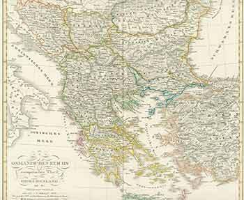
Osmanischen Reichs Europaischer Theil. (19th Century Map of Ottoman Empire's European Part)
F. V. Stülpnagel (engraver) · 1850 · Wittenborn Art Books
$125.00 (€113.42 | £94.62 | ¥19,961)
Gotha, Germany: Justus Perthes Geographische Anstalt, [1850s?]. 14 x 17 inches. Very Good. Some foxing in margins, not affecting image. 19th Century folded map, printed in color, with hand colored borders. From Stieler's Hand-Atlas (No. 38). Text in German. Scarce. Johann Geor...

Südwestliches Deutschland. (19th Century Map of Southwestern Germany)
Justus Perthes · 1850 · Wittenborn Art Books
$125.00 (€113.42 | £94.62 | ¥19,961)
Gotha, Germany: Justus Perthes Geographische Anstalt, [1850s?]. 14 x 17 inches. Very Good. Half inch tear in bottom margin, not affecting image. 19th Century folded map, printed in color, with hand colored borders. From Stieler's Hand-Atlas (No. 24). Text in German. Scarce. Jo...
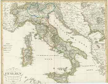
Italien Entworfen Und Gezeichnet Von F.V. Stülpnagel. (19th Century Map of Italy Designed by F.V. Stülpnagel)
F. V. Stülpnagel (engraver) · 1850 · Wittenborn Art Books
$125.00 (€113.42 | £94.62 | ¥19,961)
Gotha, Germany: Justus Perthes Geographische Anstalt, [1850s?]. 14 x 17 inches. Very Good. Some foxing in margins, not affecting image. 19th Century folded map, printed in color, with hand colored borders. From Stieler's Hand-Atlas (No. 33.). Text in German. Scarce. Johann Geo...

Die Preuss: Provinzen Preussen Und Posen. (19th Century Map of the Preuss: Provinces of Prussia and Poznan)
Stieler, Adolf (engraver) · 1850 · Wittenborn Art Books
$125.00 (€113.42 | £94.62 | ¥19,961)
Gotha, Germany: Justus Perthes Geographische Anstalt, [1850s - 1870s?]. 14 x 17 inches. Very Good. 19th Century folded map, printed in color, with hand colored borders. No. XXIX, Stieler's Hand-Atlas (No. 22b.). Text in German. Scarce. Johann Georg Justus Perthes (11 September...
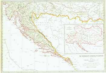
Austrian Dominions III. (19th Century Map)
J&C Walker (engraver) · 1832 · Wittenborn Art Books
$100.00 (€90.73 | £75.70 | ¥15,969)
London: Baldwin & Cradock, [1832]. 13 x 16 inches. Very Good. 19th Century map printed in color, with hand colored borders. Printed under the superintendence of the Society for the Diffusion of Useful Knowledge. Scarce. .

Italie Septentrionale (19th Century Map of Northern Italy)
L. Smith (engraver) · 1892 · Wittenborn Art Books
$125.00 (€113.42 | £94.62 | ¥19,961)
Paris: J. Migeon, [1892]. 20 x 15 inches. Very Good. Fold in top left margin, not affecting image. 19th Century folded map, printed in color. Text in French. (Grave par L. Smith. Dresse sous La Direction De J. Migeon par ch. Lacoste. Migeon, editeur, imp du Moulin Vert Paris. ...
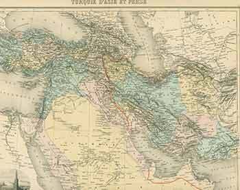
Turquie D'Asie Et Perse (19th Century Map of Turkey from Asia and Persia)
L. Smith (engraver) · 1892 · Wittenborn Art Books
$125.00 (€113.42 | £94.62 | ¥19,961)
Paris: J. Migeon, [1892]. 20 x 15 inches. Very Good. Quarter inch tear in bottom margin, not affecting image. Minor wrinkling in top right margin. Some blue staining in right margin, not affecting image. 19th Century folded map, printed in color. Text in French. (Grave par L. ...
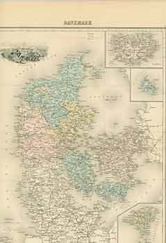
Danemark (19th Century Map of Denmark)
L. Smith (engraver) · 1892 · Wittenborn Art Books
$125.00 (€113.42 | £94.62 | ¥19,961)
Paris: J. Migeon, [1892]. 20 x 15 inches. Very Good. Half inch tear in bottom margin, not affecting image. Minor wear to edges. 19th Century folded map, printed in color. Text in French. (Grave par L. Smith. Dresse sous La Direction De J. Migeon par ch. Lacoste. Migeon, editeu...
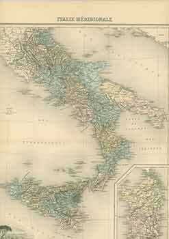
Italie Méridionale (19th Century Map of Southern Italy)
L. Smith (engraver) · 1892 · Wittenborn Art Books
$125.00 (€113.42 | £94.62 | ¥19,961)
Paris: J. Migeon, [1892]. 20 x 15 inches. Very Good. Minor wrinkling in bottom right margin, not affecting image. 19th Century folded map, printed in color. Text in French. (Grave par L. Smith. Dresse sous La Direction De J. Migeon par ch. Lacoste. Migeon, editeur, imp du Moul...

Gaule Sous Les Romains (19th Century Map of Gaul Under the Romans)
L. Smith (engraver) · 1892 · Wittenborn Art Books
$125.00 (€113.42 | £94.62 | ¥19,961)
Paris: J. Migeon, [1892]. 20 x 15 inches. Very Good. Half inch tear in right and bottom margins, not affecting image. 19th Century folded map, printed in color. Text in French. (Grave par L. Smith. Dresse sous La Direction De J. Migeon par ch. Lacoste. Migeon, editeur, imp du ...
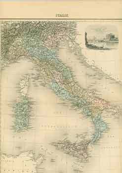
Italie (19th Century Map of Italy)
L. Smith (engraver) · 1892 · Wittenborn Art Books
$125.00 (€113.42 | £94.62 | ¥19,961)
Paris: J. Migeon, [1892]. 20 x 15 inches. Very Good. Minor, quarter inch tears and wrinkling in margin, not affecting image. 19th Century folded map, printed in color. Text in French. (Grave par L. Smith. Dresse sous La Direction De J. Migeon par ch. Lacoste. Migeon, editeur, ...

Empire de Charlemagne (19th Century Map of Empire of Charlemagne)
L. Smith (engraver) · 1892 · Wittenborn Art Books
$125.00 (€113.42 | £94.62 | ¥19,961)
Paris: J. Migeon, [1892]. 20 x 15 inches. Very Good. Minor, quarter inch loss in bottom right corner. 19th Century folded map, printed in color. Text in French. (Grave par L. Smith. Dresse sous La Direction De J. Migeon par ch. Lacoste. Migeon, editeur, imp du Moulin Vert Pari...

Grèce Ancienne (19th Century Map of Ancient Greece)
L. Smith (engraver) · 1892 · Wittenborn Art Books
$125.00 (€113.42 | £94.62 | ¥19,961)
Paris: J. Migeon, [1892]. 20 x 15 inches. Very Good. Minor foxing in right hand side top and bottom corners, not affecting image. 19th Century folded map, printed in color. Text in French. (Grave par L. Smith. Dresse sous La Direction De J. Migeon par ch. Lacoste. Migeon, edit...

France Féodale (19th Century Map of France Feudal)
L. Smith (engraver) · 1892 · Wittenborn Art Books
$125.00 (€113.42 | £94.62 | ¥19,961)
Paris: J. Migeon, [1892]. 20 x 15 inches. Very Good. 19th Century folded map, printed in color. Text in French. (Grave par L. Smith. Dresse sous La Direction De J. Migeon par ch. Lacoste. Migeon, editeur, imp du Moulin Vert Paris. Ecrit par A Bixet.). .

Suède Et Norvège (19th Century Map of Sweden and Norway)
L. Smith (engraver) · 1892 · Wittenborn Art Books
$125.00 (€113.42 | £94.62 | ¥19,961)
Paris: J. Migeon, [1892]. 20 x 15 inches. Very Good. 19th Century folded map, printed in color. Text in French. (Grave par L. Smith. Dresse sous La Direction De J. Migeon par ch. Lacoste. Migeon, editeur, imp du Moulin Vert Paris. Ecrit par A Bixet.). .

Autriche-Hongrie (19th Century Map of Austria-Hungary)
L. Smith (engraver) · 1892 · Wittenborn Art Books
$125.00 (€113.42 | £94.62 | ¥19,961)
Paris: J. Migeon, [1892]. 20 x 15 inches. Very Good. Two one-inch tears at bottom margin have been repaired. 19th Century folded map, printed in color. Text in French. (Grave par L. Smith. Dresse sous La Direction De J. Migeon par ch. Lacoste. Migeon, editeur, imp du Moulin Ve...

Italie Ancienne (19th Century Map of Old Italy)
L. Smith (engraver) · 1892 · Wittenborn Art Books
$125.00 (€113.42 | £94.62 | ¥19,961)
Paris: J. Migeon, [1892]. 20 x 15 inches. Very Good. Quarter inch tear in bottom margin. 19th Century folded map, printed in color. Text in French. (Grave par L. Smith. Dresse sous La Direction De J. Migeon par ch. Lacoste. Migeon, editeur, imp du Moulin Vert Paris. Ecrit par ...