
Ephemera
Ephemera a stampa, cartoline, manifesti e memorabilia stampati.
Risultati della ricerca
45746 libri in Ephemera

Internal Memo Concerning East Bay Interchanges, California. Map
Southern Pacific Lines (San Francisco, Calif.) · 1934 · Wittenborn Art Books
$100.00 (€90.73 | £75.69 | ¥15,964)
San Francisco, Calif.: Southern Pacific Company, 1934. Map. Typewritten correspondence, switching charges chart, 17" x 11" sheets comparing maximum hauls between switching districts. 8 pp. .

Industry Map of Oakland - Hayward and Vicinity, California
Southern Pacific Lines (San Francisco, Calif.) · 1958 · Wittenborn Art Books
$600.00 (€544.37 | £454.15 | ¥95,782)
San Francisco, Calif.: Southern Pacific Company, 1958. Map. Blueline print, 31" x 142". Map from Bay Bridge to Hayward, including Berkeley, Emeryville, Oakland, San Leandro, and Hayward. Index of Industries with approx. 1500 entries, listed alphabetically. Scale 1" = 1000'. .

Industry and Switching Zone Map of Oakland, Alameda, and Berkeley, California
Southern Pacific Lines (San Francisco, Calif.) · 1947 · Wittenborn Art Books
$400.00 (€362.91 | £302.77 | ¥63,855)
San Francisco, Calif.: Southern Pacific Company, 1947, revised 1949. Map. Blueline print, 35" x 78", with multicolor lines indicating switching zones. Map from San Francisco Bay to San Leandro, and north Berkeley to Alameda and Oakland airport. Index of Industries with approx....

Map of Oakland Railroad Yard Limits, California
Southern Pacific Lines (San Francisco, Calif.) · 1931 · Wittenborn Art Books
$325.00 (€294.87 | £246.00 | ¥51,882)
Oakland, Calif.: Southern Pacific Company, 1931. Map. Blueline print, 25" x 48". Some red and black pencilling. Map of Oakland Railroad Yard Limits, includes Air Force Intransit Depot. Scale 1" = 1500'. .

Map of Elmhurst, Alameda County, California
Southern Pacific Lines (San Francisco, Calif.) · 1930 · Wittenborn Art Books
$375.00 (€340.23 | £283.84 | ¥59,864)
Oakland, Calif.: Southern Pacific Company, 1930. Map. Blueline print. 24 x 57 inches. Minor tears along edges, minor ink smudging. Map of Elmhurst, includes Gerber Products Co, L.A. Young Spring and Wire Co, General Metals. Scale: 1 inch = 100 feet. .

Map of Oakland Railroad Yard Limits, California
Southern Pacific Lines (San Francisco, Calif.) · 1931 · Wittenborn Art Books
$300.00 (€272.18 | £227.08 | ¥47,891)
San Francisco, Calif.: Southern Pacific Company, 1931. Map. Blueline print. 24 x 48 inches. Map of Oakland Railroad Yard from Passenger Ferry to East Yard Limits. Includes list of nine transfers or cannonball moves, and list of approximately 40 intersection/ DH correspondences...

Map of Oakland Railroad Yard Limits, California
Southern Pacific Lines (San Francisco, Calif.) · 1931 · Wittenborn Art Books
$325.00 (€294.87 | £246.00 | ¥51,882)
San Francisco, Calif.: Southern Pacific Company, 1931. Map. Blueline print. 24 x 47 inches. Map of Oakland Railroad Yard from Oakland Ferry, 16th St. Station, to San Rafael Ferry and Point Orient. Includes list of 3 transfers or cannonball moves, Parr Terminal Wholesale Co, al...

Plan of Alameda Park - Blanding. California. Map
Southern Pacific Lines (San Francisco, Calif.) · 1931 · Wittenborn Art Books
$350.00 (€317.55 | £264.92 | ¥55,873)
San Francisco, Calif.: Southern Pacific Company, 1931, revised 1940. Map. Blueline print. 24 x 56 inches. Map of Alameda from west of Oak Street to High Street. Includes Boyle Manufacturing Co, Pacific Coast Engineering Co, all streets. Scale: 1 inch = 100 feet. .

Internal Memo Concerning East Bay Switching Districts, California. Map
Southern Pacific Lines (San Francisco, Calif.) · 1934 · Wittenborn Art Books
$300.00 (€272.18 | £227.08 | ¥47,891)
San Francisco, Calif.: Southern Pacific Company, 1934. Map. Typewritten correspondence, handwritten calculations and charts, switching charges chart in 8 colors, switching district and industrial maps, rate and charge sheets. Includes circa 1928 map of Oakland Harbor. Harbor m...

Map of Oakland, Alameda, and Berkeley Switching Zones, California
Southern Pacific Lines (San Francisco, Calif.) · 1947 · Wittenborn Art Books
$375.00 (€340.23 | £283.84 | ¥59,864)
San Francisco, Calif.: Southern Pacific Company, 1947, revised 1949. Map. Blueline print. 25 x 48 inches. With lines and zones indicated by red, green, mauve, etc. highlighting. Map of Oakland, Emeryville, Berkeley, Alameda, and San Leandro, from North Berkeley to San Leandro....

Map of Oakland Railroad Yard, California
Southern Pacific Lines (San Francisco, Calif.) · 1931 · Wittenborn Art Books
$350.00 (€317.55 | £264.92 | ¥55,873)
San Francisco, Calif.: Southern Pacific Company, 1931, revised 1939. Map. Blueline print. 25 x 48 inches. With red pencilling. Map of Oakland Railroad Yard and Vicinity, from Oakland Pier to Estudillo. Includes Air Force Intransit Depot, Parr Terminal Wholesale Co. Melrose Sta...

Plan of San Leandro, Alameda County, California. Map
Southern Pacific Lines (San Francisco, Calif.) · 1926 · Wittenborn Art Books
$350.00 (€317.55 | £264.92 | ¥55,873)
San Francisco, Calif.: Southern Pacific Company, 1926, revised? (illegible). Map. Blueline print. 24 x 56 inches. Map of San Leandro from Peralta Ave. to Castro St. Includes Caterpillar Tractor, California Packing Corp, San Leandro Creek. Scale: 1 inch = 100 feet. .

Industry Map of Oakland, Hayward and Vicinity, California
Southern Pacific Lines (San Francisco, Calif.) · 1962 · Wittenborn Art Books
$600.00 (€544.37 | £454.15 | ¥95,782)
San Francisco, Calif.: Southern Pacific Company, 1962. Map. Blueline print. 31 x 139 inches. Map from Bay Bridge to Hayward, including Berkeley, Emeryville, Oakland, San Leandro, and Hayward. Index of Industries with approximately 1500 entries, listed alphabetically. Scale: 1 ...

Industry and Switching Zone Map of Oakland, Alameda, and Berkeley, California
Southern Pacific Lines (San Francisco, Calif.) · 1947 · Wittenborn Art Books
$500.00 (€453.64 | £378.46 | ¥79,818)
San Francisco, Calif.: Southern Pacific Company, 1947, revised 1949. Map. Blueline print on vellum. 35 x 78 inches. With multicolor lines indicating switching zones. Map from San Francisco Bay to San Leandro, and North Berkeley to Alameda and Oakland Airport. Index of Industri...
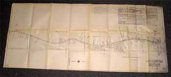
Right of Way and Track Map from Binney Junction to Oroville, Butte County, California
Southern Pacific Lines (San Francisco, Calif.) · 1920 · Wittenborn Art Books
$350.00 (€317.55 | £264.92 | ¥55,873)
San Francisco, Calif.: Southern Pacific Company, 1920. Map. Blueline print. 24 x 56 inches. Folded, with red pencilling. Map from Binney Junction to Oroville, with Schedule of Property Acquisition (Date, Original Grantor/Grantee, Instrument of Transfer, and Remarks of Sale) fo...

Right of Way and Track Map of Ostrom, Yuba County, California
Southern Pacific Lines (San Francisco, Calif.) · 1962 · Wittenborn Art Books
$350.00 (€317.55 | £264.92 | ¥55,873)
San Francisco, Calif.: Southern Pacific Company, 1962. Map. Blueline print. 24 x 56 inches. Map of Ostrom, including Olivehurst Tract Subdivision, with Schedule of Property Acquisition (Date, Original Grantor/Grantee, Instrument of Transfer, and Remarks of Sale) for 3 transfer...

Track Map of Oxnard, Ventura County, California
Southern Pacific Lines (San Francisco, Calif.) · 1921 · Wittenborn Art Books
$325.00 (€294.87 | £246.00 | ¥51,882)
Los Angeles, Calif.: Southern Pacific Company, 1921, revised 1946. Map. Blueline print. 16 x 50 inches. With red, orange, green, etc. pencilling. Map of Oxnard. Scale: 1 inch = 100 feet. With inset marginal map of region, no scale. .

Right of Way and Track Map, Palo Alto, Main Line Mayfield, Santa Clara County, California
Southern Pacific Lines (San Francisco, Calif.) · 1938 · Wittenborn Art Books
$350.00 (€317.55 | £264.92 | ¥55,873)
San Francisco, Calif.: Southern Pacific Company, 1938. Map. Blueline print. 24 x 56 inches. With red and orange pencilling. Map of Mayfield, from Churchill Avenue to Diss Road. Includes Sunnyside and Evergreen Park. With Schedule of Property Acquisition (Date, Original Grantor...
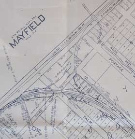
Right of Way and Track Map - Palo Alto, Mayfield to Vasona Junction, Santa Clara County, California
Southern Pacific Lines (San Francisco, Calif.) · 1938 · Wittenborn Art Books
$350.00 (€317.55 | £264.92 | ¥55,873)
San Francisco, Calif.: Southern Pacific Company, 1938. Map. Blueline print. 24 x 56 inches. With red and orange pencilling. Map of Mayfield with Schedule of Property Acquisition (Date, Original Grantor/Grantee, Instrument of Transfer, and Remarks of Sale) for approximately 9 t...

Right of Way and Track Map for Palo Alto and Vicinity, California
Southern Pacific Lines (San Francisco, Calif.) · 1939 · Wittenborn Art Books
$350.00 (€317.55 | £264.92 | ¥55,873)
San Francisco, Calif.: Southern Pacific Company, 1939. Map. Blueline print. 24 x 56 inches. With orange and red pencilled notes. Map of Palo Alto, from Menlo Avenue to Churchill Avenue, including Stanford University. With Schedule of Property Acquisition (Date, Original Granto...