
Ephemera
Ephemera a stampa, cartoline, manifesti e memorabilia stampati.
Risultati della ricerca
45746 libri in Ephemera

Map of Shell Point, West Pittsburg, Contra Costa County, California
Southern Pacific Lines (San Francisco, Calif.) · 1933 · Wittenborn Art Books
$350.00 (€317.55 | £264.92 | ¥55,873)
Oakland, Calif.: Southern Pacific Company, 1933. Map. Blueprint 24" x 55". Proposed Trackage to serve Shell Chemical Co. Includes Poinsetta Land Co, Pittsburg Ave, Sacto Northern Railway line, Bella Monte Subdivision, Scale 1" = 100'. .

Station Map of Santa Cruz, Santa Cruz County, California. Land, Tracks, and Structures
Southern Pacific Lines (San Francisco, Calif.) · 1947 · Wittenborn Art Books
$350.00 (€317.55 | £264.92 | ¥55,873)
San Francisco, Calif.: Southern Pacific Company, 1947. Map. Blueline print 24" x 56" with red pencil indicating switching limits. From Bayside Ave to Bay St. With Schedule of Property listing approx 45 transfers, 1905-1947. Scale 1" = 100'. .

Station Map of Casino, Santa Cruz County, California. Land, Tracks, and Structures
Southern Pacific Lines (San Francisco, Calif.) · 1929 · Wittenborn Art Books
$350.00 (€317.55 | £264.92 | ¥55,873)
San Francisco, Calif.: Southern Pacific Company, 1929. Map. Blueline print 24" x 56" with red pencil indicating switching limits. From Pacific Ave to Second Ave. Includes inset map detailing Right of Way at Casino. With Schedule of Property listing approx 20 transfers, 1877-19...

Right of Way and Track Map, Santa Cruz to Davenport, Santa Cruz County, California
Southern Pacific Lines (San Francisco, Calif.) · 1953 · Wittenborn Art Books
$350.00 (€317.55 | £264.92 | ¥55,873)
San Francisco, Calif.: Southern Pacific Company, 1953. Map. Blueline print 24" x 55" with red pencil indicating switching limits. From Meder Creek to the west to Cliff Drive to the east. Includes Rancho Refugio. With Schedule of Property listing 9 transfers, 1905-1953. Scale 1...

Right of Way and Track Map, Watsonville Junction to Olympia, Santa Cruz County, California
Southern Pacific Lines (San Francisco, Calif.) · 1937 · Wittenborn Art Books
$350.00 (€317.55 | £264.92 | ¥55,873)
San Francisco, Calif.: Southern Pacific Company, 1937. Map. Blueline print 24" x 55" with red pencil indicating switching limits. Includes Rancho de la Canada de Rincon, discontinued station point Golf Links. From approx 4000' northwest of Golf Links, to Coral St to the south-...

Right of Way and Track Map, Santa Cruz to Davenport, Santa Cruz County, California
Southern Pacific Lines (San Francisco, Calif.) · 0 · Wittenborn Art Books
$350.00 (€317.55 | £264.92 | ¥55,873)
San Francisco, Calif.: Southern Pacific Company, [n.d.]. Map. Blueline print 24" x 55" with red pencil indicating switching limits. From Cliff Drive to the west to Bay of Monterey and Bay St to the east. Scale 1" = 200'. Includes inset Index map of area, with Rancho Refugio, s...

Right of Way and Track Map, Watsonville Junction to Olympia, Santa Cruz County, California
Southern Pacific Lines (San Francisco, Calif.) · 0 · Wittenborn Art Books
$350.00 (€317.55 | £264.92 | ¥55,873)
San Francisco, Calif.: Southern Pacific Company, [n.d.]. Map. Blueline print 24" x 55" with red pencil indicating switching limits. Includes Santa Cruz and station point Eblis. From San Lorenzo, Cottonwood St and River St to the north, to Bay of Monterey and Santa Cruz St to t...

Right of Way and Track Map, Watsonville Junction to Santa Cruz, Santa Cruz County, California
Southern Pacific Lines (San Francisco, Calif.) · 0 · Wittenborn Art Books
$350.00 (€317.55 | £264.92 | ¥55,873)
San Francisco, Calif.: Southern Pacific Company, [n.d.]. Map. Blueline print 24" x 55" with red pencil indicating switching limits. Includes station points Santa Cruz, Casino, Seabright, Cliffside. Scale 1" = 400'. .

Station Plan of Seabright - Twin Lakes, Santa Cruz County, California. Map
Southern Pacific Lines (San Francisco, Calif.) · 1925 · Wittenborn Art Books
$350.00 (€317.55 | £264.92 | ¥55,873)
San Francisco, Calif.: Southern Pacific Company, 1925, revised 1942. Map. Blueline print 24" x 55". Includes Woods Lagoon, land approx. 2500" each direction perpendicular, from San Lorenzo River to beyond Twin Lakes/Seventh Ave. Scale 1" = 100'. .

Plan of San Ramon, Contra Costa County, California. Map
Southern Pacific Lines (San Francisco, Calif.) · 1960 · Wittenborn Art Books
$300.00 (€272.18 | £227.08 | ¥47,891)
Oakland, Calif.: Southern Pacific Company, 1960. Map. Blueline print 8" x 65" . Plan indicates railroad track, communication wiring, and two buildings. Includes Bishop Bros Warehouse, Bishop Bros Wholesale. Scale 1" = 100'. .

Assessment Map of San Leandro, Alameda County, California
Southern Pacific Lines (San Francisco, Calif.) · 0 · Wittenborn Art Books
$300.00 (€272.18 | £227.08 | ¥47,891)
Alameda County, Calif.: County Surveyor 193? (unfinished date). Map. Blueline print 37.5" x 39" with switching limits in red pencil. From Mento St and Dorchester Ave to Kent/Laurel Ave and Lake Chabot. Includes Rancho San Leandro, Eden City, lower portion of Brooklyn Township....

Plan of Estudillo, Alameda County, California. Map
Southern Pacific Lines (San Francisco, Calif.) · 1931 · Wittenborn Art Books
$220.00 (€199.60 | £166.52 | ¥35,120)
San Francisco, Calif.: Southern Pacific Company, 1931. Map. Blueline print 8" x 39" with red pencilling. From west of Washington St crossing to approx. 1500 ft east of Halcyon Drive. Includes Levy and Zetner Packing, telephone, Western Pacific, and Southern Pacific wire lines....

Industrial Map of San Jose, Santa Clara County, California
Southern Pacific Lines (San Francisco, Calif.) · 1920 · Wittenborn Art Books
$350.00 (€317.55 | £264.92 | ¥55,873)
San Francisco, Calif.: Southern Pacific Company, 1920, revised 1924. Map. Blueline print 24" x 55". From Morris St to McLellan Ave and Valbrick. Includes Southern Pacific Yard, Guadalupe Creek, Washington Square, Shell Oil Co. With Index to Industries with approx. 65 entries. ...

Industry Map of Santa Clara - San Jose, California
Southern Pacific Lines (San Francisco, Calif.) · 1947 · Wittenborn Art Books
$250.00 (€226.82 | £189.23 | ¥39,909)
San Francisco, Calif.: Southern Pacific Company, 1947, revised 1963. Map. Blackline print 15.5" x 39", printed mirror-image reverse. From Milpitas to Oak Grove and Alamitos. Includes Wayne, College Park, Shell Oil Co, Municipal Airport, Agnew State Hospital. With Index to Indu...

Station Plan of San Jose, Santa Clara County, California. Berryessa Road. Map
Southern Pacific Lines (San Francisco, Calif.) · 1926 · Wittenborn Art Books
$300.00 (€272.18 | £227.08 | ¥47,891)
San Francisco, Calif.: Southern Pacific Company, 1926, revised 1942. Map. Blueline print 24" x 36". From North Ninth St to Seventeenth St, along Berryessa Road, including approx 2 1/2 blocks in each direction. Includes California Packing Corp, Modern Ice and Cold Storage Co. S...

Map of San Jose, Santa Clara County, California
Southern Pacific Lines (San Francisco, Calif.) · 1929 · Wittenborn Art Books
$375.00 (€340.23 | £283.84 | ¥59,864)
San Francisco, Calif.: Southern Pacific Company, 1929, revised 1940. Map. Blueline print 25" x 68". From Maple St to Hillsdale Ave and Lick. Includes former town of Willow Glen, Lewis Canal, Washington Square, Oakhill Cemetery. Scale 1" = 500'. .
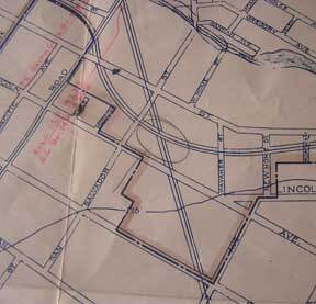
Map of San Jose, Santa Clara County, California
Southern Pacific Lines (San Francisco, Calif.) · 1933 · Wittenborn Art Books
$375.00 (€340.23 | £283.84 | ¥59,864)
San Francisco, Calif.: Southern Pacific Company, 1933. Map. Blueline print 27" x 68.5" with red, black, and mauve outline and pencilling . From Maple St to Hillsdale Ave and Lick. Includes former College of the Pacific, Southern Pacific Yards, Willow Glen, Washington Square, O...

Present and Proposed Pickup and Delivery Limits of San Jose, Santa Clara County, California. Map
Southern Pacific Lines (San Francisco, Calif.) · 1955 · Wittenborn Art Books
$225.00 (€204.14 | £170.31 | ¥35,918)
San Francisco, Calif.: Southern Pacific Company, 1955. Map. Blueline print 16" x 15" with red outline of proposed pickup and delivery limits, and green lines indicating proposed extensions of present limits. From Los Gatos and Edenvale to Wayne and Kirk Ave. Not drawn to scale. .

Industrial Map of San Jose, Santa Clara County, California
Southern Pacific Lines (San Francisco, Calif.) · 1920 · Wittenborn Art Books
$500.00 (€453.64 | £378.46 | ¥79,818)
San Francisco, Calif.: Southern Pacific Company, 1920, revised 1937. Map. Blueline print 24" x 54". From Cypress Ave to Phelan Ave. Only streets indicated west of Meridian Road, approx. 50 industries indicated directly on map. Scale 1" = 500'. .

Industrial Map of San Jose, Santa Clara County, California
Southern Pacific Lines (San Francisco, Calif.) · 1920 · Wittenborn Art Books
$500.00 (€453.64 | £378.46 | ¥79,818)
San Francisco, Calif.: Southern Pacific Company, 1920, revised 1926. Map. Blueline print 24" x 54", with mauve, red, and green highlighting. From Cypress Ave to Phelan Ave. Only streets indicated west of Meridian Road, approx. 40 industries indicated in downtown and West San J...