
Ephemera
Ephemera a stampa, cartoline, manifesti e memorabilia stampati.
Risultati della ricerca
45746 libri in Ephemera

Fresno City Street Map, Fresno County, Ca
Southern Pacific Lines (San Francisco, Calif.) · 1700 · Wittenborn Art Books
$300.00 (€272.18 | £227.08 | ¥47,891)
Fresno, Calif.: Progressive Map Service, [n.d.]. Blueline print, 38" x 26", with red and black pencilling indicating track lines, switching limits. From Marks Avenue to Willow Avenue and Annadale Avenue to Barstow Avenue. Includes City Directory, street index, approx 400 listi...

Map of Barton's Spur, Fresno County, Ca
Southern Pacific Lines (San Francisco, Calif.) · 1937 · Wittenborn Art Books
$250.00 (€226.82 | £189.23 | ¥39,909)
San Francisco, Calif.: Southern Pacific Company, 1937. Blueprint, 13" x 46". From Nevada Avenue to Tyler Avenue along Maple Avenue. Includes Yard Limit Board, Fresno Building Corp, Imperial Building Company, station point. Scale 1" = 100'. .

Yard Limit Map to Fresno, Fresno County, Ca
Southern Pacific Lines (San Francisco, Calif.) · 0 · Wittenborn Art Books
$250.00 (€226.82 | £189.23 | ¥39,909)
San Francisco, Calif.: Southern Pacific Company, [n.d.]. Blackline print, 15" x 41". Portion of previous map indicating only area of railroad yard. No legend. From Biola Junction and Muscatel to Barton, Calwa Tower. Detailed listing of structures and signals inside railroad ya...

Key Map to Fresno, Fresno County, Ca
Southern Pacific Lines (San Francisco, Calif.) · 1932 · Wittenborn Art Books
$375.00 (€340.23 | £283.84 | ¥59,864)
San Francisco, Calif.: Southern Pacific Company, 1932, rev. 1940. Blueline print, 25" x 48" with red pencil indicating switching limits. From Biola Junction, Muscatel to Mattei, Calwa Tower. Includes Fresno Yard, Forsey, Crayold, Fresno station point, Cincotta Bartonette, Sun ...
Right of Way and Track Map of Eugene, Lake County, or - Coos Bay Branch to Myrtile Point
Southern Pacific Lines (San Francisco, Calif.) · 0 · Wittenborn Art Books
$350.00 (€317.55 | £264.92 | ¥55,873)
San Francisco, Calif.: Southern Pacific Company, [n.d.]. Blueline print, 24" x 56". From west of Oak Home addition and Solomon Zumwalt Donation Land east to Jackson Street. With western portion of City of Eugene, F.P. Blair's Donation land claim, Cooper's Plat, Ross Plat, McCl...
Industry Map of El Paso, El Paso County, Tx
Southern Pacific Lines (San Francisco, Calif.) · 1951 · Wittenborn Art Books
$750.00 (€680.46 | £567.69 | ¥119,727)
San Francisco, Calif.: Southern Pacific Company, 1951, rev. 1958. Blueline print, 36" x 91". From Anapra station point, near Bowen and Brickland station points to Ed Anderson Municipal Airport, and Rio Grande River north to Biggs Field. WIth Index to Industries, approx 650 ent...
Industry Map of El Paso, El Paso County, Tx
Southern Pacific Lines (San Francisco, Calif.) · 1925 · Wittenborn Art Books
$350.00 (€317.55 | £264.92 | ¥55,873)
San Francisco, Calif.: Southern Pacific Company, 1925, rev. 1949. Blueline print, 24" x 56". From meeting of Franklin canal and Rio Grande to approx 1 1/2 miles east of city limits, and from Juarez border to Arizona Street, Tularosa Street. WIth Index to Industries, approx 175...

Station Map of East Pleasanton, Alameda County, Ca
Southern Pacific Lines (San Francisco, Calif.) · 1926 · Wittenborn Art Books
$350.00 (€317.55 | £264.92 | ¥55,873)
Oakland, Calif.: Southern Pacific Company, 1926, rev. 1959. Blueline print, 24" x 56". Sheet three of three. Formerly "Eliot." Southern Pacific tracks through land, no labelled roadways. Including Coast Rock and Gravel Company, Eliot gravel pit. Scale 1" = 100'. .
Station Map of East Pleasanton, Alameda County, Ca
Southern Pacific Lines (San Francisco, Calif.) · 1926 · Wittenborn Art Books
$350.00 (€317.55 | £264.92 | ¥55,873)
Oakland, Calif.: Southern Pacific Company, 1926, rev. 1959. Blueline print, 24" x 56". Sheet two of three. Formerly "Eliot." To approx 2700' in each direction and 2200' south from Pacific Coast Aggregates spur track intersection with mainline, along Pleasanton-Livermore Road. ...

Station Map of East Pleasanton, Alameda County, Ca
Southern Pacific Lines (San Francisco, Calif.) · 1926 · Wittenborn Art Books
$350.00 (€317.55 | £264.92 | ¥55,873)
Oakland, Calif.: Southern Pacific Company, 1926, rev. 1959. Blueline print, 24" x 56". Sheet one of three. To approx 2700' in each direction and 2200' south from East Pleasanton station point, along Pleasanton-Livermore Road. Including Rio de Valle river, Concrete Materials Co...
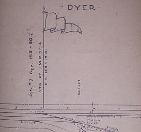
Station Map of Dyer, Alameda County, Ca
Southern Pacific Lines (San Francisco, Calif.) · 1943 · Wittenborn Art Books
$350.00 (€317.55 | £264.92 | ¥55,873)
San Francisco, Calif.: Southern Pacific Company, 1943. Blueline print, 18" x 82". Two inch tear, no missing material. From Standard Avenue and Berkeley Street to Newport Avenue. With Holly Sugar Company complex including details on each building, Valencia Truck Company, H.M Ca...
Station Map of Dyer, Orange County, Ca
Southern Pacific Lines (San Francisco, Calif.) · 1943 · Wittenborn Art Books
$350.00 (€317.55 | £264.92 | ¥55,873)
San Francisco, Calif.: Southern Pacific Company, 1943, rev. 1953. Blueline print, 18" x 82". From Standard Avenue and Berkeley Street to Newport Avenue. With Holly Sugar Company complex including details on each building, Valencia Truck Company, H.M Canning Company, Alexander ...

Station Map of Di Giorgio, Kern County, Ca
Southern Pacific Lines (San Francisco, Calif.) · 1930 · Wittenborn Art Books
$350.00 (€317.55 | £264.92 | ¥55,873)
San Francisco, Calif.: Southern Pacific Company, 1930, rev. 1959. Blueline print, 12" x 61". Along Greenfield Road, 3300' west and 2600' east of Comanche Drive. With Di Giorgio Farms, station, cold storage packing. Scale 1" = 100'. Including insert map of railroad lines approx...
Station Map of Daly City, San Mateo County, Ca
Southern Pacific Lines (San Francisco, Calif.) · 1929 · Wittenborn Art Books
$350.00 (€317.55 | £264.92 | ¥55,873)
San Francisco, Calif.: Southern Pacific Company, 1929, rev. 1960. Blueline print, 24" x 56". From beyond Belle Avenue , San Luis Avenue and San Diego Street to Curtis Avenue and Garden Street. With Lake Marced Golf and Country Club, Ocean View Park Tract, Vista Grande Tract, W...

Station Map of Curtiss, Cochise County, Arizona
Southern Pacific Lines (San Francisco, Calif.) · 1931 · Wittenborn Art Books
$350.00 (€317.55 | £264.92 | ¥55,873)
El Paso, Tex.: El Paso & Southwestern Railroad Company, 1931, Rev. 1949. Blueline print, 24" x 56" with red pencilling indicating switching limits. With mainline and two spur tracks. No buildings indicated. Scale 1" = 100'. .

Right of Way and Track Map for San Diego and Arizona Railway Co, Palm City, San Diego County, Ca
Southern Pacific Lines (San Francisco, Calif.) · 1953 · Wittenborn Art Books
$350.00 (€317.55 | £264.92 | ¥55,873)
San Francisco, Calif.: Southern Pacific Company, 1953. Blackline print, 24" x 56". From G Street to Coronado Avenue along Bay Boulevard, National Avenue. Includes Chula Vista, Otay, Palm City, and G.H. Colton, Henry Eummelen, Luther Johnson, F. Heilman plots. With Schedule of ...

Right of Way and Track Map for San Diego and Arizona Railway Co, F Street Line, Chula Vista, San Diego County, Ca
Southern Pacific Lines (San Francisco, Calif.) · 1920 · Wittenborn Art Books
$350.00 (€317.55 | £264.92 | ¥55,873)
San Francisco, Calif.: Southern Pacific Company, 1920. Black ink drawing on vellum, 24" x 56". From San Diego Bay and Fourteenth Street in National City to southern limits of Chula Vista. With National City, Marlborough Heights, San Diego Fruit Co. San Diego Land Co. plots, Sa...

Station Plan of Chowchilla Branch, Madera County, Ca
Southern Pacific Lines (San Francisco, Calif.) · 1930 · Wittenborn Art Books
$350.00 (€317.55 | £264.92 | ¥55,873)
San Francisco, Calif.: Southern Pacific Company, 1930, rev. 1949. Blueline print, 24" x 56", with red pencilling indicating switching limits. From Front Street to Thirteenth Street, and Humboldt Avenue to Madera County Fair Grounds. WIth San Joaquin Cotton Oil Co, New Fertiliz...

Map of Northwestern Pacific Railroad Agreement with Hammond Lumber Co, Arcata, Humboldt County, Ca
Southern Pacific Lines (San Francisco, Calif.) · 1924 · Wittenborn Art Books
$350.00 (€317.55 | £264.92 | ¥55,873)
San Francisco, Calif.: Southern Pacific Company, 1924. Blueprint, 24" x 56", with yellow and brown pencilling indicating leases. From beyond little Chico Creek and Dayton Avenue to beyond big Chico creek, with block numbers of buildings on three blocks each side along railroad...
Map of Northwestern Pacific Railroad Agreement with Hammond Lumber Co, Arcata, Humboldt County, Ca
Southern Pacific Lines (San Francisco, Calif.) · 1947 · Wittenborn Art Books
$350.00 (€317.55 | £264.92 | ¥55,873)
San Francisco, Calif.: Southern Pacific Company, 1947, rev. 1961. Blueline print, 24" x 56", with red ink indicating Interchange track. From Hammond Lumber Co Railroad switch on Western line Simpson land east to railroad intersection with county road. Includes mill. Scale 1" =...